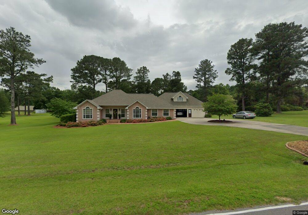
112 Mayfield Rd Laurel, MS 39443
Estimated Value: $356,000 - $523,000
Studio
1
Bath
2,415
Sq Ft
$168/Sq Ft
Est. Value
About This Home
This home is located at 112 Mayfield Rd, Laurel, MS 39443 and is currently estimated at $405,568, approximately $167 per square foot. 112 Mayfield Rd is a home located in Jones County.
Ownership History
Date
Name
Owned For
Owner Type
Purchase Details
Closed on
Mar 7, 2008
Sold by
Rawls Bobbie
Bought by
White James H and White Carol A
Current Estimated Value
Home Financials for this Owner
Home Financials are based on the most recent Mortgage that was taken out on this home.
Original Mortgage
$205,945
Interest Rate
5.65%
Purchase Details
Closed on
Feb 15, 2008
Sold by
Dickerson Bobby D and Dickerson Christine F
Bought by
White James H and White Carol A
Home Financials for this Owner
Home Financials are based on the most recent Mortgage that was taken out on this home.
Original Mortgage
$205,945
Interest Rate
5.65%
Create a Home Valuation Report for This Property
The Home Valuation Report is an in-depth analysis detailing your home's value as well as a comparison with similar homes in the area
Purchase History
| Date | Buyer | Sale Price | Title Company |
|---|---|---|---|
| White James H | -- | -- | |
| White James H | -- | -- |
Source: Public Records
Mortgage History
| Date | Status | Borrower | Loan Amount |
|---|---|---|---|
| Closed | White James H | $205,945 |
Source: Public Records
Tax History
| Year | Tax Paid | Tax Assessment Tax Assessment Total Assessment is a certain percentage of the fair market value that is determined by local assessors to be the total taxable value of land and additions on the property. | Land | Improvement |
|---|---|---|---|---|
| 2025 | $1,705 | $24,103 | $0 | $0 |
| 2024 | $1,792 | $22,376 | $0 | $0 |
| 2023 | $1,792 | $22,379 | $0 | $0 |
| 2022 | $1,833 | $22,382 | $0 | $0 |
| 2021 | $1,841 | $22,384 | $0 | $0 |
| 2020 | $1,874 | $21,672 | $0 | $0 |
| 2019 | $1,945 | $22,151 | $0 | $0 |
| 2018 | $1,945 | $22,151 | $0 | $0 |
| 2017 | $1,942 | $22,151 | $0 | $0 |
| 2016 | $1,769 | $21,148 | $0 | $0 |
| 2015 | $1,688 | $21,142 | $0 | $0 |
| 2014 | $1,688 | $21,137 | $0 | $0 |
Source: Public Records
Map
Nearby Homes
- 73 Mayfield Rd
- 338 Reedy Creek Rd
- 909 Sharon Moss Rd
- 4398 Sharon Rd
- 0 Sharon Rd
- 1067 Trace Rd
- 24 Dean Matthews Rd
- 363 Sharon Moss Rd
- 00 Graham Dr
- 14 Hoss Dr
- 11 Redbud Dr
- 122 County Road 237
- 0 Sharon Moss Rd Unit 145888
- 4514 Forest Dr
- 1 Loblolly Ln
- 1105 Glenway Dr
- 60 Forest Dr
- 213 Sandersville Heidelberg Rd
- 0 Pine St
- 209 S Maple St
- 112 Mayfield Rd
- 104 Mayfield Rd
- 104 Mayfield Rd
- 128 Mayfield Rd
- 4284 Sharon Rd
- 105 Mayfield Rd
- 127 Mayfield Rd
- 84 Mayfield Rd
- 50 Pressly Dr
- 4268 Sharon Rd
- 4279 Sharon Rd
- 65 Mayfield Rd
- 4317 Sharon Rd
- 56 Mayfield Rd
- 4260 Sharon Rd
- 4263 Sharon Rd
- 8 Pressly Dr
- 83 Mayfield Rd
- 66 Mayfield Rd
- 27 Pressly Dr
Your Personal Tour Guide
Ask me questions while you tour the home.