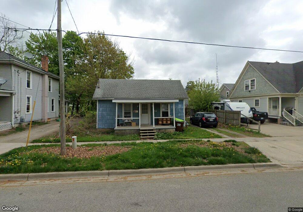
112 N Mcvicar St Adrian, MI 49221
Estimated Value: $85,974 - $95,000
3
Beds
1
Bath
871
Sq Ft
$104/Sq Ft
Est. Value
About This Home
This home is located at 112 N Mcvicar St, Adrian, MI 49221 and is currently estimated at $90,325, approximately $103 per square foot. 112 N Mcvicar St is a home located in Lenawee County with nearby schools including Adrian High School, St. Joseph Academy, and St. Joseph's Academy.
Ownership History
Date
Name
Owned For
Owner Type
Purchase Details
Closed on
Jan 25, 2013
Sold by
Fannie Mae
Bought by
Schadewald Harold G
Current Estimated Value
Purchase Details
Closed on
Oct 5, 2006
Sold by
Novaster Mortgage Inc
Bought by
Grayer Geirrell and Grayer Geirrell L
Home Financials for this Owner
Home Financials are based on the most recent Mortgage that was taken out on this home.
Original Mortgage
$46,000
Interest Rate
6.5%
Mortgage Type
New Conventional
Purchase Details
Closed on
Jan 5, 2006
Sold by
Gray Deb and Gray Charles
Bought by
Novastar Mortgage Inc
Create a Home Valuation Report for This Property
The Home Valuation Report is an in-depth analysis detailing your home's value as well as a comparison with similar homes in the area
Home Values in the Area
Average Home Value in this Area
Purchase History
| Date | Buyer | Sale Price | Title Company |
|---|---|---|---|
| Schadewald Harold G | $14,000 | None Available | |
| Grayer Geirrell | $45,988 | None Available | |
| Novastar Mortgage Inc | $55,000 | None Available |
Source: Public Records
Mortgage History
| Date | Status | Borrower | Loan Amount |
|---|---|---|---|
| Previous Owner | Grayer Geirrell | $46,000 |
Source: Public Records
Tax History Compared to Growth
Tax History
| Year | Tax Paid | Tax Assessment Tax Assessment Total Assessment is a certain percentage of the fair market value that is determined by local assessors to be the total taxable value of land and additions on the property. | Land | Improvement |
|---|---|---|---|---|
| 2025 | $1,406 | $28,900 | $0 | $0 |
| 2024 | $1,091 | $28,200 | $0 | $0 |
| 2023 | $1,346 | $25,900 | $0 | $0 |
| 2022 | $1,061 | $23,800 | $0 | $0 |
| 2021 | $1,042 | $21,200 | $0 | $0 |
| 2020 | $1,585 | $20,300 | $0 | $0 |
| 2019 | $47,245 | $18,600 | $0 | $0 |
| 2018 | $1,040 | $22,317 | $0 | $0 |
| 2017 | $970 | $16,258 | $0 | $0 |
| 2016 | $1,237 | $15,581 | $0 | $0 |
| 2014 | -- | $17,000 | $0 | $0 |
Source: Public Records
Map
Nearby Homes
- 112 N Mcvicar St Unit MCVICAR
- 903 E Maumee St
- 909 E Maumee St
- 909 E Maumee St Unit MAUMEE
- 831 E Maumee St
- 116 N Mcvicar St
- 904 E Maumee St
- 904 E Maumee St Unit MAUMEE
- 915 E Maumee St
- 829 E Maumee St
- 111 N Mcvicar St
- 910 Toledo St
- 908 E Maumee St
- 821 E Maumee St
- 921 E Maumee St
- 838 Toledo St
- 838 Toledo St Unit 840 Toledo
- 838 Toledo St Unit 838.5 Toledo St.
- 904 Toledo St
- 832 E Maumee St