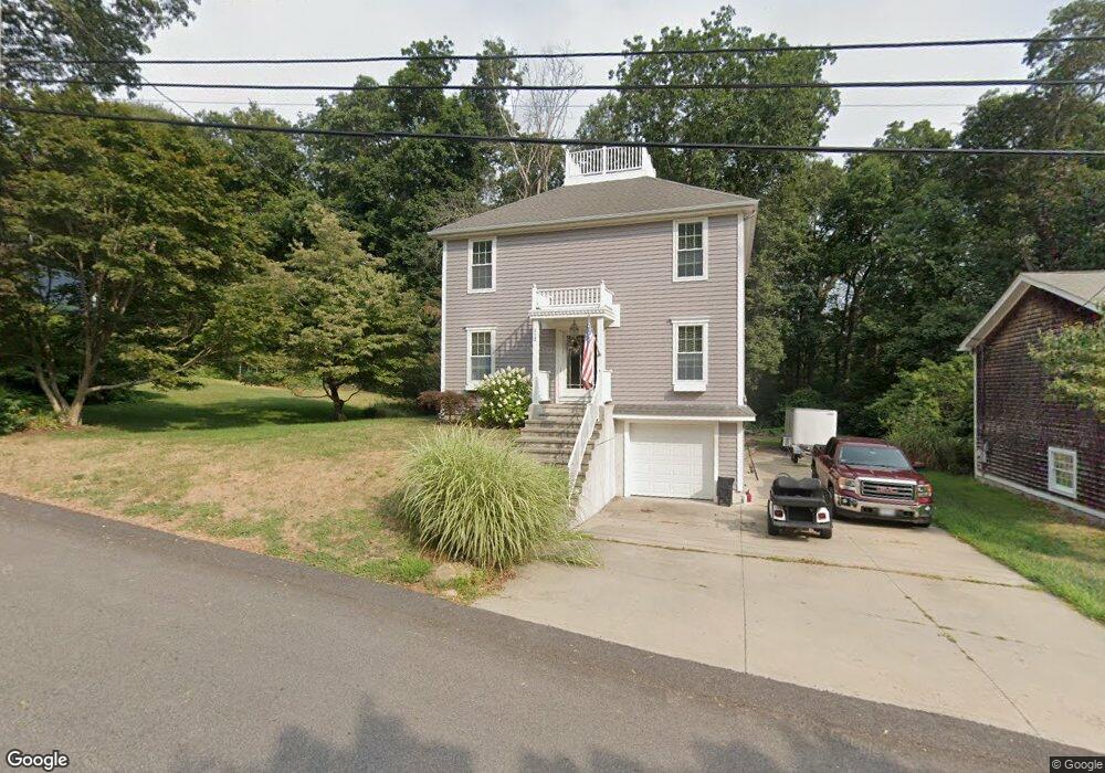
112 Plum Point Rd Saunderstown, RI 02874
Saunderstown NeighborhoodEstimated Value: $666,000 - $755,422
2
Beds
3
Baths
1,800
Sq Ft
$392/Sq Ft
Est. Value
About This Home
This home is located at 112 Plum Point Rd, Saunderstown, RI 02874 and is currently estimated at $705,356, approximately $391 per square foot. 112 Plum Point Rd is a home located in Washington County with nearby schools including Hamilton Elementary School, Wickford Middle School, and North Kingstown Sr. High School.
Ownership History
Date
Name
Owned For
Owner Type
Purchase Details
Closed on
Jan 18, 2012
Sold by
Noel Eugene E and Noel Mark E
Bought by
Noel Mark E and Dobras Denise E
Current Estimated Value
Purchase Details
Closed on
Oct 8, 2004
Sold by
Brackenbury Keb
Bought by
Edwards 2 Bldrs & Dev
Create a Home Valuation Report for This Property
The Home Valuation Report is an in-depth analysis detailing your home's value as well as a comparison with similar homes in the area
Home Values in the Area
Average Home Value in this Area
Purchase History
| Date | Buyer | Sale Price | Title Company |
|---|---|---|---|
| Noel Mark E | -- | -- | |
| Edwards 2 Bldrs & Dev | $122,000 | -- |
Source: Public Records
Mortgage History
| Date | Status | Borrower | Loan Amount |
|---|---|---|---|
| Previous Owner | Edwards 2 Bldrs & Dev | $70,000 |
Source: Public Records
Tax History Compared to Growth
Tax History
| Year | Tax Paid | Tax Assessment Tax Assessment Total Assessment is a certain percentage of the fair market value that is determined by local assessors to be the total taxable value of land and additions on the property. | Land | Improvement |
|---|---|---|---|---|
| 2025 | $6,946 | $629,200 | $259,600 | $369,600 |
| 2024 | $6,060 | $422,600 | $143,000 | $279,600 |
| 2023 | $6,060 | $422,600 | $143,000 | $279,600 |
| 2022 | $5,942 | $422,600 | $143,000 | $279,600 |
| 2021 | $5,815 | $332,300 | $96,600 | $235,700 |
| 2020 | $5,679 | $332,300 | $96,600 | $235,700 |
| 2019 | $5,679 | $332,300 | $96,600 | $235,700 |
| 2018 | $5,300 | $279,400 | $70,800 | $208,600 |
| 2017 | $5,194 | $279,400 | $70,800 | $208,600 |
| 2016 | $5,046 | $279,400 | $70,800 | $208,600 |
| 2015 | $5,059 | $262,100 | $70,800 | $191,300 |
| 2014 | $4,932 | $262,100 | $70,800 | $191,300 |
Source: Public Records
Map
Nearby Homes
- 10 Highland Rd
- 73 Oceanwoods Dr
- 127 Oceanwoods Dr
- 51 Salisbury Ave
- 121 Seaside Dr
- 94 Spindrift St
- 174 Seaside Dr
- 2180 Tower Hill Rd
- 31 Stanchion St
- 2424 Tower Hill Rd
- 229 Earle Dr
- 86 Spanker St
- 65 Village Hill Ln
- 21 Helm St
- 63 Duck Cove Rd
- 480 Boston Neck Rd
- 58 Dolphin St
- 49 Meadow Sweet Trail
- 47 Wake Robin Trail
- 471 Annaquatucket Rd
- 118 Plum Point Rd
- 13 Plum Point Rd
- 0 Plum Point Rd
- 115 Plum Point Rd
- 128 Plum Point Rd
- 94 Plum Point Rd
- 4 Triton Dr
- 5 Neptune Dr
- 16 Neptune Dr
- 10 Triton Dr
- 15 Neptune Dr
- 16 Triton Dr
- 82 Plum Point Rd
- 139 Plum Point Rd
- 20 Neptune Dr
- 6 Calypso Dr
- 25 Nautilus Dr
- 76 Plum Point Rd
- 22 Triton Dr
- 21 Neptune Dr