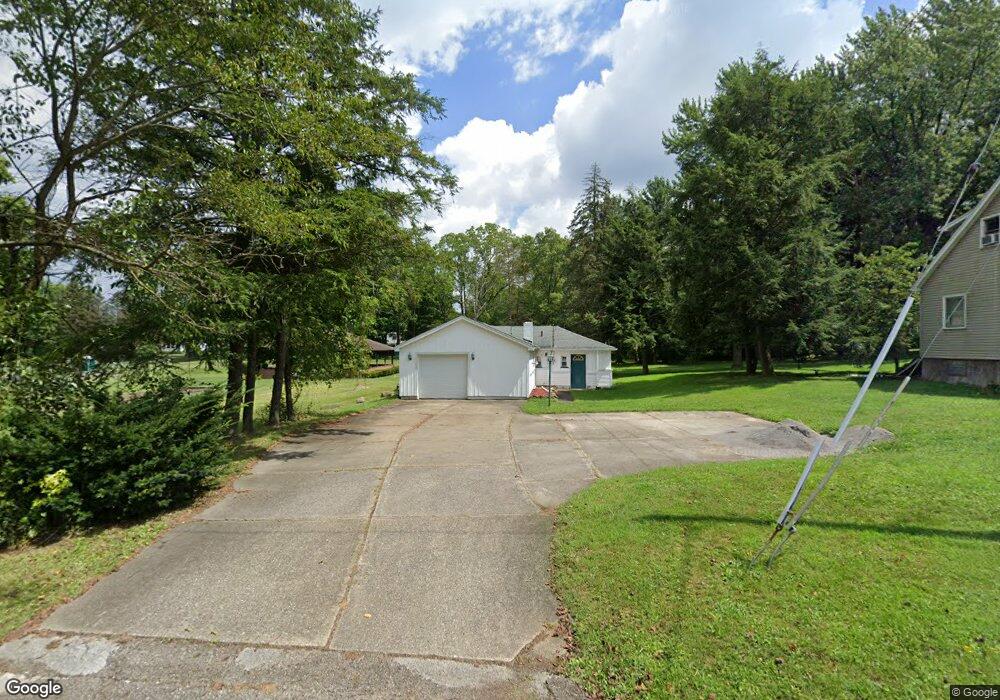
112 Riverside Dr Youngstown, OH 44514
Estimated Value: $183,000 - $960,000
2
Beds
1
Bath
840
Sq Ft
$544/Sq Ft
Est. Value
About This Home
This home is located at 112 Riverside Dr, Youngstown, OH 44514 and is currently estimated at $457,000, approximately $544 per square foot. 112 Riverside Dr is a home located in Mahoning County with nearby schools including Poland Union Elementary School, Poland Middle School, and Poland Seminary High School.
Ownership History
Date
Name
Owned For
Owner Type
Purchase Details
Closed on
Jan 10, 2019
Bought by
Poland Cemetery Association
Current Estimated Value
Home Financials for this Owner
Home Financials are based on the most recent Mortgage that was taken out on this home.
Interest Rate
4.45%
Purchase Details
Closed on
Feb 18, 1999
Sold by
Tabaka Construction Co
Bought by
The Poland Cemetery Assn
Purchase Details
Closed on
Jun 9, 1997
Sold by
Tavaka Construction Inc
Bought by
Mcclement Keith G
Home Financials for this Owner
Home Financials are based on the most recent Mortgage that was taken out on this home.
Original Mortgage
$43,225
Interest Rate
8.17%
Mortgage Type
Purchase Money Mortgage
Purchase Details
Closed on
Jul 13, 1993
Bought by
Tabaka Constr Inc
Create a Home Valuation Report for This Property
The Home Valuation Report is an in-depth analysis detailing your home's value as well as a comparison with similar homes in the area
Home Values in the Area
Average Home Value in this Area
Purchase History
| Date | Buyer | Sale Price | Title Company |
|---|---|---|---|
| Poland Cemetery Association | $48,000 | -- | |
| The Poland Cemetery Assn | $179,000 | -- | |
| Mcclement Keith G | $45,500 | -- | |
| Tabaka Constr Inc | $193,500 | -- |
Source: Public Records
Mortgage History
| Date | Status | Borrower | Loan Amount |
|---|---|---|---|
| Closed | Poland Cemetery Association | -- | |
| Previous Owner | Mcclement Keith G | $43,225 | |
| Closed | The Poland Cemetery Assn | $0 |
Source: Public Records
Tax History Compared to Growth
Tax History
| Year | Tax Paid | Tax Assessment Tax Assessment Total Assessment is a certain percentage of the fair market value that is determined by local assessors to be the total taxable value of land and additions on the property. | Land | Improvement |
|---|---|---|---|---|
| 2024 | $511 | $9,290 | $9,290 | -- |
| 2023 | $505 | $9,290 | $9,290 | $0 |
| 2022 | $576 | $9,290 | $9,290 | $0 |
| 2021 | $1,394 | $23,430 | $10,320 | $13,110 |
| 2020 | $1,399 | $23,430 | $10,320 | $13,110 |
| 2019 | $745 | $20,560 | $10,320 | $10,240 |
| 2018 | $722 | $20,560 | $10,320 | $10,240 |
| 2017 | $647 | $20,560 | $10,320 | $10,240 |
| 2016 | $576 | $17,730 | $6,780 | $10,950 |
| 2015 | $546 | $17,730 | $6,780 | $10,950 |
| 2014 | $548 | $17,730 | $6,780 | $10,950 |
| 2013 | $542 | $17,730 | $6,780 | $10,950 |
Source: Public Records
Map
Nearby Homes
- 6074 Frontier Dr
- 2667 Center Rd
- 2721 Algonquin Dr
- 2831 Center Rd
- 20 Nesbitt St
- 2379 Clyde St
- 2295 Bel Aire Ln
- 154 Rocky Ledge Dr
- 2856 Heatherbrae Dr
- 1 Michigan Ave
- 2959 Holyoke Dr
- 5838 Poland Struthers Rd
- 2959 Algonquin Dr
- 2985 Algonquin Dr
- 43 Venloe Dr
- 7085 Youngstown Pittsburgh Rd
- 2307 Hamilton Ave
- 7109 Youngstown Pittsburgh Rd
- 2829 Poland Village Blvd
- 6137 Acatello Place
- 6386 Duncan Dr
- 6370 Duncan Dr
- 6400 Duncan Dr
- 6356 Duncan Dr
- 6416 Duncan Dr
- 6342 Duncan Dr
- 6430 Duncan Dr
- 6328 Duncan Dr
- 107 E Mckinley Way
- 101 E Mckinley Way
- 115 E Mckinley Way
- 2458 Center Rd
- 6308 Duncan Dr
- 2474 Center Rd
- 6284 Duncan Dr
- 6369 Duncan Dr
- 6401 Duncan Dr
- 6262 Duncan Dr
- 6385 Duncan Dr
- 62 Duncan Dr