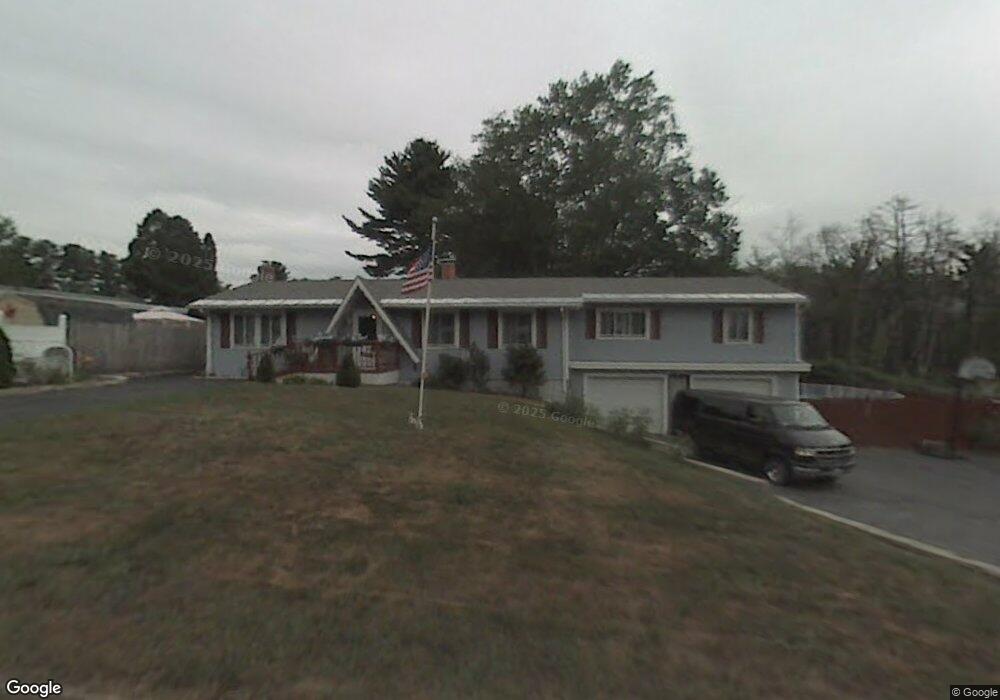
112 Roycraft Rd Manchester, NH 03103
Lower South Willow NeighborhoodEstimated Value: $485,000 - $524,369
4
Beds
2
Baths
1,792
Sq Ft
$280/Sq Ft
Est. Value
About This Home
This home is located at 112 Roycraft Rd, Manchester, NH 03103 and is currently estimated at $501,342, approximately $279 per square foot. 112 Roycraft Rd is a home located in Hillsborough County with nearby schools including Henry J. McLaughlin Middle School, Manchester Memorial High School, and The Founders Academy Charter School (El).
Ownership History
Date
Name
Owned For
Owner Type
Purchase Details
Closed on
Jan 6, 2023
Sold by
Wang Yuehui
Bought by
Prescott Laura E and Prescott Julian P
Current Estimated Value
Home Financials for this Owner
Home Financials are based on the most recent Mortgage that was taken out on this home.
Original Mortgage
$413,374
Outstanding Balance
$400,543
Interest Rate
6.58%
Mortgage Type
FHA
Estimated Equity
$100,799
Purchase Details
Closed on
Aug 26, 2016
Sold by
Lacourse Diana L
Bought by
Wang Yuehui
Create a Home Valuation Report for This Property
The Home Valuation Report is an in-depth analysis detailing your home's value as well as a comparison with similar homes in the area
Home Values in the Area
Average Home Value in this Area
Purchase History
| Date | Buyer | Sale Price | Title Company |
|---|---|---|---|
| Prescott Laura E | $421,000 | None Available | |
| Wang Yuehui | $143,000 | -- |
Source: Public Records
Mortgage History
| Date | Status | Borrower | Loan Amount |
|---|---|---|---|
| Open | Prescott Laura E | $413,374 |
Source: Public Records
Tax History Compared to Growth
Tax History
| Year | Tax Paid | Tax Assessment Tax Assessment Total Assessment is a certain percentage of the fair market value that is determined by local assessors to be the total taxable value of land and additions on the property. | Land | Improvement |
|---|---|---|---|---|
| 2024 | $6,716 | $343,000 | $100,000 | $243,000 |
| 2023 | $6,469 | $343,000 | $100,000 | $243,000 |
| 2022 | $6,256 | $343,000 | $100,000 | $243,000 |
| 2021 | $6,064 | $343,000 | $100,000 | $243,000 |
| 2020 | $5,620 | $227,900 | $69,000 | $158,900 |
| 2019 | $5,543 | $227,900 | $69,000 | $158,900 |
| 2018 | $5,397 | $227,900 | $69,000 | $158,900 |
| 2017 | $5,315 | $227,900 | $69,000 | $158,900 |
| 2016 | $5,274 | $227,900 | $69,000 | $158,900 |
| 2015 | $5,438 | $232,000 | $69,000 | $163,000 |
| 2014 | $5,452 | $232,000 | $69,000 | $163,000 |
| 2013 | $5,259 | $232,000 | $69,000 | $163,000 |
Source: Public Records
Map
Nearby Homes
- 116 Roysan St
- 73 Lucille St
- 195 Corning Rd
- 133 Corning Rd
- 167 Jobin Dr
- 126 Cohas Ave
- 323 Seames Dr
- lot 719-1 & 2 Sheffield Rd
- 67 Murphy St
- 63 Maynard Ave
- 197 Laxson Ave
- 1035 S Mammoth Rd Unit 6
- 82 S Jewett St
- 145 Fox St
- 593 Cohas Ave
- 10100 S Willow St Unit 214
- 10100 S Willow St Unit 101
- 10100 S Willow St Unit 109
- 10100 S Willow St Unit 207
- 10100 S Willow St Unit 110