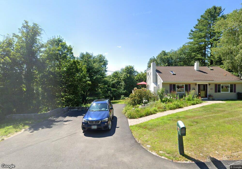
112 S Mayhew Turnpike Hebron, NH 03241
Estimated Value: $668,325 - $1,430,000
3
Beds
2
Baths
1,994
Sq Ft
$456/Sq Ft
Est. Value
About This Home
This home is located at 112 S Mayhew Turnpike, Hebron, NH 03241 and is currently estimated at $908,331, approximately $455 per square foot. 112 S Mayhew Turnpike is a home located in Grafton County with nearby schools including Bridgewater-Hebron Village School.
Ownership History
Date
Name
Owned For
Owner Type
Purchase Details
Closed on
May 3, 2024
Sold by
Bergenholtz Thomas M and Bergenholtz Marianne
Bought by
Bergenholtz Ft and Bergenholtz
Current Estimated Value
Create a Home Valuation Report for This Property
The Home Valuation Report is an in-depth analysis detailing your home's value as well as a comparison with similar homes in the area
Home Values in the Area
Average Home Value in this Area
Purchase History
| Date | Buyer | Sale Price | Title Company |
|---|---|---|---|
| Bergenholtz Ft | -- | None Available |
Source: Public Records
Tax History Compared to Growth
Tax History
| Year | Tax Paid | Tax Assessment Tax Assessment Total Assessment is a certain percentage of the fair market value that is determined by local assessors to be the total taxable value of land and additions on the property. | Land | Improvement |
|---|---|---|---|---|
| 2024 | $3,420 | $489,300 | $263,600 | $225,700 |
| 2023 | $3,122 | $489,300 | $263,600 | $225,700 |
| 2022 | $3,342 | $489,300 | $263,600 | $225,700 |
| 2021 | $3,190 | $489,300 | $263,600 | $225,700 |
| 2020 | $3,066 | $319,400 | $157,900 | $161,500 |
| 2019 | $3,095 | $319,400 | $157,900 | $161,500 |
| 2018 | $2,810 | $336,100 | $175,100 | $161,000 |
| 2017 | $3,005 | $336,100 | $175,100 | $161,000 |
| 2016 | $2,796 | $336,100 | $175,100 | $161,000 |
| 2015 | $3,069 | $385,500 | $203,400 | $182,100 |
| 2014 | $3,153 | $385,500 | $203,400 | $182,100 |
| 2013 | $2,950 | $366,400 | $203,400 | $163,000 |
Source: Public Records
Map
Nearby Homes
- 10 Merrill Rd
- 431 George Rd
- Lot 26 Skyline Dr
- 497 W Shore Rd
- 0 Skyline Dr Unit 19
- 00 Ledgewood Cir Unit 7
- 33 Winterberry Ln
- 613 Mayhew Turnpike Unit 227-024 & 227-023
- 4 Birchwood Dr Unit A
- 862 Mayhew Turnpike Unit 1
- 171 Bell Rd
- 76 Davis Rd Unit 3
- 154 Bell Rd
- 114 Ledgewood Terrace
- 199 Cottage City Rd
- 341 Perkins Hill Rd
- 40 Adams Rd
- 383 Wulamat Rd
- 301 Perkins Hill Rd
- 193 New Hebron Rd
- 118 S Mayhew Turnpike
- 120 S Mayhew Turnpike
- 31 Hillside Dr
- 37 Hillside Dr
- 27 Hillside Dr Unit 17
- 27 Hillside Dr
- 27 Hillside Dr Unit 17
- 117 S Mayhew Turnpike
- 99 S Mayhew Turnpike
- 110 S Mayhew Turnpike
- 132 S Mayhew Turnpike Unit 14
- 132 S Mayhew Turnpike Unit 13
- 132 S Mayhew Turnpike Unit 12
- 132 S Mayhew Turnpike Unit 11
- 132 S Mayhew Turnpike Unit 10
- 132 S Mayhew Turnpike Unit 9
- 132 S Mayhew Turnpike Unit 8
- 132 S Mayhew Turnpike Unit 7
- 132 S Mayhew Turnpike Unit 6
- 132 S Mayhew Turnpike Unit 5