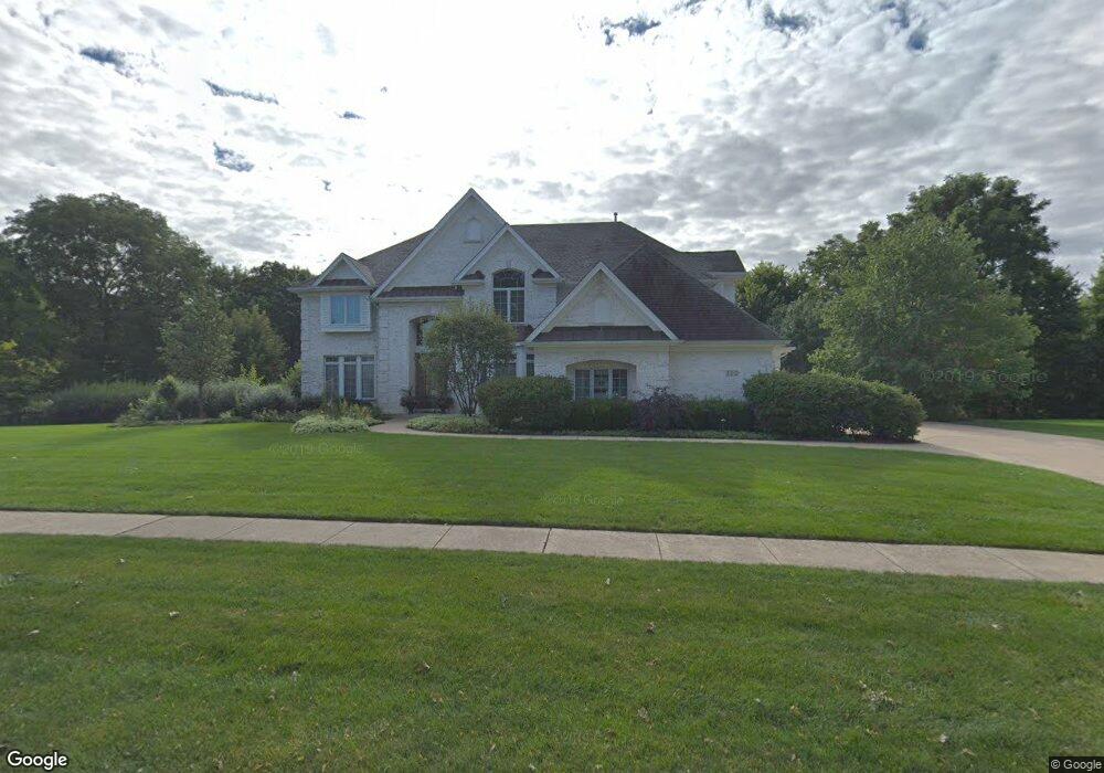
112 Stone Gate Dr Oswego, IL 60543
North Oswego NeighborhoodEstimated Value: $1,042,000 - $1,171,211
4
Beds
4
Baths
5,000
Sq Ft
$217/Sq Ft
Est. Value
About This Home
This home is located at 112 Stone Gate Dr, Oswego, IL 60543 and is currently estimated at $1,087,070, approximately $217 per square foot. 112 Stone Gate Dr is a home located in Kendall County with nearby schools including Old Post Elementary School, Thompson Jr. High School, and Oswego High School.
Ownership History
Date
Name
Owned For
Owner Type
Purchase Details
Closed on
Jul 9, 2018
Sold by
Casillas Hector R and Casillas Maria E
Bought by
Casillas Maria E and Casillas Hector R
Current Estimated Value
Purchase Details
Closed on
Jun 22, 2011
Sold by
Credit Union 1
Bought by
Casillas Hector R and Casillas Maria E
Home Financials for this Owner
Home Financials are based on the most recent Mortgage that was taken out on this home.
Original Mortgage
$400,000
Interest Rate
4.67%
Mortgage Type
New Conventional
Purchase Details
Closed on
Mar 29, 2011
Sold by
Old Second National Bank Of Aurora
Bought by
Credit Union 1
Create a Home Valuation Report for This Property
The Home Valuation Report is an in-depth analysis detailing your home's value as well as a comparison with similar homes in the area
Home Values in the Area
Average Home Value in this Area
Purchase History
| Date | Buyer | Sale Price | Title Company |
|---|---|---|---|
| Casillas Maria E | -- | None Available | |
| Casillas Hector R | $557,500 | Greater Illinois Title Co | |
| Credit Union 1 | -- | None Available |
Source: Public Records
Mortgage History
| Date | Status | Borrower | Loan Amount |
|---|---|---|---|
| Closed | Casillas Hector R | $400,000 |
Source: Public Records
Tax History Compared to Growth
Tax History
| Year | Tax Paid | Tax Assessment Tax Assessment Total Assessment is a certain percentage of the fair market value that is determined by local assessors to be the total taxable value of land and additions on the property. | Land | Improvement |
|---|---|---|---|---|
| 2024 | $25,908 | $327,950 | $73,522 | $254,428 |
| 2023 | $24,392 | $295,450 | $66,236 | $229,214 |
| 2022 | $24,392 | $276,122 | $61,903 | $214,219 |
| 2021 | $24,768 | $270,708 | $60,689 | $210,019 |
| 2020 | $24,267 | $262,823 | $58,921 | $203,902 |
| 2019 | $23,900 | $254,981 | $58,921 | $196,060 |
| 2018 | $24,134 | $249,248 | $57,596 | $191,652 |
| 2017 | $23,954 | $239,662 | $55,381 | $184,281 |
| 2016 | $20,924 | $227,168 | $52,494 | $174,674 |
| 2015 | $20,765 | $216,350 | $49,994 | $166,356 |
| 2014 | -- | $204,104 | $47,164 | $156,940 |
| 2013 | -- | $198,159 | $45,790 | $152,369 |
Source: Public Records
Map
Nearby Homes
- 170 Chicago Rd
- 34 N Adams St
- 55 Garfield St
- 101 Bell Ct
- 613 Murdock Place
- 388 Danforth Dr
- 423 Hathaway Ln
- 610 Murdock Place
- 611 Murdock Place
- 421 Hathaway Ln
- 2110 State Route 31
- 156 River Mist Dr
- 177 Franklin St
- 141 River Mist Dr
- 3 Orchard Rd
- 123 Orchard Rd
- 2 Orchard Rd
- 5055 U S 34
- 206 E Washington St
- 505 Parkland Ct
- 112 Stonegate Dr
- 116 Stone Gate Dr
- 107 Stone Gate Dr
- 111 Stone Gate Dr
- 104 Stonehate Dr
- 103 Stonegate Dr
- 103 Stone Gate Dr
- 104 Stone Gate Dr
- 115 Stone Gate Dr
- 10 Penn Ct
- 6 Penn Ct
- 100 Stone Gate Dr
- 22 Penn Ct
- 635 N Madison St
- 18 Penn Ct
- 150 N Madison St
- 133 N Madison St
- 127 N Madison St
- 2 Penn Ct
- 113 N Madison St