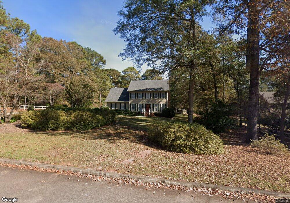
112 Sturbridge Dr Lagrange, GA 30240
Estimated Value: $341,390 - $419,000
4
Beds
3
Baths
2,464
Sq Ft
$157/Sq Ft
Est. Value
About This Home
This home is located at 112 Sturbridge Dr, Lagrange, GA 30240 and is currently estimated at $387,848, approximately $157 per square foot. 112 Sturbridge Dr is a home located in Troup County with nearby schools including Hillcrest Elementary School, Franklin Forest Elementary School, and Hollis Hand Elementary School.
Ownership History
Date
Name
Owned For
Owner Type
Purchase Details
Closed on
Jun 17, 2014
Sold by
Ayers William C
Bought by
Ayres Susan M
Current Estimated Value
Purchase Details
Closed on
Jun 18, 1993
Sold by
George Rodney Campbell
Bought by
Ayers William C and Ayers Susan M
Purchase Details
Closed on
Aug 11, 1987
Bought by
George Rodney Campbell
Purchase Details
Closed on
Dec 1, 1986
Create a Home Valuation Report for This Property
The Home Valuation Report is an in-depth analysis detailing your home's value as well as a comparison with similar homes in the area
Purchase History
| Date | Buyer | Sale Price | Title Company |
|---|---|---|---|
| Ayres Susan M | -- | -- | |
| Ayers William C | $133,500 | -- | |
| George Rodney Campbell | $124,800 | -- | |
| George Rodney Campbell | $124,800 | -- | |
| -- | $11,000 | -- |
Source: Public Records
Tax History
| Year | Tax Paid | Tax Assessment Tax Assessment Total Assessment is a certain percentage of the fair market value that is determined by local assessors to be the total taxable value of land and additions on the property. | Land | Improvement |
|---|---|---|---|---|
| 2025 | $2,883 | $125,320 | $12,000 | $113,320 |
| 2024 | $2,883 | $107,680 | $12,000 | $95,680 |
| 2023 | $3,034 | $113,240 | $12,000 | $101,240 |
| 2022 | $2,929 | $106,920 | $12,000 | $94,920 |
| 2021 | $2,265 | $77,080 | $12,000 | $65,080 |
| 2020 | $2,265 | $77,080 | $12,000 | $65,080 |
| 2019 | $2,200 | $74,920 | $12,000 | $62,920 |
| 2018 | $1,847 | $63,240 | $12,000 | $51,240 |
| 2017 | $1,847 | $63,240 | $12,000 | $51,240 |
| 2016 | $1,851 | $63,363 | $12,000 | $51,363 |
| 2015 | $1,855 | $63,363 | $12,000 | $51,363 |
| 2014 | $1,776 | $60,660 | $12,000 | $48,660 |
| 2013 | -- | $48,422 | $12,000 | $36,422 |
Source: Public Records
Map
Nearby Homes
- 206 Sturbridge Dr
- 3011 Mooty Bridge Rd
- 223 Village Dr
- 219 E Yorktown Dr
- 1006 Wares Cross Rd
- 111 Copper Creek Dr
- 107 Cameron Pointe Dr
- 64 Waterview Ct
- 102 Plantation Ct
- 0 Waterview Dr Unit 10558462
- 589 Waterview Dr
- 57 Hubbard Rd
- 300 Willow Pointe Dr
- 302 Willow Pointe Dr
- 178 Waterview Dr
- 348 Willow Pointe Dr
- 24 N Brooks Rd
- 102 Woodchase
- 114 Taylor Len Dr
- 103 Ford Dr
- 110 Sturbridge Dr
- 101 Village Dr
- 108 Sturbridge Dr
- 113 Sturbridge Dr
- 55 Sanders Rd
- 111 Sturbridge Dr
- 200 Sturbridge Dr
- 106 Sturbridge Dr
- 201 Sturbridge Dr
- 109 Sturbridge Dr
- 1353 Mooty Bridge Rd
- 1351 Mooty Bridge Rd
- 1349 Mooty Bridge Rd
- 1347 Mooty Bridge Rd
- 1343 Mooty Bridge Rd
- 65 Sanders Rd
- 202 Sturbridge Dr
- 201 Village Dr
- 107 Sturbridge Dr
- 203 Sturbridge Dr
