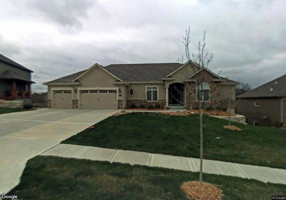
112 SW Gray Cir Lees Summit, MO 64081
Estimated Value: $618,000 - $749,000
4
Beds
4
Baths
2,799
Sq Ft
$247/Sq Ft
Est. Value
About This Home
This home is located at 112 SW Gray Cir, Lees Summit, MO 64081 and is currently estimated at $692,541, approximately $247 per square foot. 112 SW Gray Cir is a home located in Jackson County with nearby schools including Cedar Creek Elementary School, Pleasant Lea Middle School, and Lee's Summit Senior High School.
Ownership History
Date
Name
Owned For
Owner Type
Purchase Details
Closed on
Mar 28, 2007
Sold by
Kelley Rodney L and Kelley Susan D
Bought by
Susan D Kelley Revocable Living Trust
Current Estimated Value
Purchase Details
Closed on
Jan 27, 2006
Sold by
Sallee Homes Inc
Bought by
Kelley Rodney L and Kelley Susan D
Home Financials for this Owner
Home Financials are based on the most recent Mortgage that was taken out on this home.
Original Mortgage
$400,000
Outstanding Balance
$224,164
Interest Rate
6.22%
Mortgage Type
New Conventional
Estimated Equity
$468,377
Purchase Details
Closed on
Jun 7, 2005
Sold by
Gale Communities Inc
Bought by
Sallee Homes Inc
Home Financials for this Owner
Home Financials are based on the most recent Mortgage that was taken out on this home.
Original Mortgage
$440,000
Interest Rate
5.78%
Mortgage Type
Purchase Money Mortgage
Create a Home Valuation Report for This Property
The Home Valuation Report is an in-depth analysis detailing your home's value as well as a comparison with similar homes in the area
Home Values in the Area
Average Home Value in this Area
Purchase History
| Date | Buyer | Sale Price | Title Company |
|---|---|---|---|
| Susan D Kelley Revocable Living Trust | -- | None Available | |
| Kelley Rodney L | -- | Stewart Title Of Kansas City | |
| Sallee Homes Inc | -- | Stewart |
Source: Public Records
Mortgage History
| Date | Status | Borrower | Loan Amount |
|---|---|---|---|
| Open | Kelley Rodney L | $400,000 | |
| Previous Owner | Sallee Homes Inc | $440,000 |
Source: Public Records
Tax History
| Year | Tax Paid | Tax Assessment Tax Assessment Total Assessment is a certain percentage of the fair market value that is determined by local assessors to be the total taxable value of land and additions on the property. | Land | Improvement |
|---|---|---|---|---|
| 2025 | $9,450 | $135,208 | $18,356 | $116,852 |
| 2024 | $9,381 | $130,872 | $18,441 | $112,431 |
| 2023 | $9,381 | $130,873 | $21,746 | $109,127 |
| 2022 | $10,062 | $124,640 | $13,861 | $110,779 |
| 2021 | $10,270 | $124,640 | $13,861 | $110,779 |
| 2020 | $9,882 | $118,766 | $13,861 | $104,905 |
| 2019 | $9,612 | $118,766 | $13,861 | $104,905 |
| 2018 | $1,755,124 | $116,061 | $18,550 | $97,511 |
| 2017 | $10,122 | $116,061 | $18,550 | $97,511 |
| 2016 | $10,215 | $115,938 | $15,257 | $100,681 |
Source: Public Records
Map
Nearby Homes
- 129 NW Morton Dr
- 2114 NW Killarney Ln
- 313 SW Bridlewood Ct
- 2905 SW Muir Dr
- 2828 SW Saddlewood Dr
- 2809 NW Audubon Ln
- 216 SW Ansel Adams Dr
- 321 NW Nutall Dr
- 205 NW Lovins
- 317 NW Lovins
- 316 NW Lovins
- 320 NW Lovins
- 321 NW Lovins
- 214 SW Roosevelt Ridge
- 248 SW Winterpark Cir
- 321 NW Earle Ln
- 325 NW Earle Ln
- 316 NW Earle Ln
- 308 NW Earle Ln
- 2635 NW Ashurst Ln
- 108 SW Gray Cir
- 116 SW Gray Cir
- 113 SW Gray Cir
- 120 SW Gray Cir
- 104 SW Gray Cir
- 121 SW Gray Cir
- 105 SW Gray Cir
- 124 SW Gray Cir
- 101 NW Lewis Dr
- 2801 SW Lewis Dr
- 125 SW Gray Cir
- 100 SW Gray Cir
- 101 SW Gray Cir
- 105 NW Morton Dr
- 2805 SW Lewis Dr
- 128 SW Gray Cir
- 109 NW Morton Dr
- 2801 SW Muir Dr
- 2700 SW Gray Ln
- 2720 SW Gray Ln
Your Personal Tour Guide
Ask me questions while you tour the home.