Estimated Value: $438,000 - $607,000
5
Beds
3
Baths
3,042
Sq Ft
$164/Sq Ft
Est. Value
About This Home
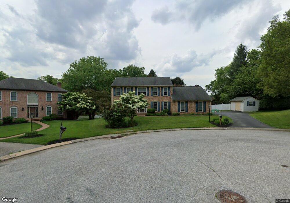
This home is located at 112 Townsend Ct, York, PA 17402 and is currently estimated at $499,390, approximately $164 per square foot. 112 Townsend Ct is a home located in York County with nearby schools including Leaders Heights Elementary School, Dallastown Area Middle School, and Dallastown Area High School.
Ownership History
Date
Name
Owned For
Owner Type
Purchase Details
Closed on
Feb 26, 1999
Sold by
Newberger Jonathan S and Diane Newberger A
Bought by
Arcieri Rocco R and Arcieri Kelly A
Current Estimated Value
Home Financials for this Owner
Home Financials are based on the most recent Mortgage that was taken out on this home.
Original Mortgage
$179,550
Outstanding Balance
$43,566
Interest Rate
6.78%
Estimated Equity
$455,824
Purchase Details
Closed on
Feb 10, 1993
Bought by
Newberger Jonathans and Newberger Diane A
Create a Home Valuation Report for This Property
The Home Valuation Report is an in-depth analysis detailing your home's value as well as a comparison with similar homes in the area
Home Values in the Area
Average Home Value in this Area
Purchase History
| Date | Buyer | Sale Price | Title Company |
|---|---|---|---|
| Arcieri Rocco R | $189,000 | -- | |
| Newberger Jonathans | $220,000 | -- |
Source: Public Records
Mortgage History
| Date | Status | Borrower | Loan Amount |
|---|---|---|---|
| Open | Arcieri Rocco R | $179,550 |
Source: Public Records
Tax History Compared to Growth
Tax History
| Year | Tax Paid | Tax Assessment Tax Assessment Total Assessment is a certain percentage of the fair market value that is determined by local assessors to be the total taxable value of land and additions on the property. | Land | Improvement |
|---|---|---|---|---|
| 2025 | $8,631 | $251,430 | $40,160 | $211,270 |
| 2024 | $8,505 | $251,430 | $40,160 | $211,270 |
| 2023 | $8,505 | $251,430 | $40,160 | $211,270 |
| 2022 | $8,227 | $251,430 | $40,160 | $211,270 |
| 2021 | $7,837 | $251,430 | $40,160 | $211,270 |
| 2020 | $7,837 | $251,430 | $40,160 | $211,270 |
| 2019 | $7,812 | $251,430 | $40,160 | $211,270 |
| 2018 | $7,759 | $251,430 | $40,160 | $211,270 |
| 2017 | $7,450 | $251,430 | $40,160 | $211,270 |
| 2016 | $0 | $251,430 | $40,160 | $211,270 |
| 2015 | -- | $251,430 | $40,160 | $211,270 |
| 2014 | -- | $251,430 | $40,160 | $211,270 |
Source: Public Records
Map
Nearby Homes
- 119 Lexington Rd
- 1818 Roxboro Rd
- 146 Lexington Rd
- 114 Dew Drop Ct Unit 114
- 30 Fox Run Dr
- 1899 Powder Mill Rd Unit B
- 2214 S Queen St
- 224 Wheatfield Way Unit 71D
- 229 Wheatfield Way Unit 76C
- 2458 Schultz Way Unit 30
- 2505 Joppa Rd
- 245 Leaders Heights Rd
- 189 Tuscarora Dr
- 553 Green Spring Rd
- 109 Lyle Cir
- 1903 Woodland Rd
- 215 Wyntre Brooke Dr Unit 1
- 421 Corbin Rd
- 110 Oak Ridge Ln Unit 110
- 304 Edgehill Rd
- 111 Townsend Ct
- 114 Townsend Ct
- 109 Townsend Ct
- 113 Townsend Ct
- 116 Townsend Ct
- 1809 Saratoga Rd
- 115 Townsend Ct
- 1805 Saratoga Rd
- 128 Lexington Rd
- 1811 Saratoga Rd
- 126 Lexington Rd
- 118 Townsend Ct
- 1813 Saratoga Rd
- 130 Lexington Rd
- 150 Dew Drop Rd
- 1817 Saratoga Rd
- 1800 Saratoga Rd
- 120 Townsend Ct
- 122 Lexington Rd
- 117 Townsend Ct