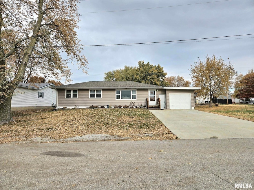

112 W Linn St Lone Tree, IA 52755
Estimated payment $1,492/month
Highlights
- Deck
- Ranch Style House
- No HOA
- Lone Tree Elementary School Rated 9+
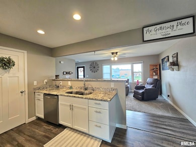
- Solid Surface Countertops
- 1 Car Attached Garage
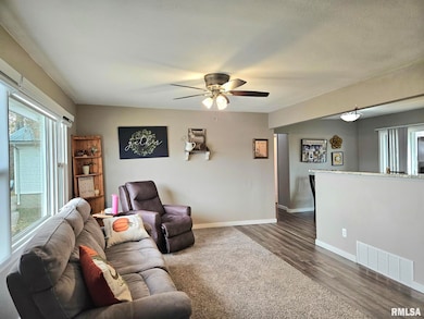
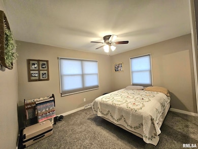
About This Home
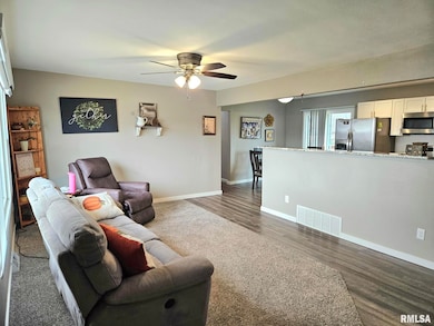
Absolutely turn key move in ready 3 bedroom 2 bathroom home with neutral colors, full appliance package, granite counter tops, electric controlled blinds, storage shed, black chain link fence, vinyl windows and partially finished lower level. Spacious bedrooms sizes, open floor plan, main level laundry, newer driveway and a single stall garage. All of this in the quiet town of Lone Tree with an easy commute to Iowa City.
Listing Agent
First Choice Real Estate LLC Brokerage Phone: 563-732-2600 License #B44442000 Listed on: 11/11/2025
Home Details
Home Type
- Single Family
Est. Annual Taxes
- $2,788
Year Built
- Built in 1969
Lot Details
- 10,454 Sq Ft Lot
- Lot Dimensions are 75' x 140'
- Fenced
- Level Lot
Parking
- 1 Car Attached Garage
- Garage Door Opener
Home Design
- Ranch Style House
- Poured Concrete
- Frame Construction
- Shingle Roof
- Vinyl Siding
- Radon Mitigation System
- Concrete Perimeter Foundation
Interior Spaces
- 2,064 Sq Ft Home
- Ceiling Fan
- Replacement Windows
- Window Treatments
- Partially Finished Basement
- Basement Fills Entire Space Under The House
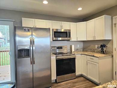
Kitchen
- Eat-In Kitchen
- Range
- Microwave
- Dishwasher
- Solid Surface Countertops
Bedrooms and Bathrooms
- 3 Bedrooms
- 2 Full Bathrooms
Laundry
- Dryer
- Washer
Outdoor Features
- Deck
- Shed
Schools
- Lone Tree High School
Utilities
- Forced Air Heating and Cooling System
- Heating System Uses Natural Gas
- Gas Water Heater
- Water Softener is Owned
- Cable TV Available
Community Details
- No Home Owners Association
Listing and Financial Details
- Assessor Parcel Number 1709412011
Map
Home Values in the Area
Average Home Value in this Area
Tax History
| Year | Tax Paid | Tax Assessment Tax Assessment Total Assessment is a certain percentage of the fair market value that is determined by local assessors to be the total taxable value of land and additions on the property. | Land | Improvement |
|---|---|---|---|---|
| 2025 | $2,788 | $209,600 | $34,900 | $174,700 |
| 2024 | $2,708 | $201,700 | $34,900 | $166,800 |
| 2023 | $2,578 | $201,700 | $34,900 | $166,800 |
| 2022 | $2,550 | $163,600 | $27,600 | $136,000 |
| 2021 | $2,668 | $163,600 | $27,600 | $136,000 |
| 2020 | $2,668 | $163,600 | $27,600 | $136,000 |
| 2019 | $1,754 | $90,600 | $27,600 | $63,000 |
| 2018 | $1,580 | $105,600 | $27,600 | $78,000 |
| 2017 | $1,598 | $105,600 | $27,600 | $78,000 |
| 2016 | $1,526 | $100,400 | $27,600 | $72,800 |
| 2015 | $1,526 | $100,400 | $27,600 | $72,800 |
| 2014 | $1,704 | $114,700 | $27,600 | $87,100 |
Property History
| Date | Event | Price | List to Sale | Price per Sq Ft |
|---|---|---|---|---|
| 11/11/2025 11/11/25 | For Sale | $239,500 | -- | $116 / Sq Ft |
Purchase History
| Date | Type | Sale Price | Title Company |
|---|---|---|---|
| Warranty Deed | $180,000 | None Available | |
| Warranty Deed | $74,500 | None Available | |
| Warranty Deed | $139,000 | None Available |
Mortgage History
| Date | Status | Loan Amount | Loan Type |
|---|---|---|---|
| Open | $174,500 | New Conventional | |
| Previous Owner | $129,000 | Commercial | |
| Previous Owner | $141,897 | USDA |
Source: RMLS Alliance
MLS Number: QC4269260
APN: 1709412011
Disclaimer: Certain information contained herein is derived from information provided by parties other than Homes.com. All information provided is deemed reliable, but is not guaranteed to be accurate and should be independently verified.
![]() IDX information is provided exclusively for personal, non-commercial use, and may not be used for any purpose other than to identify prospective properties consumers may be interested in purchasing. Information is deemed reliable but not guaranteed.
IDX information is provided exclusively for personal, non-commercial use, and may not be used for any purpose other than to identify prospective properties consumers may be interested in purchasing. Information is deemed reliable but not guaranteed.
- 221 W Commercial St
- 201 N Devoe St
- 500 S Center St
- 407 E Elm St
- 106 Dorothy Ln
- 745 N Perkins St
- 5888 Sand Rd SE
- 25840 Golden Oak Ln Lot 1
- 25838 Golden Oak Ln Lot 7
- 25836 Golden Oak Ln Lot 8
- 25832 Golden Oak Ln Lot 12
- 25736 Golden Pond Ln Se Lot 17
- 25738 Golden Pond Ln Se Lot 16
- 25824 Golden Oak Ln Lot 9
- 0 520th St SE
- 1092 Walnut Ave Unit 114 Bld D
- 3135 115th St
- Lot 2 116th Cir
- Lot 39 Walter Mapp Dr
- 3096 145th Ct
- 120 Oakridge Ave Unit 7
- 131 Oakridge Ave Unit 8
- 306 Sycamore St Unit 306.0
- 2037 Kountry Ln SE
- 2725 Heinz Rd
- 2665 Triple Crown Ln
- 2100 S Scott Blvd
- 2401 Highway 6 E
- 17 Video Ct
- 2125 Hollywood Blvd
- 2130 Davis St
- 2132 Davis St
- 2016 1/2 Davis St
- 2130 S Riverside Dr
- 3701-3761 Eastbrook Dr
- 944 Spring Ridge Dr
- 1118 Essex St
- 1030 William St
- 330 Mosswood Ln
- 2539 Catskill Ct
