Estimated Value: $503,864 - $570,000
4
Beds
5
Baths
1,838
Sq Ft
$285/Sq Ft
Est. Value
About This Home
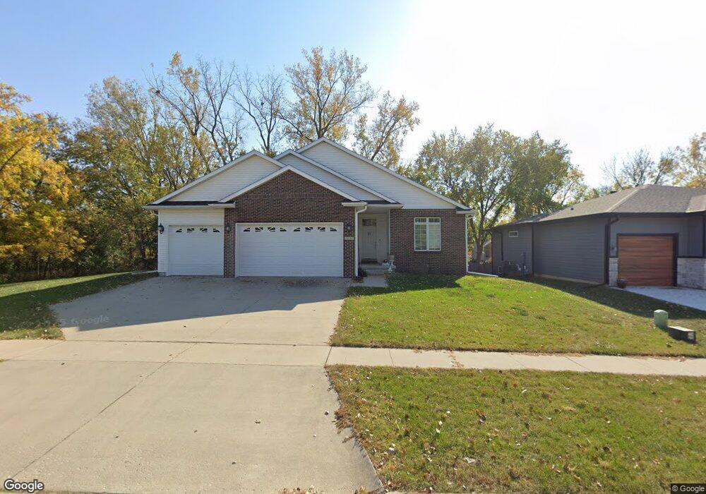
This home is located at 1120 Adams St, Ames, IA 50010 and is currently estimated at $524,466, approximately $285 per square foot. 1120 Adams St is a home located in Story County with nearby schools including Gilbert Elementary School, Gilbert Intermediate School, and Gilbert Middle School.
Ownership History
Date
Name
Owned For
Owner Type
Purchase Details
Closed on
Aug 23, 2006
Sold by
Clark Jerry R and Clark Mary P
Bought by
Lair Mark S and Lair Audrey E
Current Estimated Value
Home Financials for this Owner
Home Financials are based on the most recent Mortgage that was taken out on this home.
Original Mortgage
$226,375
Outstanding Balance
$18,337
Interest Rate
6.77%
Mortgage Type
New Conventional
Estimated Equity
$506,129
Purchase Details
Closed on
Jan 11, 2006
Sold by
Clark Karl B and Clark Karine A
Bought by
Clark Jerry and Clark Mary
Home Financials for this Owner
Home Financials are based on the most recent Mortgage that was taken out on this home.
Original Mortgage
$300,000
Interest Rate
6.42%
Mortgage Type
Future Advance Clause Open End Mortgage
Create a Home Valuation Report for This Property
The Home Valuation Report is an in-depth analysis detailing your home's value as well as a comparison with similar homes in the area
Home Values in the Area
Average Home Value in this Area
Purchase History
| Date | Buyer | Sale Price | Title Company |
|---|---|---|---|
| Lair Mark S | $319,000 | None Available | |
| Clark Jerry | $65,000 | -- |
Source: Public Records
Mortgage History
| Date | Status | Borrower | Loan Amount |
|---|---|---|---|
| Open | Lair Mark S | $226,375 | |
| Previous Owner | Clark Jerry | $300,000 |
Source: Public Records
Tax History Compared to Growth
Tax History
| Year | Tax Paid | Tax Assessment Tax Assessment Total Assessment is a certain percentage of the fair market value that is determined by local assessors to be the total taxable value of land and additions on the property. | Land | Improvement |
|---|---|---|---|---|
| 2025 | $8,436 | $543,200 | $114,200 | $429,000 |
| 2024 | $8,028 | $525,400 | $94,200 | $431,200 |
| 2023 | $6,764 | $525,400 | $94,200 | $431,200 |
| 2022 | $6,662 | $376,700 | $94,200 | $282,500 |
| 2021 | $6,962 | $376,700 | $94,200 | $282,500 |
| 2020 | $7,030 | $371,100 | $92,800 | $278,300 |
| 2019 | $7,030 | $371,100 | $92,800 | $278,300 |
| 2018 | $7,248 | $371,100 | $92,800 | $278,300 |
| 2017 | $7,248 | $371,100 | $92,800 | $278,300 |
| 2016 | $7,192 | $365,500 | $66,200 | $299,300 |
| 2015 | $7,192 | $365,500 | $66,200 | $299,300 |
| 2014 | $6,662 | $341,900 | $61,900 | $280,000 |
Source: Public Records
Map
Nearby Homes
- 3917 Fletcher Ct
- 3814 Brookdale Ave
- 3500 Grand Ave
- 2003 Polk Dr
- 532 W Riverside Rd
- 4882 Copperstone Dr
- 2133 Polk Dr
- 0 Hyde Ave
- 1636 Johnson St
- 2425 Dalton Cir
- 1216 26th St
- 2403 Clayton Dr
- 5007 Skycrest Dr
- 435 25th St
- 2516 Somerset Dr
- 2007 Ketelsen Dr
- 2242 Ketelsen Dr
- 2206 Ketelsen Dr
- 1914 Ada Hayden Rd
- 2734 Clayton Dr
- 1126 Adams St
- 1132 Adams St
- 1125 Kinyon Cir
- 4002 Frances E Davis Ct
- 1131 Kinyon Cir
- 4001 Laura Ct
- 1202 Adams St
- 1205 Kinyon Cir
- 4008 Frances E Davis Ct
- 1208 Adams St
- 4007 Laura Ct
- 4001 Frances E Davis Ct
- 1124 Kinyon Cir
- 1211 Kinyon Cir
- 1214 Adams St
- 4002 Laura Ct
- 4014 Frances E Davis Ct
- 1130 Kinyon Cir
- 1303 Kinyon Cir
- 1202 Kinyon Cir