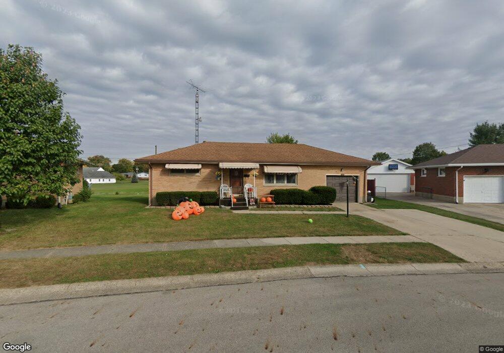
1120 Blithe Rd Springfield, OH 45503
Estimated Value: $179,871 - $203,000
2
Beds
1
Bath
975
Sq Ft
$198/Sq Ft
Est. Value
About This Home
This home is located at 1120 Blithe Rd, Springfield, OH 45503 and is currently estimated at $192,718, approximately $197 per square foot. 1120 Blithe Rd is a home located in Clark County with nearby schools including Northridge Elementary School, Kenton Ridge Middle & High School, and Emmanuel Christian Academy.
Ownership History
Date
Name
Owned For
Owner Type
Purchase Details
Closed on
Apr 13, 2022
Sold by
Michael Gale Robert and Michael Ellen Mary
Bought by
Graham Emily Jeanne and Graham Robert Vance
Current Estimated Value
Purchase Details
Closed on
Nov 22, 2021
Sold by
White Patricia J and Robert M And Ruth M Gale 2005
Bought by
Gale Robert Michael and Gale Mary Ellen
Purchase Details
Closed on
Aug 16, 2013
Sold by
Shonkwiler Martha J
Bought by
Gale Robert M and Gale Ruth H
Create a Home Valuation Report for This Property
The Home Valuation Report is an in-depth analysis detailing your home's value as well as a comparison with similar homes in the area
Home Values in the Area
Average Home Value in this Area
Purchase History
| Date | Buyer | Sale Price | Title Company |
|---|---|---|---|
| Graham Emily Jeanne | -- | Cole Acton Harmon Dunn | |
| Gale Robert Michael | -- | None Available | |
| Gale Robert M | $87,900 | None Available |
Source: Public Records
Tax History
| Year | Tax Paid | Tax Assessment Tax Assessment Total Assessment is a certain percentage of the fair market value that is determined by local assessors to be the total taxable value of land and additions on the property. | Land | Improvement |
|---|---|---|---|---|
| 2025 | $1,959 | $57,620 | $18,620 | $39,000 |
| 2024 | $1,896 | $43,840 | $10,830 | $33,010 |
| 2023 | $1,896 | $43,840 | $10,830 | $33,010 |
| 2022 | $1,903 | $43,840 | $10,830 | $33,010 |
| 2021 | $1,831 | $35,740 | $8,020 | $27,720 |
| 2020 | $1,832 | $35,740 | $8,020 | $27,720 |
| 2019 | $1,867 | $35,740 | $8,020 | $27,720 |
| 2018 | $1,753 | $32,180 | $10,230 | $21,950 |
| 2017 | $1,508 | $29,386 | $10,234 | $19,152 |
| 2016 | $1,498 | $29,386 | $10,234 | $19,152 |
| 2015 | $733 | $28,991 | $9,839 | $19,152 |
| 2014 | $1,465 | $28,991 | $9,839 | $19,152 |
| 2013 | $992 | $28,991 | $9,839 | $19,152 |
Source: Public Records
Map
Nearby Homes
- 4741 Cullen Ave
- 4733 Curtis Dr
- 4802 Willowbrook Dr
- 1341 Student Ave
- 4322 Midfield St Unit 15
- 4446 Ridgewood Rd E Unit 3
- 4256 Midfield St Unit 9
- 4577 Reno Ln Unit 2
- 4652 Reno Ln Unit 15
- 5033 Ridgewood Rd E
- 5235 W Ridgewood Rd
- 5300 Brookshire Ln
- 1521 Erika Dr
- 4732 Lehigh Dr
- 1644 Delmar Dr
- 3942 Harris Ln
- 1162 Kingsgate Rd
- 1201 Kingsgate Rd
- 4890 Brannan Dr W Unit 4890
- 5564 Ridgewood Rd W
- 1116 Blithe Rd
- 1126 Blithe Rd
- 1112 Blithe Rd
- 1134 Blithe Rd
- 1125 Blithe Rd
- 1115 Blithe Rd
- 1131 Northlawn Dr
- 1133 Blithe Rd
- 1140 Blithe Rd
- 1108 Blithe Rd
- 1137 Northlawn Dr
- 1139 Blithe Rd
- 1120 Blaine Ave
- 1126 Blaine Ave
- 1146 Blithe Rd
- 1104 Blithe Rd
- 1134 Blaine Ave
- 1143 Northlawn Dr
- 1145 Blithe Rd
- 1060 Blaine Ave
Your Personal Tour Guide
Ask me questions while you tour the home.