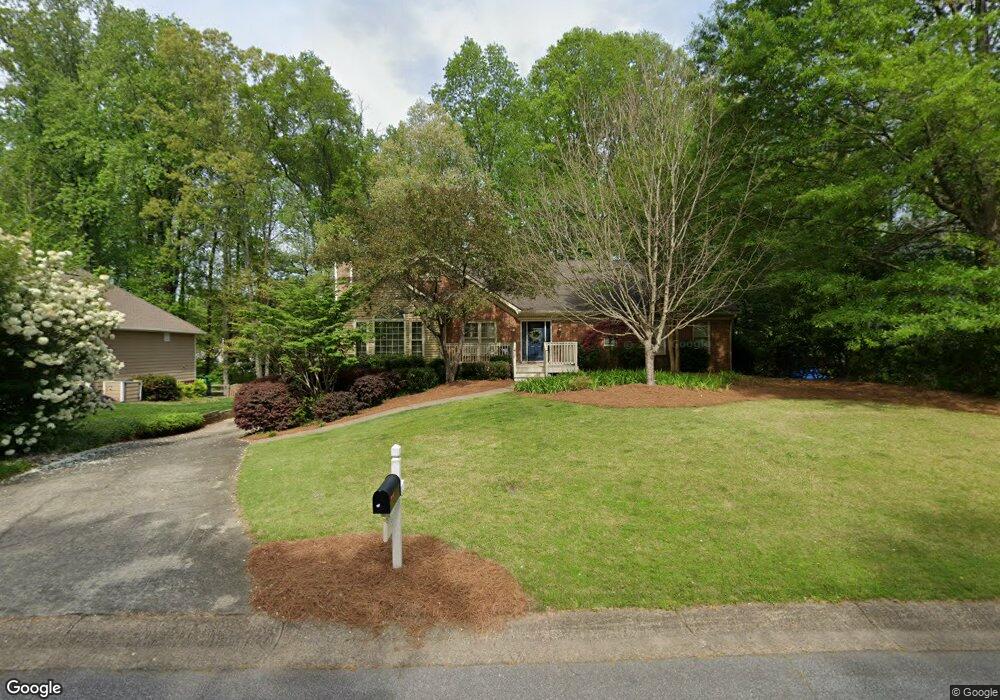
1120 Cedar Branch Ct SW Marietta, GA 30064
Southwestern Marietta NeighborhoodEstimated Value: $537,665 - $578,000
4
Beds
2
Baths
2,236
Sq Ft
$249/Sq Ft
Est. Value
About This Home
This home is located at 1120 Cedar Branch Ct SW, Marietta, GA 30064 and is currently estimated at $556,416, approximately $248 per square foot. 1120 Cedar Branch Ct SW is a home located in Cobb County with nearby schools including A.L. Burruss Elementary School, Marietta Sixth Grade Academy, and Marietta Middle School.
Ownership History
Date
Name
Owned For
Owner Type
Purchase Details
Closed on
Nov 26, 2018
Sold by
Cole Elizabeth B
Bought by
Parker Lorna W
Current Estimated Value
Home Financials for this Owner
Home Financials are based on the most recent Mortgage that was taken out on this home.
Original Mortgage
$304,000
Outstanding Balance
$265,116
Interest Rate
4.8%
Mortgage Type
New Conventional
Estimated Equity
$291,300
Create a Home Valuation Report for This Property
The Home Valuation Report is an in-depth analysis detailing your home's value as well as a comparison with similar homes in the area
Home Values in the Area
Average Home Value in this Area
Purchase History
| Date | Buyer | Sale Price | Title Company |
|---|---|---|---|
| Parker Lorna W | $320,000 | -- |
Source: Public Records
Mortgage History
| Date | Status | Borrower | Loan Amount |
|---|---|---|---|
| Open | Parker Lorna W | $304,000 |
Source: Public Records
Tax History Compared to Growth
Tax History
| Year | Tax Paid | Tax Assessment Tax Assessment Total Assessment is a certain percentage of the fair market value that is determined by local assessors to be the total taxable value of land and additions on the property. | Land | Improvement |
|---|---|---|---|---|
| 2025 | $1,890 | $223,440 | $56,000 | $167,440 |
| 2024 | $1,617 | $191,172 | $44,000 | $147,172 |
| 2023 | $1,617 | $191,172 | $44,000 | $147,172 |
| 2022 | $1,092 | $129,028 | $28,000 | $101,028 |
| 2021 | $1,108 | $129,028 | $28,000 | $101,028 |
| 2020 | $1,108 | $129,028 | $28,000 | $101,028 |
| 2019 | $983 | $114,488 | $24,000 | $90,488 |
| 2018 | $477 | $114,488 | $24,000 | $90,488 |
| 2017 | $384 | $114,488 | $24,000 | $90,488 |
| 2016 | $388 | $102,356 | $24,000 | $78,356 |
| 2015 | $428 | $102,356 | $24,000 | $78,356 |
| 2014 | $436 | $83,108 | $0 | $0 |
Source: Public Records
Map
Nearby Homes
- 1047 Chestnut Hill Cir SW
- 332 Rockmann Ln SW
- 1198 Seminary Dr SW
- 1211 Cliffpine Ct SW
- 1161 Rockmann Terrace SW
- 560 Manning Rd SW
- 1410 Dallas Cir SW
- 805 Manning Way SW
- 594 Manning Rd SW
- 818 Manning Way SW Unit 1
- 988 Grantham Way SW
- 1121 Cannongate Crossing SW
- 839 Manning Villas Ct SW
- 1017 Cannongate Crossing SW
- 1011 Cannongate Crossing SW
- 652 Trailwood Ln SW
- 834 Cannon Run SW
- 1124 Cedar Branch Ct SW
- 1130 Cedar Branch Ct SW
- 1043 Chestnut Hill Cir SW
- 1110 Cedar Branch Ct SW
- 1115 Cedar Branch Ct SW
- 1121 Cedar Branch Ct SW
- 1125 Cedar Branch Ct SW
- 1045 Chestnut Hill Cir SW
- 1041 Chestnut Hill Cir SW
- 1136 Cedar Branch Ct SW
- 1109 Cedar Branch Ct SW
- 0 Chestnut Hill Cir SW Unit 7365208
- 0 Chestnut Hill Cir SW Unit 8236428
- 0 Chestnut Hill Cir SW Unit 8596153
- 0 Chestnut Hill Cir SW Unit 3163670
- 0 Chestnut Hill Cir SW Unit 3187415
- 0 Chestnut Hill Cir SW Unit 3263083
- 0 Chestnut Hill Cir SW Unit 7308641
- 0 Chestnut Hill Cir SW
- 1104 Cedar Branch Ct SW