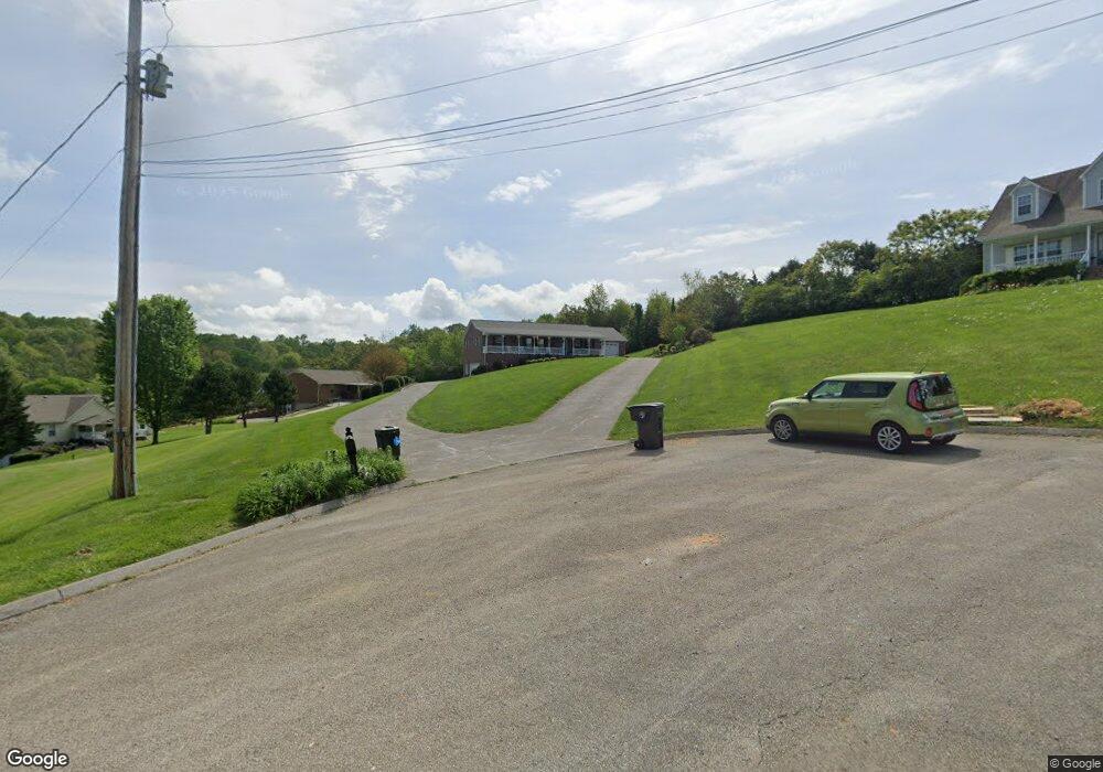
1120 E Branch Dr Talbott, TN 37877
Estimated Value: $331,989 - $417,000
Studio
2
Baths
1,595
Sq Ft
$240/Sq Ft
Est. Value
About This Home
This home is located at 1120 E Branch Dr, Talbott, TN 37877 and is currently estimated at $382,497, approximately $239 per square foot. 1120 E Branch Dr is a home located in Hamblen County with nearby schools including Alpha Elementary School, West View Middle School, and Morristown West High School.
Ownership History
Date
Name
Owned For
Owner Type
Purchase Details
Closed on
Nov 18, 2020
Sold by
Armstrong Robert J and Armstrong Joan C
Bought by
Armstrong Robert J and Armstrong Joan C
Current Estimated Value
Purchase Details
Closed on
Aug 19, 1998
Bought by
Armstrong Robert J and Armstrong Joan C
Purchase Details
Closed on
Oct 14, 1949
Bought by
Mcmurray James G and Mcmurray Martha H
Create a Home Valuation Report for This Property
The Home Valuation Report is an in-depth analysis detailing your home's value as well as a comparison with similar homes in the area
Purchase History
| Date | Buyer | Sale Price | Title Company |
|---|---|---|---|
| Armstrong Robert J | $8,132 | None Available | |
| Armstrong Robert J | $136,600 | -- | |
| Mcmurray James G | -- | -- |
Source: Public Records
Tax History
| Year | Tax Paid | Tax Assessment Tax Assessment Total Assessment is a certain percentage of the fair market value that is determined by local assessors to be the total taxable value of land and additions on the property. | Land | Improvement |
|---|---|---|---|---|
| 2025 | $1,408 | $95,775 | $11,825 | $83,950 |
| 2024 | $1,001 | $50,825 | $9,475 | $41,350 |
| 2023 | $1,001 | $50,825 | $0 | $0 |
| 2022 | $1,001 | $50,825 | $9,475 | $41,350 |
| 2021 | $1,001 | $50,825 | $9,475 | $41,350 |
| 2020 | $1,001 | $50,825 | $9,475 | $41,350 |
| 2019 | $961 | $45,125 | $7,425 | $37,700 |
| 2018 | $961 | $45,125 | $7,425 | $37,700 |
| 2017 | $961 | $45,125 | $7,425 | $37,700 |
| 2016 | $898 | $45,125 | $7,425 | $37,700 |
| 2015 | $835 | $45,125 | $7,425 | $37,700 |
| 2014 | -- | $45,125 | $7,425 | $37,700 |
| 2013 | -- | $49,300 | $0 | $0 |
Source: Public Records
Map
Nearby Homes
- 8070 W Pointe Dr
- 2562 Liberty Rd
- 1437 Beacon Rd
- 506 Alpine Cir
- 120 Waverly Path
- 248 Belle Ct
- 2559 Dogwood Ln
- 1265 Greenbriar Rd
- 1171 W E Hwy 11e E
- 1623 Fledgling Ln
- 595 Ricky Dr
- 413 English Dr
- 158 Claire Place
- 1205 Cole
- 7713 Melanie Cir
- 1209 Cole Dr
- 2540 Lucille Ln
- 605 Clay Dr
- 2548 Lucille Ln
- 2556 Lucille Ln
- Lot 135 W Point Dr
- 8115 W Pointe Dr
- 1110 E Branch Dr
- 8121 W Pointe Dr
- 8109 W Pointe Dr
- 1741 W Pointe Dr
- 1770 W Pointe Dr
- 1771 W Pointe Dr
- Lot 135 W Pointe Dr
- 8120 Robert Watkins Rd
- 8106 W Pointe Dr
- 1151 E Branch Dr
- 8112 W Pointe Dr
- 1121 E Branch Dr
- 8100 W Pointe Dr
- 8118 W Pointe Dr
- 8008 S Pointe Dr
- 8124 W Pointe Dr
- 8092 W Pointe Dr
- 8016 S Pointe Dr
