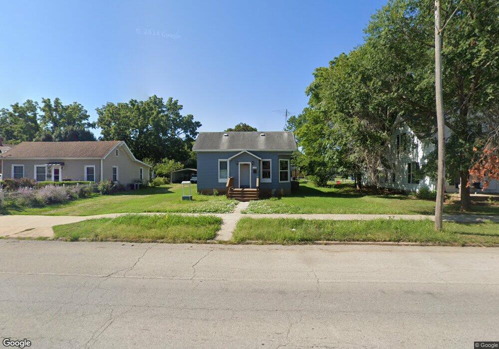
1120 E Wall St Fort Scott, KS 66701
Estimated Value: $62,000 - $101,000
3
Beds
1
Bath
1,222
Sq Ft
$65/Sq Ft
Est. Value
About This Home
This home is located at 1120 E Wall St, Fort Scott, KS 66701 and is currently estimated at $79,999, approximately $65 per square foot. 1120 E Wall St is a home located in Bourbon County with nearby schools including Winfield Scott Elementary School, Eugene Ware Elementary School, and Fort Scott Middle School.
Ownership History
Date
Name
Owned For
Owner Type
Purchase Details
Closed on
Sep 22, 2023
Sold by
Whitley Tiffany L
Bought by
Foster Korben D
Current Estimated Value
Home Financials for this Owner
Home Financials are based on the most recent Mortgage that was taken out on this home.
Original Mortgage
$100,152
Outstanding Balance
$98,122
Interest Rate
7.2%
Mortgage Type
Construction
Estimated Equity
-$18,123
Purchase Details
Closed on
Apr 7, 2016
Sold by
Russell Gerald A and Russell Beverly
Bought by
Marquess Tiffany L
Create a Home Valuation Report for This Property
The Home Valuation Report is an in-depth analysis detailing your home's value as well as a comparison with similar homes in the area
Home Values in the Area
Average Home Value in this Area
Purchase History
| Date | Buyer | Sale Price | Title Company |
|---|---|---|---|
| Foster Korben D | $101,153 | Security First Title | |
| Marquess Tiffany L | -- | -- |
Source: Public Records
Mortgage History
| Date | Status | Borrower | Loan Amount |
|---|---|---|---|
| Open | Foster Korben D | $100,152 |
Source: Public Records
Tax History
| Year | Tax Paid | Tax Assessment Tax Assessment Total Assessment is a certain percentage of the fair market value that is determined by local assessors to be the total taxable value of land and additions on the property. | Land | Improvement |
|---|---|---|---|---|
| 2025 | -- | $3,496 | $220 | $3,276 |
| 2024 | $6 | $3,298 | $215 | $3,083 |
| 2023 | $519 | $3,026 | $227 | $2,799 |
| 2022 | $502 | $2,937 | $214 | $2,723 |
| 2021 | $538 | $2,937 | $214 | $2,723 |
| 2020 | $551 | $2,978 | $232 | $2,746 |
| 2019 | $555 | $2,974 | $232 | $2,742 |
| 2018 | $548 | $2,944 | $201 | $2,743 |
| 2017 | $551 | $2,944 | $201 | $2,743 |
| 2016 | -- | $2,944 | $222 | $2,722 |
| 2015 | -- | $2,781 | $222 | $2,559 |
| 2014 | -- | $2,808 | $222 | $2,586 |
Source: Public Records
Map
Nearby Homes
- 1117 E 1st St
- 101 Andrick St
- 501 Arthur St
- 624 S Broadway St
- 622 S Little St
- 1732 E Oak St
- 0 S Madison St Unit HMS2558732
- 2317 Maple Rd
- 912 S Margrave St
- 523 S Judson St
- 108 N Crawford St
- 202 N Crawford St
- 107 N Eddy St
- 850 State St
- 12 S Eddy St
- 419 S Eddy St
- 846 S Main St
- 224 S Lowman St
- 816 S Crawford St
- 910 S Judson St
- 1126 E Wall St
- 1116 E Wall St
- 1130 E Wall St
- 1134 E Wall St
- 1102 E Wall St
- 1115 E 1st St
- 1111 E 1st St
- 1123 E 1st St
- 1138 E Wall St
- 1127 E Wall St
- 1127 E 1st St
- 1103 E 1st St
- 1133 E 1st St
- 1020 E Wall St
- 10 N Caldwell St
- 15 N Broadway St
- 102 Andrick St
- 22 S Broadway St
- 1014 E Wall St
- 101 S Broadway St
Your Personal Tour Guide
Ask me questions while you tour the home.