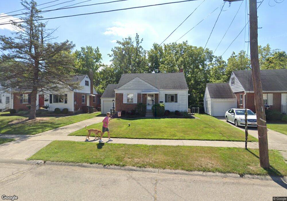
1120 Madeleine Cir Cincinnati, OH 45231
Finneytown NeighborhoodEstimated Value: $197,000 - $215,582
4
Beds
2
Baths
1,350
Sq Ft
$152/Sq Ft
Est. Value
About This Home
This home is located at 1120 Madeleine Cir, Cincinnati, OH 45231 and is currently estimated at $205,146, approximately $151 per square foot. 1120 Madeleine Cir is a home located in Hamilton County with nearby schools including Finneytown Elementary School, Finneytown Secondary Campus, and St. Vivian School.
Ownership History
Date
Name
Owned For
Owner Type
Purchase Details
Closed on
Jul 7, 2006
Sold by
Johnson Christopher
Bought by
Johnson Molly
Current Estimated Value
Purchase Details
Closed on
Jul 11, 2000
Sold by
Theresa Moertl Angela
Bought by
Johnson Christopher and Johnson Molly
Home Financials for this Owner
Home Financials are based on the most recent Mortgage that was taken out on this home.
Original Mortgage
$76,000
Interest Rate
8.55%
Create a Home Valuation Report for This Property
The Home Valuation Report is an in-depth analysis detailing your home's value as well as a comparison with similar homes in the area
Home Values in the Area
Average Home Value in this Area
Purchase History
| Date | Buyer | Sale Price | Title Company |
|---|---|---|---|
| Johnson Molly | -- | None Available | |
| Johnson Christopher | $95,000 | -- |
Source: Public Records
Mortgage History
| Date | Status | Borrower | Loan Amount |
|---|---|---|---|
| Previous Owner | Johnson Christopher | $76,000 |
Source: Public Records
Tax History Compared to Growth
Tax History
| Year | Tax Paid | Tax Assessment Tax Assessment Total Assessment is a certain percentage of the fair market value that is determined by local assessors to be the total taxable value of land and additions on the property. | Land | Improvement |
|---|---|---|---|---|
| 2024 | $3,395 | $49,725 | $11,631 | $38,094 |
| 2023 | $3,338 | $49,725 | $11,631 | $38,094 |
| 2022 | $3,099 | $33,482 | $11,477 | $22,005 |
| 2021 | $3,041 | $33,482 | $11,477 | $22,005 |
| 2020 | $3,090 | $33,482 | $11,477 | $22,005 |
| 2019 | $2,839 | $28,375 | $9,727 | $18,648 |
| 2018 | $2,621 | $28,375 | $9,727 | $18,648 |
| 2017 | $2,498 | $28,375 | $9,727 | $18,648 |
| 2016 | $2,626 | $29,327 | $10,045 | $19,282 |
| 2015 | $2,643 | $29,327 | $10,045 | $19,282 |
| 2014 | $2,645 | $29,327 | $10,045 | $19,282 |
| 2013 | $2,693 | $30,871 | $10,574 | $20,297 |
Source: Public Records
Map
Nearby Homes
- 1116 Madeleine Cir
- 8693 Mockingbird Ln
- 8663 Mockingbird Ln
- 1125 Murkett Ct
- 8627 Mockingbird Ln
- 1052 Vacationland Dr
- 8622 Mockingbird Ln
- 8772 Balboa Dr
- 8831 Daly Rd
- 8543 Foxcroft Dr
- 8584 Mockingbird Ln
- 1101 Meadowind Ct
- 8579 Daly Rd
- 8925 Monsanto Dr
- 1013 Vacationland Dr
- 8950 Daly Rd
- 1100 Gracewind Ct
- 8840 Grenada Dr
- 1190 Sugartree Ct
- 1029 Bluejay Dr
- 1122 Madeleine Cir
- 1124 Madeleine Cir
- 1126 Madeleine Cir
- 1114 Madeleine Cir
- 1119 Madeleine Cir
- 1121 Madeleine Cir
- 1128 Madeleine Cir
- 1123 Madeleine Cir
- 1115 Madeleine Cir
- 1125 Madeleine Cir
- 1112 Madeleine Cir
- 1130 Madeleine Cir
- 1113 Madeleine Cir
- 1127 Madeleine Cir
- 1110 Madeleine Cir
- 1129 Madeleine Cir
- 1109 Madeleine Cir
- 1136 Madeleine Cir
- 1131 Madeleine Cir
- 1108 Madeleine Cir