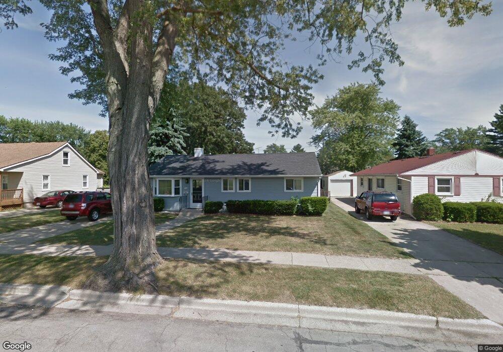
1120 Maple Ave Monroe, MI 48162
Northeast Monroe NeighborhoodEstimated Value: $175,000 - $193,000
3
Beds
1
Bath
1,056
Sq Ft
$174/Sq Ft
Est. Value
About This Home
This home is located at 1120 Maple Ave, Monroe, MI 48162 and is currently estimated at $183,554, approximately $173 per square foot. 1120 Maple Ave is a home located in Monroe County with nearby schools including Monroe High School, Zion Lutheran School, and St Mary's Catholic Elementary School.
Ownership History
Date
Name
Owned For
Owner Type
Purchase Details
Closed on
Jul 12, 2021
Sold by
Bollenberg David
Bought by
Adams Justin R
Current Estimated Value
Home Financials for this Owner
Home Financials are based on the most recent Mortgage that was taken out on this home.
Original Mortgage
$147,184
Outstanding Balance
$133,547
Interest Rate
2.9%
Mortgage Type
FHA
Estimated Equity
$50,007
Purchase Details
Closed on
Mar 2, 2016
Sold by
Bollenberg Don W and Bollenberg Patricia A
Bought by
Bollenberg Don W and Bollenberg Patricia A
Create a Home Valuation Report for This Property
The Home Valuation Report is an in-depth analysis detailing your home's value as well as a comparison with similar homes in the area
Home Values in the Area
Average Home Value in this Area
Purchase History
| Date | Buyer | Sale Price | Title Company |
|---|---|---|---|
| Adams Justin R | $149,900 | Lawyers Title Agcy Of Monroe | |
| Bollenberg Don W | -- | None Available |
Source: Public Records
Mortgage History
| Date | Status | Borrower | Loan Amount |
|---|---|---|---|
| Open | Adams Justin R | $147,184 |
Source: Public Records
Tax History
| Year | Tax Paid | Tax Assessment Tax Assessment Total Assessment is a certain percentage of the fair market value that is determined by local assessors to be the total taxable value of land and additions on the property. | Land | Improvement |
|---|---|---|---|---|
| 2025 | $1,917 | $77,900 | $77,900 | $0 |
| 2024 | $1,830 | $68,430 | $0 | $0 |
| 2023 | $1,750 | $52,410 | $0 | $0 |
| 2022 | $2,354 | $52,410 | $0 | $0 |
| 2021 | $1,701 | $47,990 | $0 | $0 |
| 2020 | $1,589 | $46,780 | $0 | $0 |
| 2019 | $1,511 | $46,780 | $0 | $0 |
| 2018 | $1,471 | $40,910 | $0 | $0 |
| 2017 | $1,443 | $40,910 | $0 | $0 |
| 2016 | $1,411 | $38,810 | $0 | $0 |
| 2015 | $1,342 | $36,760 | $0 | $0 |
| 2014 | $1,342 | $36,760 | $0 | $0 |
| 2013 | -- | $33,050 | $0 | $0 |
Source: Public Records
Map
Nearby Homes
- 1008 Maple Ave
- 623 Maywood Ave
- 434 Arbor Ave
- 504 Rosewood Ave
- 603 Scottwood Ave
- 23 Linswood Dr
- 74 Linswood Dr
- 230 E Grove St
- 734 N Monroe St
- 303 E Lorain St
- 465 Riverview Ave
- E E Lorain St
- 1290 N Monroe St Unit B
- 1290 N Monroe St Unit A
- 702 N Monroe St
- 942 Elliot St
- 525 N Macomb St
- 422 Lapoint Ave
- 425 Fern Ct
- 1605 Arbor Ave
- 1120 Maple Ave
- 1116 Maple Ave
- 1128 Maple Ave
- 1136 Maple Ave
- 1112 Maple Ave
- 1119 Michigan Ave
- 1115 Michigan Ave
- 1123 Michigan Ave
- 1106 Maple Ave
- 1109 Michigan Ave
- 1127 Michigan Ave
- 1131 Michigan Ave
- 1140 Maple Ave
- 1107 Michigan Ave
- 1063 Michigan Ave
- 1102 Maple Ave
- 1139 Michigan Ave
- 1148 Maple Ave
- 1143 Michigan Ave
- 1059 Michigan Ave
Your Personal Tour Guide
Ask me questions while you tour the home.