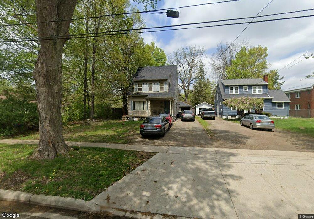
1120 Michigan Ave Adrian, MI 49221
Estimated Value: $175,000 - $228,000
4
Beds
2
Baths
1,519
Sq Ft
$131/Sq Ft
Est. Value
About This Home
This home is located at 1120 Michigan Ave, Adrian, MI 49221 and is currently estimated at $199,470, approximately $131 per square foot. 1120 Michigan Ave is a home located in Lenawee County with nearby schools including Adrian High School, Berean Baptist Academy, and St. Stephen Lutheran School.
Ownership History
Date
Name
Owned For
Owner Type
Purchase Details
Closed on
Mar 29, 2009
Sold by
Fannie Mae
Bought by
Briggs Michael A
Current Estimated Value
Home Financials for this Owner
Home Financials are based on the most recent Mortgage that was taken out on this home.
Original Mortgage
$68,732
Outstanding Balance
$43,845
Interest Rate
5.11%
Mortgage Type
FHA
Estimated Equity
$155,625
Purchase Details
Closed on
Mar 6, 2008
Sold by
Snead Benjamin L and Snead Angela
Bought by
Federal National Mortgage Association
Create a Home Valuation Report for This Property
The Home Valuation Report is an in-depth analysis detailing your home's value as well as a comparison with similar homes in the area
Home Values in the Area
Average Home Value in this Area
Purchase History
| Date | Buyer | Sale Price | Title Company |
|---|---|---|---|
| Briggs Michael A | $70,000 | E Title Agency | |
| Federal National Mortgage Association | $112,229 | None Available |
Source: Public Records
Mortgage History
| Date | Status | Borrower | Loan Amount |
|---|---|---|---|
| Open | Briggs Michael A | $68,732 |
Source: Public Records
Tax History
| Year | Tax Paid | Tax Assessment Tax Assessment Total Assessment is a certain percentage of the fair market value that is determined by local assessors to be the total taxable value of land and additions on the property. | Land | Improvement |
|---|---|---|---|---|
| 2025 | $2,567 | $80,400 | $0 | $0 |
| 2024 | $22 | $75,300 | $0 | $0 |
| 2023 | $2,765 | $69,600 | $0 | $0 |
| 2022 | $2,272 | $65,000 | $0 | $0 |
| 2021 | $2,232 | $59,800 | $0 | $0 |
| 2020 | $2,225 | $54,400 | $0 | $0 |
| 2019 | $135,035 | $51,700 | $0 | $0 |
| 2018 | $2,156 | $60,835 | $0 | $0 |
| 2017 | $2,091 | $50,945 | $0 | $0 |
| 2016 | $2,134 | $53,314 | $0 | $0 |
| 2014 | -- | $45,600 | $0 | $0 |
Source: Public Records
Map
Nearby Homes
- 1139 College Ave
- 1006 College Ave
- 176 S Scott St
- 155 S Scott St
- 967 W Maumee St Unit A
- 1060 Scottdale Dr
- 3520 Crestone Way
- 1144 W Maumee St
- 1062 Oram Dr
- 1335 Spencer Place
- 404 S Mckenzie St
- 914 W Maumee St
- 313 Rice St
- 1351 University Ave
- 705 College Ave
- 107 Renfrew Ave
- 169 Park St
- 143 Park St
- 217 Red River Dr
- 301 Hidden River Dr
- 1116 Michigan Ave
- 1136 Michigan Ave
- 1136 Michigan Ave
- 1136 Michigan Ave
- 1125 Michigan Ave
- 1056 Michigan Ave
- 1101 Michigan Ave
- 1052 Michigan Ave
- 1055 Michigan Ave
- 1144 Michigan Ave
- 1048 Michigan Ave
- 1155 Michigan Ave
- 1117 Michigan Ave
- 1051 Michigan Ave
- 1133 Michigan Ave
- 1137 Michigan Ave
- 1115 Michigan Ave
- 1117 College Ave
- 1109 College Ave
- 1123 College Ave
Your Personal Tour Guide
Ask me questions while you tour the home.