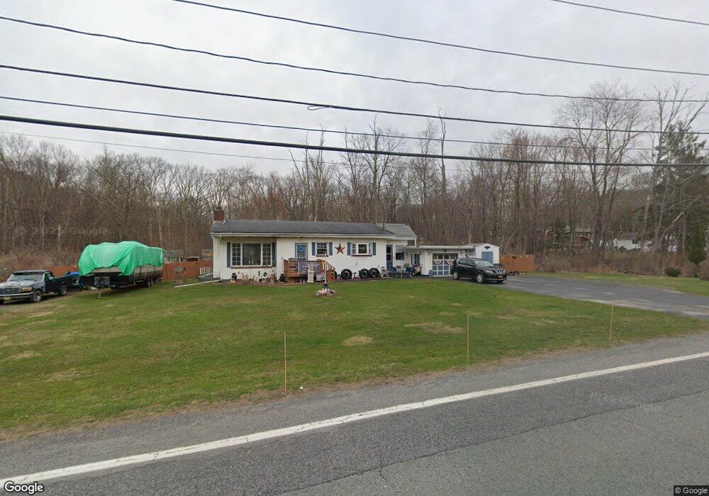
1120 Route 211 E Middletown, NY 10941
Estimated Value: $392,000 - $820,883
3
Beds
2
Baths
1,445
Sq Ft
$354/Sq Ft
Est. Value
About This Home
This home is located at 1120 Route 211 E, Middletown, NY 10941 and is currently estimated at $511,721, approximately $354 per square foot. 1120 Route 211 E is a home located in Orange County with nearby schools including Scotchtown Avenue School, Goshen Intermediate School, and CJ Hooker Middle School.
Ownership History
Date
Name
Owned For
Owner Type
Purchase Details
Closed on
May 24, 2023
Sold by
Turner Linda D
Bought by
Afav Hld Llc
Current Estimated Value
Purchase Details
Closed on
Dec 29, 2000
Sold by
Turner George A and Turner Gustav L
Bought by
Turner Linda D
Home Financials for this Owner
Home Financials are based on the most recent Mortgage that was taken out on this home.
Original Mortgage
$140,000
Interest Rate
7.69%
Mortgage Type
Purchase Money Mortgage
Create a Home Valuation Report for This Property
The Home Valuation Report is an in-depth analysis detailing your home's value as well as a comparison with similar homes in the area
Home Values in the Area
Average Home Value in this Area
Purchase History
| Date | Buyer | Sale Price | Title Company |
|---|---|---|---|
| Afav Hld Llc | $784,000 | None Available | |
| Turner Linda D | $76,000 | -- |
Source: Public Records
Mortgage History
| Date | Status | Borrower | Loan Amount |
|---|---|---|---|
| Previous Owner | Turner Linda D | $140,000 |
Source: Public Records
Tax History
| Year | Tax Paid | Tax Assessment Tax Assessment Total Assessment is a certain percentage of the fair market value that is determined by local assessors to be the total taxable value of land and additions on the property. | Land | Improvement |
|---|---|---|---|---|
| 2024 | $7,799 | $49,000 | $15,000 | $34,000 |
| 2023 | $7,711 | $49,000 | $15,000 | $34,000 |
| 2022 | $8,037 | $49,000 | $15,000 | $34,000 |
| 2021 | $8,252 | $49,000 | $15,000 | $34,000 |
| 2020 | $7,395 | $49,000 | $15,000 | $34,000 |
| 2019 | $5,786 | $49,000 | $15,000 | $34,000 |
| 2018 | $5,786 | $49,000 | $15,000 | $34,000 |
| 2017 | $5,792 | $49,000 | $15,000 | $34,000 |
| 2016 | $5,431 | $49,000 | $15,000 | $34,000 |
| 2015 | -- | $49,000 | $15,000 | $34,000 |
| 2014 | -- | $49,000 | $15,000 | $34,000 |
Source: Public Records
Map
Nearby Homes
- 100 Hillside Dr Unit F6
- 100 Hillside Dr Unit B10
- 34 Poplar Ln
- 37 Pinto Rd E
- 14 Scotchtown Dr
- 52 Scotchtown Dr
- 48 Loch Lomond Ln
- 3 Ben Lomond Dr
- 24 Edinburgh Rd
- 5 Loch Invar Ln
- 482 Scotchtown Ave
- 10 Frederick St
- 22 Sharon Dr
- 63 Blumel Rd
- 3 Bristol Dr
- 375 Blumel Rd
- 913 Silver Lake Scotchtown Rd
- 0 Fortune Rd E Unit KEYH6205613
- 3 Kings Dr
- 529 5th Ave
- 1096 Route 211 E
- 1105 Route 211 E
- 1089 Route 211 E
- 1086 Route 211 E
- 1072 Route 211 E
- 1060 E Nys Route 211
- 1060 E Nys Rte 211
- 1060 Route 211 E
- 1050 New York 211
- 1026 New York 211
- 1026 Route 211 E
- 2 Edward Diana Way
- 2064 Goshen Turnpike
- 1012 Route 211 E
- 2048 Goshen Turnpike
- 2250 Goshen Turnpike
- 33 Fini Dr
- 23 Fini Dr
- 2040 Goshen Turnpike
- D-13 Hillside Dr
Your Personal Tour Guide
Ask me questions while you tour the home.