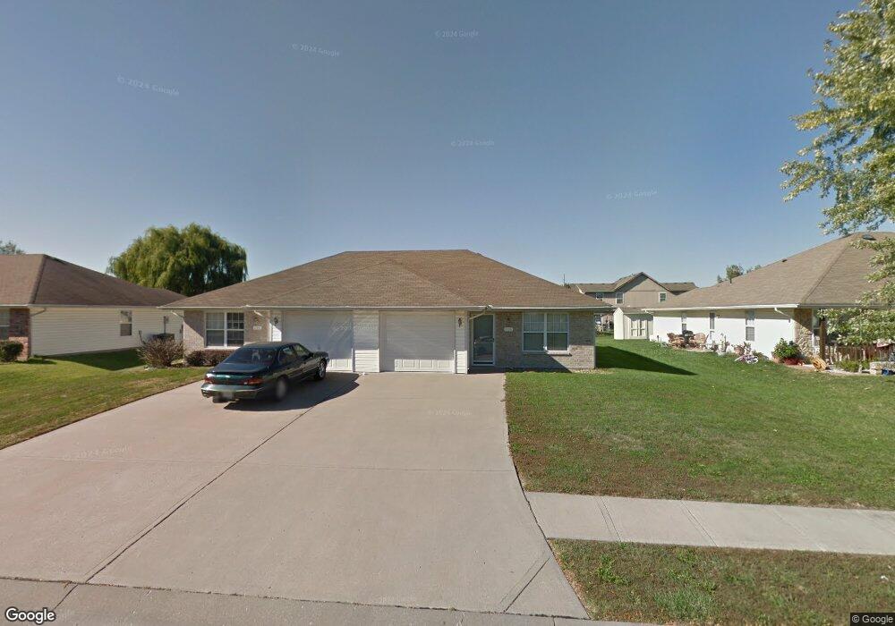
1120 SW Ephraim Dr Grain Valley, MO 64029
Estimated Value: $272,000 - $314,000
4
Beds
4
Baths
1,782
Sq Ft
$166/Sq Ft
Est. Value
About This Home
This home is located at 1120 SW Ephraim Dr, Grain Valley, MO 64029 and is currently estimated at $296,247, approximately $166 per square foot. 1120 SW Ephraim Dr is a home located in Jackson County with nearby schools including Grain Valley High School.
Ownership History
Date
Name
Owned For
Owner Type
Purchase Details
Closed on
May 15, 1997
Sold by
Bamesberger Norman G and Bamesberger Helene T
Bought by
Schoonover Robert L and Schoonover Deane A
Current Estimated Value
Purchase Details
Closed on
Feb 17, 1997
Sold by
Campbell Leroy and Campbell Karen J
Bought by
Bamesberger Norman G and Bamesberger Helen T
Home Financials for this Owner
Home Financials are based on the most recent Mortgage that was taken out on this home.
Original Mortgage
$77,000
Interest Rate
11.5%
Mortgage Type
Purchase Money Mortgage
Create a Home Valuation Report for This Property
The Home Valuation Report is an in-depth analysis detailing your home's value as well as a comparison with similar homes in the area
Home Values in the Area
Average Home Value in this Area
Purchase History
| Date | Buyer | Sale Price | Title Company |
|---|---|---|---|
| Schoonover Robert L | -- | -- | |
| Bamesberger Norman G | -- | -- |
Source: Public Records
Mortgage History
| Date | Status | Borrower | Loan Amount |
|---|---|---|---|
| Previous Owner | Bamesberger Norman G | $77,000 |
Source: Public Records
Tax History Compared to Growth
Tax History
| Year | Tax Paid | Tax Assessment Tax Assessment Total Assessment is a certain percentage of the fair market value that is determined by local assessors to be the total taxable value of land and additions on the property. | Land | Improvement |
|---|---|---|---|---|
| 2025 | $3,160 | $39,951 | $7,009 | $32,942 |
| 2024 | $3,042 | $38,365 | $6,726 | $31,639 |
| 2023 | $3,042 | $38,365 | $6,179 | $32,186 |
| 2022 | $2,739 | $30,210 | $3,439 | $26,771 |
| 2021 | $2,674 | $30,210 | $3,439 | $26,771 |
| 2020 | $2,372 | $26,434 | $3,439 | $22,995 |
| 2019 | $2,324 | $26,434 | $3,439 | $22,995 |
| 2018 | $2,279 | $24,224 | $3,070 | $21,154 |
| 2017 | $2,279 | $24,224 | $3,070 | $21,154 |
| 2016 | $2,221 | $23,617 | $4,275 | $19,342 |
| 2014 | $2,027 | $21,394 | $4,276 | $17,118 |
Source: Public Records
Map
Nearby Homes
- 1024 Christie Ln
- 509 SW Joseph Ct
- 1418 SW Blue Branch Dr
- 401 S Minter Rd
- 200 Cross Creek Ln
- 636 SW Lakeview Dr
- 1215 SW Lone Star Ct
- 209 SW Cross Creek Dr
- 1214 SW Windcrest Ct
- 207 Pebblebrook St
- 1219 SW Windcrest Ct
- 719 S Minter Rd
- 725 SW Tisha Ln
- 714 SW Brome Dr
- 1309 SW Graystone Cir
- 640 SW Crestview Dr
- 1402 NW Broadway Throughway
- 1203 SW Lakeview Dr
- 1235 NW Ashley Ln
- 506 SW Meadowood Dr
- 1118 SW Ephraim Dr
- 1124 SW Ephraim Dr
- 1116 SW Ephraim Dr
- 1127 Dean Dr
- 1129 Dean Dr
- 1125 Dean Dr
- 1114 SW Ephraim Dr
- 1123 Dean Dr
- 1128 SW Ephraim Dr
- 1121 Dean Dr
- 1121 Dean Dr
- 1121 Dean Dr
- 1121 SW Ephraim Dr
- 1125 SW Ephraim Dr
- 1127 SW Ephraim Dr
- 1112 SW Ephraim Dr
- 1133 Dean Dr
- 1117 SW Ephraim Dr
- 1129 SW Ephraim Dr
- 1117 Dean Dr