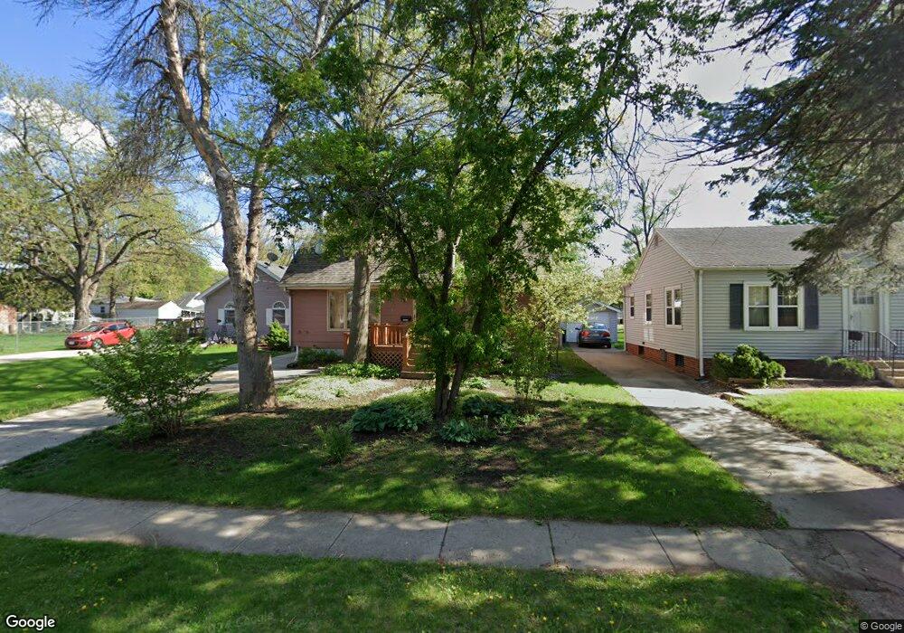
1120 Thornton Ave Des Moines, IA 50315
Greater South Side NeighborhoodEstimated Value: $203,000 - $227,790
3
Beds
2
Baths
1,148
Sq Ft
$186/Sq Ft
Est. Value
About This Home
This home is located at 1120 Thornton Ave, Des Moines, IA 50315 and is currently estimated at $213,198, approximately $185 per square foot. 1120 Thornton Ave is a home located in Polk County with nearby schools including Park Avenue Elementary School, Brody Middle School, and Lincoln High School.
Ownership History
Date
Name
Owned For
Owner Type
Purchase Details
Closed on
Jul 11, 2023
Sold by
Eckert Michael Dennis
Bought by
Eckert Brandon James
Current Estimated Value
Purchase Details
Closed on
Apr 30, 2015
Sold by
Hays Louis H and Hays Nancy L
Bought by
Eckert Michael Dennis and Eckert Brandon James
Create a Home Valuation Report for This Property
The Home Valuation Report is an in-depth analysis detailing your home's value as well as a comparison with similar homes in the area
Home Values in the Area
Average Home Value in this Area
Purchase History
| Date | Buyer | Sale Price | Title Company |
|---|---|---|---|
| Eckert Brandon James | -- | None Listed On Document | |
| Eckert Brandon James | -- | None Listed On Document | |
| Eckert Michael Dennis | $115,000 | None Available |
Source: Public Records
Mortgage History
| Date | Status | Borrower | Loan Amount |
|---|---|---|---|
| Closed | Eckert Michael Dennis | $0 |
Source: Public Records
Tax History Compared to Growth
Tax History
| Year | Tax Paid | Tax Assessment Tax Assessment Total Assessment is a certain percentage of the fair market value that is determined by local assessors to be the total taxable value of land and additions on the property. | Land | Improvement |
|---|---|---|---|---|
| 2025 | $3,304 | $210,000 | $34,400 | $175,600 |
| 2024 | $3,304 | $185,400 | $29,900 | $155,500 |
| 2023 | $3,496 | $185,400 | $29,900 | $155,500 |
| 2022 | $3,468 | $157,200 | $26,600 | $130,600 |
| 2021 | $3,242 | $157,200 | $26,600 | $130,600 |
| 2020 | $3,362 | $138,500 | $23,300 | $115,200 |
| 2019 | $3,028 | $138,500 | $23,300 | $115,200 |
| 2018 | $2,992 | $121,200 | $20,800 | $100,400 |
| 2017 | $2,652 | $121,200 | $20,800 | $100,400 |
| 2016 | $2,578 | $112,900 | $19,000 | $93,900 |
| 2015 | $2,578 | $112,900 | $19,000 | $93,900 |
| 2014 | $2,638 | $114,300 | $18,500 | $95,800 |
Source: Public Records
Map
Nearby Homes
- 3514 SW 12th St
- 3808 SW 12th St
- 3824 SW 12th St
- 3618 SW 9th St
- 3724 SW 13th St
- 3605 SW 9th St
- 1230 Park Ave
- 1222 Watrous Ave
- 3903 SW 9th St
- 3224 SW 13th Place
- 4020 SW 12th St
- 4108 SW 12th St
- 3308 SW 7th St
- 3125 SW 13th Place
- 1219 Elder Ln
- 1204 Elder Ln
- 3634 SW 4th St
- 606 Marion St
- 4204 SW 7th St
- 1518 Park Ave
- 1118 Thornton Ave
- 1124 Thornton Ave
- 1126 Thornton Ave
- 1121 Wolcott Ave
- 1132 Thornton Ave
- 1125 Wolcott Ave
- 1121 Thornton Ave
- 3608 Glover Ave
- 1115 Wolcott Ave
- 1131 Wolcott Ave
- 1111 Thornton Ave
- 3525 SW 12th St
- 1135 Wolcott Ave
- 3612 Glover Ave
- 3521 SW 12th St
- 3616 Glover Ave
- 3524 Glover Ave
- 3610 SW 12th St
- 3624 Glover Ave
- 3620 SW 12th St