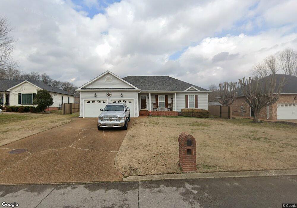
1120 Thunder Rd Gallatin, TN 37066
Estimated Value: $348,515 - $391,000
Studio
2
Baths
1,488
Sq Ft
$250/Sq Ft
Est. Value
About This Home
This home is located at 1120 Thunder Rd, Gallatin, TN 37066 and is currently estimated at $371,879, approximately $249 per square foot. 1120 Thunder Rd is a home located in Sumner County with nearby schools including Howard Elementary School and St. John Vianney Catholic School.
Ownership History
Date
Name
Owned For
Owner Type
Purchase Details
Closed on
Oct 19, 2018
Sold by
Williams Dana and Estate Of Doris Marie Gann
Bought by
Campbell Ricky Gene
Current Estimated Value
Purchase Details
Closed on
Jun 6, 2003
Sold by
Burris Stuart Campbell and Burris Glenda R
Bought by
Gann Doris M
Home Financials for this Owner
Home Financials are based on the most recent Mortgage that was taken out on this home.
Original Mortgage
$99,900
Interest Rate
5.68%
Mortgage Type
Purchase Money Mortgage
Purchase Details
Closed on
Jul 31, 2001
Sold by
Jones Randall R and Jones Barbara C
Bought by
Burris Stuart Campbell and Burris Glenda R
Home Financials for this Owner
Home Financials are based on the most recent Mortgage that was taken out on this home.
Original Mortgage
$104,700
Interest Rate
7.09%
Create a Home Valuation Report for This Property
The Home Valuation Report is an in-depth analysis detailing your home's value as well as a comparison with similar homes in the area
Home Values in the Area
Average Home Value in this Area
Purchase History
| Date | Buyer | Sale Price | Title Company |
|---|---|---|---|
| Campbell Ricky Gene | -- | None Available | |
| Gann Doris M | $134,900 | Bankers Title & Escrow Corp | |
| Burris Stuart Campbell | $130,900 | Advantage Title & Escrow |
Source: Public Records
Mortgage History
| Date | Status | Borrower | Loan Amount |
|---|---|---|---|
| Previous Owner | Gann Doris M | $99,900 | |
| Previous Owner | Burris Stuart Campbell | $104,700 |
Source: Public Records
Tax History
| Year | Tax Paid | Tax Assessment Tax Assessment Total Assessment is a certain percentage of the fair market value that is determined by local assessors to be the total taxable value of land and additions on the property. | Land | Improvement |
|---|---|---|---|---|
| 2025 | $1,337 | $94,075 | $25,000 | $69,075 |
| 2023 | $1,618 | $53,000 | $15,025 | $37,975 |
| 2022 | $1,623 | $53,000 | $15,025 | $37,975 |
| 2021 | $1,623 | $53,000 | $15,025 | $37,975 |
| 2020 | $1,623 | $53,000 | $15,025 | $37,975 |
| 2019 | $1,623 | $0 | $0 | $0 |
| 2018 | $1,406 | $0 | $0 | $0 |
| 2017 | $1,406 | $0 | $0 | $0 |
| 2016 | $1,007 | $0 | $0 | $0 |
| 2015 | $1,406 | $0 | $0 | $0 |
| 2014 | $1,216 | $0 | $0 | $0 |
Source: Public Records
Map
Nearby Homes
- 1122 Wedgewood Dr
- 292 Grassy Glen Dr
- 160 Putter Point Dr
- 269 Grassy Glen Dr
- 631 Wassil Dr
- 308 Oakley Dr
- 508 Coffee Ct Unit Lot 39
- 508 Coffee Ct
- 193 Summerlin Dr
- 180 Summerlin Dr
- 344 Winston Way
- 177 Summerlin Dr
- 173 Summerlin Dr
- 173 Summerlin Dr Unit Lot 46
- 365 Goodman Dr
- 2014 Sperling Dr
- 233 Summerlin Dr
- 309 Blade St
- 563 Becks Place
- 337 Fannis Cir
- 1116 Thunder Rd
- 1124 Thunder Rd
- 183 Abbey Rd
- 1112 Thunder Rd
- 179 Abbey Rd
- 1126 Thunder Rd
- 1119 Thunder Rd
- 178 Abbey Rd
- 1123 Thunder Rd
- 1115 Thunder Rd
- 1127 Thunder Rd
- 1108 Thunder Rd
- 175 Abbey Rd
- 1111 Thunder Rd
- 174 Abbey Rd
- 1118 Wedgewood Dr
- 1107 Thunder Rd
- 1114 Wedgewood Dr
- 171 Abbey Rd
- 173 Putter Point Dr
Your Personal Tour Guide
Ask me questions while you tour the home.