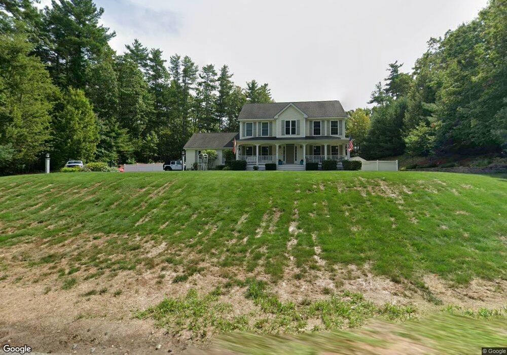
1120 W Hollis St Nashua, NH 03062
West Hollis NeighborhoodEstimated Value: $674,000 - $856,000
4
Beds
4
Baths
2,320
Sq Ft
$321/Sq Ft
Est. Value
About This Home
This home is located at 1120 W Hollis St, Nashua, NH 03062 and is currently estimated at $744,372, approximately $320 per square foot. 1120 W Hollis St is a home located in Hillsborough County with nearby schools including Main Dunstable School, Elm Street Middle School, and Nashua High School South.
Ownership History
Date
Name
Owned For
Owner Type
Purchase Details
Closed on
Dec 3, 2007
Sold by
Gateway Homes Llc
Bought by
Theodore Steven and Theodore Cristen
Current Estimated Value
Home Financials for this Owner
Home Financials are based on the most recent Mortgage that was taken out on this home.
Original Mortgage
$409,900
Interest Rate
6.48%
Mortgage Type
Purchase Money Mortgage
Purchase Details
Closed on
Mar 30, 2007
Sold by
Slater John F
Bought by
Gateway Homes Llc
Home Financials for this Owner
Home Financials are based on the most recent Mortgage that was taken out on this home.
Original Mortgage
$97,500
Interest Rate
6.33%
Mortgage Type
Purchase Money Mortgage
Create a Home Valuation Report for This Property
The Home Valuation Report is an in-depth analysis detailing your home's value as well as a comparison with similar homes in the area
Home Values in the Area
Average Home Value in this Area
Purchase History
| Date | Buyer | Sale Price | Title Company |
|---|---|---|---|
| Theodore Steven | $409,900 | -- | |
| Gateway Homes Llc | $130,000 | -- |
Source: Public Records
Mortgage History
| Date | Status | Borrower | Loan Amount |
|---|---|---|---|
| Open | Gateway Homes Llc | $289,000 | |
| Closed | Gateway Homes Llc | $409,900 | |
| Previous Owner | Gateway Homes Llc | $97,500 |
Source: Public Records
Tax History Compared to Growth
Tax History
| Year | Tax Paid | Tax Assessment Tax Assessment Total Assessment is a certain percentage of the fair market value that is determined by local assessors to be the total taxable value of land and additions on the property. | Land | Improvement |
|---|---|---|---|---|
| 2024 | $11,661 | $733,400 | $185,200 | $548,200 |
| 2023 | $11,153 | $611,800 | $148,100 | $463,700 |
| 2022 | $11,055 | $611,800 | $148,100 | $463,700 |
| 2021 | $10,098 | $434,900 | $99,200 | $335,700 |
| 2020 | $9,523 | $421,200 | $99,200 | $322,000 |
| 2019 | $9,165 | $421,200 | $99,200 | $322,000 |
| 2018 | $8,934 | $421,200 | $99,200 | $322,000 |
| 2017 | $9,973 | $386,700 | $81,200 | $305,500 |
| 2016 | $9,695 | $386,700 | $81,200 | $305,500 |
| 2015 | $9,135 | $372,400 | $81,200 | $291,200 |
| 2014 | $8,956 | $372,400 | $81,200 | $291,200 |
Source: Public Records
Map
Nearby Homes
- 12 Clovercrest Dr
- 67 Groton Rd Unit B
- 5 Plainfield Ln
- 1 Ladd Ln
- 9-48-8 Ladd Ln
- 11 Rideout Rd
- 77 Birchwood Dr
- 80 Twiss Ln
- 20 Martha St
- 300 Candlewood Park Unit 336
- 25 Cortez Dr Unit U57
- 147 Nashua Rd
- 4-58 Dow Rd
- 194 Dow Rd
- 24-A 34-A Dow St
- 3 Mayfair Ln Unit U108
- 12 Spring Cove Rd Unit U103
- 91 Century Way
- 375 Main Dunstable Rd
- 139 Nashua Rd
- 1116 W Hollis St
- 6 Tammy Cir
- 9 Tammy Cir
- 1128 W Hollis St
- 7 Tammy Cir
- 4 Tammy Cir
- 5 Tammy Cir
- 1110 W Hollis St
- 46 Old Runnells Bridge Rd
- 3 Tammy Cir
- 117 Gilson Rd
- 119 Gilson Rd
- 111 Gilson Rd
- 1097 W Hollis St Unit 10-16
- 1100 W Hollis St
- 43 Old Runnells Bridge Rd
- 7 Runnells Bridge Rd
- 113 Gilson Rd
- 115 Gilson Rd
- 1 Eric Ave