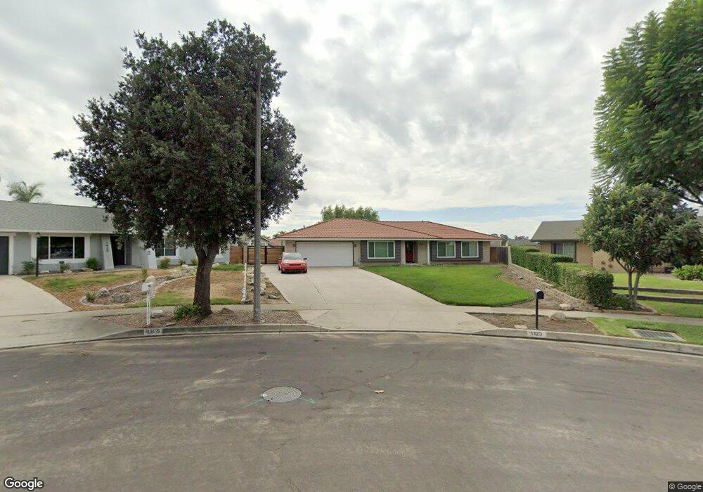
1120 W Winslow St Upland, CA 91786
Estimated Value: $861,503 - $918,000
3
Beds
2
Baths
1,615
Sq Ft
$549/Sq Ft
Est. Value
About This Home
This home is located at 1120 W Winslow St, Upland, CA 91786 and is currently estimated at $886,626, approximately $548 per square foot. 1120 W Winslow St is a home located in San Bernardino County with nearby schools including Sycamore Elementary, Pioneer Junior High School, and Upland High School.
Ownership History
Date
Name
Owned For
Owner Type
Purchase Details
Closed on
Feb 22, 2021
Sold by
Black Christopher and Kelley Black Jennifer
Bought by
Black Christopher and Kelley Black Jennifer
Current Estimated Value
Home Financials for this Owner
Home Financials are based on the most recent Mortgage that was taken out on this home.
Original Mortgage
$393,700
Outstanding Balance
$352,727
Interest Rate
2.8%
Mortgage Type
New Conventional
Estimated Equity
$533,899
Purchase Details
Closed on
Jul 17, 2012
Sold by
Black Christopher
Bought by
Black Christopher and Kelley Black Jennifer M
Purchase Details
Closed on
Dec 16, 2009
Sold by
Kelley Black Jennifer M
Bought by
Black Christopher
Home Financials for this Owner
Home Financials are based on the most recent Mortgage that was taken out on this home.
Original Mortgage
$320,000
Interest Rate
4.88%
Mortgage Type
New Conventional
Purchase Details
Closed on
Nov 18, 2009
Sold by
Federal Home Loan Mortgage Corporation
Bought by
Black Christopher
Home Financials for this Owner
Home Financials are based on the most recent Mortgage that was taken out on this home.
Original Mortgage
$320,000
Interest Rate
4.88%
Mortgage Type
New Conventional
Purchase Details
Closed on
Oct 21, 2009
Sold by
Rohani Mohammad H and Fathipour Parvaneh
Bought by
Federal Home Loan Mortgage Corporation
Home Financials for this Owner
Home Financials are based on the most recent Mortgage that was taken out on this home.
Original Mortgage
$320,000
Interest Rate
4.88%
Mortgage Type
New Conventional
Purchase Details
Closed on
Apr 16, 2002
Sold by
Farris Lester C and Farris Lester
Bought by
Rohani Mohammad H and Fathipour Parvaneh
Home Financials for this Owner
Home Financials are based on the most recent Mortgage that was taken out on this home.
Original Mortgage
$275,500
Interest Rate
7.18%
Create a Home Valuation Report for This Property
The Home Valuation Report is an in-depth analysis detailing your home's value as well as a comparison with similar homes in the area
Home Values in the Area
Average Home Value in this Area
Purchase History
| Date | Buyer | Sale Price | Title Company |
|---|---|---|---|
| Black Christopher | -- | Unisource | |
| Black Christopher | -- | Nations Title Company | |
| Black Christopher | -- | Lsi Title | |
| Black Christopher | $400,000 | Lsi Title | |
| Federal Home Loan Mortgage Corporation | $356,404 | Servicelink | |
| Rohani Mohammad H | $275,500 | First American |
Source: Public Records
Mortgage History
| Date | Status | Borrower | Loan Amount |
|---|---|---|---|
| Open | Black Christopher | $393,700 | |
| Closed | Black Christopher | $320,000 | |
| Previous Owner | Rohani Mohammad H | $275,500 |
Source: Public Records
Tax History Compared to Growth
Tax History
| Year | Tax Paid | Tax Assessment Tax Assessment Total Assessment is a certain percentage of the fair market value that is determined by local assessors to be the total taxable value of land and additions on the property. | Land | Improvement |
|---|---|---|---|---|
| 2025 | $5,565 | $516,329 | $180,714 | $335,615 |
| 2024 | $5,565 | $506,205 | $177,171 | $329,034 |
| 2023 | $5,481 | $496,279 | $173,697 | $322,582 |
| 2022 | $5,364 | $486,548 | $170,291 | $316,257 |
| 2021 | $5,357 | $477,008 | $166,952 | $310,056 |
| 2020 | $5,212 | $472,117 | $165,240 | $306,877 |
| 2019 | $5,195 | $462,860 | $162,000 | $300,860 |
| 2018 | $5,068 | $453,785 | $158,824 | $294,961 |
| 2017 | $4,923 | $444,887 | $155,710 | $289,177 |
| 2016 | $9,733 | $436,164 | $152,657 | $283,507 |
| 2015 | $9,636 | $429,612 | $150,364 | $279,248 |
| 2014 | $9,518 | $421,197 | $147,419 | $273,778 |
Source: Public Records
Map
Nearby Homes
- 1469 N Erin Ave
- 1018 W 15th St
- 1547 Shamrock Ave
- 1193 W 13th St
- 1427 N San Antonio Ave
- 939 W Pine St Unit 44
- 1354 Lakewood Ave
- 1090 Springfield St
- 1613 Erin Ave
- 1359 Lakewood Ave
- 880 W Pine St
- 1099 Sullivan St
- 1669 Erin Ave
- 1623 N Vallejo Way
- 1520 Cantabria Place
- 1400 Sullivan St
- 388 Harford Place
- 882 W 17th St
- 1146 Oneil St
- 1635 Wilson Ave
- 1124 W Winslow St
- 1427 N Cambridge Ave
- 1433 N Cambridge Ave
- 1134 W Winslow St
- 1444 Kelly Ave
- 1439 N Cambridge Ave
- 1082 W Westridge Ct
- 1443 Kelly Ave
- 1441 N Cambridge Ave
- 1432 N Erin Ave
- 1078 W Westridge Ct
- 1454 Kelly Ave
- 1422 N Erin Ave
- 1455 Kelly Ave
- 1444 N Erin Ave
- 1416 N Erin Ave
- 1097 W 14th St
- 1428 N Cambridge Ave
- 1070 W Westridge Ct
- 1078 Overland Ave