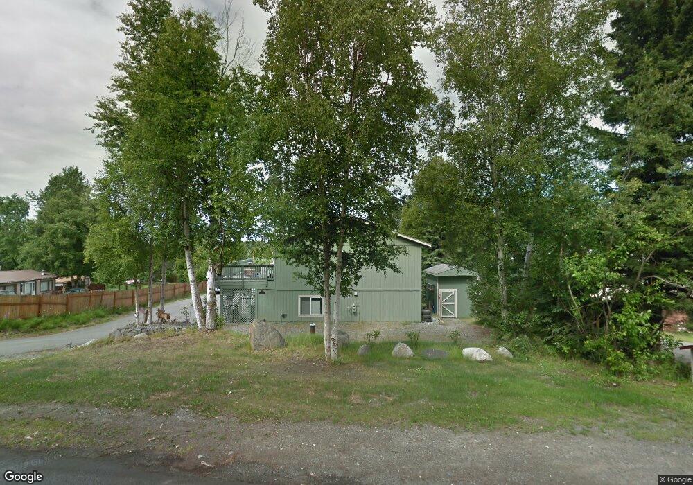
11200 Polar Dr Anchorage, AK 99516
Huffman-O'Malley NeighborhoodEstimated Value: $459,000 - $553,000
3
Beds
2
Baths
2,061
Sq Ft
$252/Sq Ft
Est. Value
About This Home
This home is located at 11200 Polar Dr, Anchorage, AK 99516 and is currently estimated at $518,598, approximately $251 per square foot. 11200 Polar Dr is a home located in Anchorage Municipality with nearby schools including Bowman Elementary School, Hanshew Middle School, and Service High School.
Ownership History
Date
Name
Owned For
Owner Type
Purchase Details
Closed on
May 10, 2001
Sold by
Wood Jason R
Bought by
Wood Dennis L
Current Estimated Value
Create a Home Valuation Report for This Property
The Home Valuation Report is an in-depth analysis detailing your home's value as well as a comparison with similar homes in the area
Home Values in the Area
Average Home Value in this Area
Purchase History
| Date | Buyer | Sale Price | Title Company |
|---|---|---|---|
| Wood Dennis L | -- | First American Title Co | |
| Wood Dennis L | -- | -- |
Source: Public Records
Tax History Compared to Growth
Tax History
| Year | Tax Paid | Tax Assessment Tax Assessment Total Assessment is a certain percentage of the fair market value that is determined by local assessors to be the total taxable value of land and additions on the property. | Land | Improvement |
|---|---|---|---|---|
| 2025 | $3,631 | $470,500 | $106,400 | $364,100 |
| 2024 | $3,631 | $449,900 | $101,400 | $348,500 |
| 2023 | $7,062 | $414,700 | $97,500 | $317,200 |
| 2022 | $3,233 | $392,000 | $97,600 | $294,400 |
| 2021 | $6,630 | $367,900 | $97,600 | $270,300 |
| 2020 | $2,607 | $354,500 | $97,600 | $256,900 |
| 2019 | $4,926 | $351,100 | $97,600 | $253,500 |
| 2018 | $5,066 | $358,900 | $110,400 | $248,500 |
| 2017 | $5,396 | $364,600 | $110,400 | $254,200 |
| 2016 | $4,395 | $370,900 | $110,400 | $260,500 |
| 2015 | $4,395 | $354,900 | $106,400 | $248,500 |
| 2014 | $4,395 | $327,900 | $88,900 | $239,000 |
Source: Public Records
Map
Nearby Homes
- 2640 E 112th Ave
- 11135 Red Sky Cir
- L16 Sky Ridge Dr
- 11359 Tulin Park Loop
- 11097 Sky Ridge Dr
- 11335 Tulin Park Loop
- 2735 Meadow Wood Cir
- 10359 Valley Park Dr
- 8000 Independence Park Dr
- 1510 Elcadore Dr Unit 134
- 11483 Moonrise Ridge Place Unit 10
- 1540 Elcadore Dr Unit 125
- 1900-1941 Marthas Vineyard Cir
- 12170 Woodward Dr
- 10260 Jamestown Dr Unit A8
- 1677 Circlewood Dr
- 10261 Arborvitae Dr
- 10285 Arborvitae Dr
- 2521 Winterchase Cir
- 2060 Sturbridge Cir
- 11210 Polar Dr
- 11140 Polar Dr
- L20 B4 Polar Dr
- 11220 Polar Dr
- 11130 Polar Dr
- 11101 Forest Dr
- 11111 Forest Dr
- 11031 Forest Dr
- 11211 Polar Dr
- 11121 Forest Dr
- 11021 Forest Dr
- 11230 Polar Dr
- 11141 Polar Dr
- 11221 Polar Dr
- 11131 Forest Dr
- 11011 Forest Dr
- 11020 Polar Dr
- 11231 Polar Dr
- 11300 Polar Dr
- 11100 Polar Dr