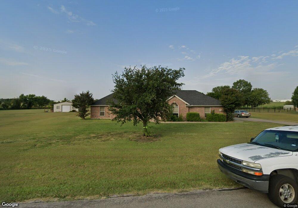
11201 Blue Sky Dr Haslet, TX 76052
Estimated Value: $572,000 - $659,000
4
Beds
2
Baths
2,767
Sq Ft
$220/Sq Ft
Est. Value
About This Home
This home is located at 11201 Blue Sky Dr, Haslet, TX 76052 and is currently estimated at $607,639, approximately $219 per square foot. 11201 Blue Sky Dr is a home located in Tarrant County with nearby schools including Carl E. Schluter Elementary School, Leo Adams Middle School, and V.R. Eaton High School.
Ownership History
Date
Name
Owned For
Owner Type
Purchase Details
Closed on
Dec 14, 2001
Sold by
Butter Homes Inc
Bought by
Mitchell Anthony S and Mitchell Kimberly Anne
Current Estimated Value
Home Financials for this Owner
Home Financials are based on the most recent Mortgage that was taken out on this home.
Original Mortgage
$142,813
Outstanding Balance
$55,059
Interest Rate
6.39%
Estimated Equity
$552,580
Create a Home Valuation Report for This Property
The Home Valuation Report is an in-depth analysis detailing your home's value as well as a comparison with similar homes in the area
Home Values in the Area
Average Home Value in this Area
Purchase History
| Date | Buyer | Sale Price | Title Company |
|---|---|---|---|
| Mitchell Anthony S | -- | -- |
Source: Public Records
Mortgage History
| Date | Status | Borrower | Loan Amount |
|---|---|---|---|
| Open | Mitchell Anthony S | $142,813 | |
| Closed | Mitchell Anthony S | $17,851 |
Source: Public Records
Tax History Compared to Growth
Tax History
| Year | Tax Paid | Tax Assessment Tax Assessment Total Assessment is a certain percentage of the fair market value that is determined by local assessors to be the total taxable value of land and additions on the property. | Land | Improvement |
|---|---|---|---|---|
| 2025 | $2,234 | $479,000 | $124,022 | $354,978 |
| 2024 | $2,234 | $544,470 | $124,022 | $420,448 |
| 2023 | $7,022 | $529,100 | $78,375 | $450,725 |
| 2022 | $7,413 | $413,777 | $78,375 | $335,402 |
| 2021 | $7,449 | $348,607 | $78,375 | $270,232 |
| 2020 | $7,315 | $349,896 | $78,375 | $271,521 |
| 2019 | $7,199 | $347,812 | $75,000 | $272,812 |
| 2018 | $2,045 | $302,025 | $45,000 | $257,025 |
| 2017 | $6,101 | $306,001 | $49,500 | $256,501 |
| 2016 | $5,546 | $304,897 | $49,500 | $255,397 |
| 2015 | $4,923 | $258,400 | $50,600 | $207,800 |
| 2014 | $4,923 | $258,400 | $50,600 | $207,800 |
Source: Public Records
Map
Nearby Homes
- 11108 Blue Sky Dr
- 11325 Elk Horn Ct
- 1820 Walpole Way
- 1816 Walpole Way
- 11516 Ely Place
- 1872 Naseby Rd
- 11536 Ely Place
- 11540 Ely Place
- 11528 Wulstone Rd
- Plan 1456 - 40 at Wellington - 40'
- Plan 1523 - 50 at Wellington - 50'
- Plan 1523 - 60 at Wellington - 60'
- Plan 1452 - 40 at Wellington - 40'
- Plan 1455 - 40 at Wellington - 40'
- Plan 1535 - 50 at Wellington - 50'
- Plan 1682 - 60 at Wellington - 60'
- Plan 1578 - 50 at Wellington - 50'
- Plan 1527 - 60 at Wellington - 60'
- Plan 1681 - 60 at Wellington - 60'
- Plan 1522 - 50 at Wellington - 50'
- 11133 Blue Sky Dr
- 11209 Blue Sky Dr
- 11132 Blue Sky Dr
- 11301 Alpine Ct
- 11125 Blue Sky Dr
- 11217 Blue Sky Dr
- 11124 Blue Sky Dr
- 11309 Alpine Ct
- 11117 Blue Sky Dr
- 11308 Alpine Ct
- 11116 Blue Sky Dr
- 11109 Blue Sky Dr
- 11401 Alpine Ct
- 11408 Alpine Ct
- 11101 Blue Sky Dr
- 11417 Alpine Ct
- 11100 Blue Sky Dr
- 1948 Saw Tooth Ct
- 11317 Elk Horn Ct
- 1936 Saw Tooth Ct