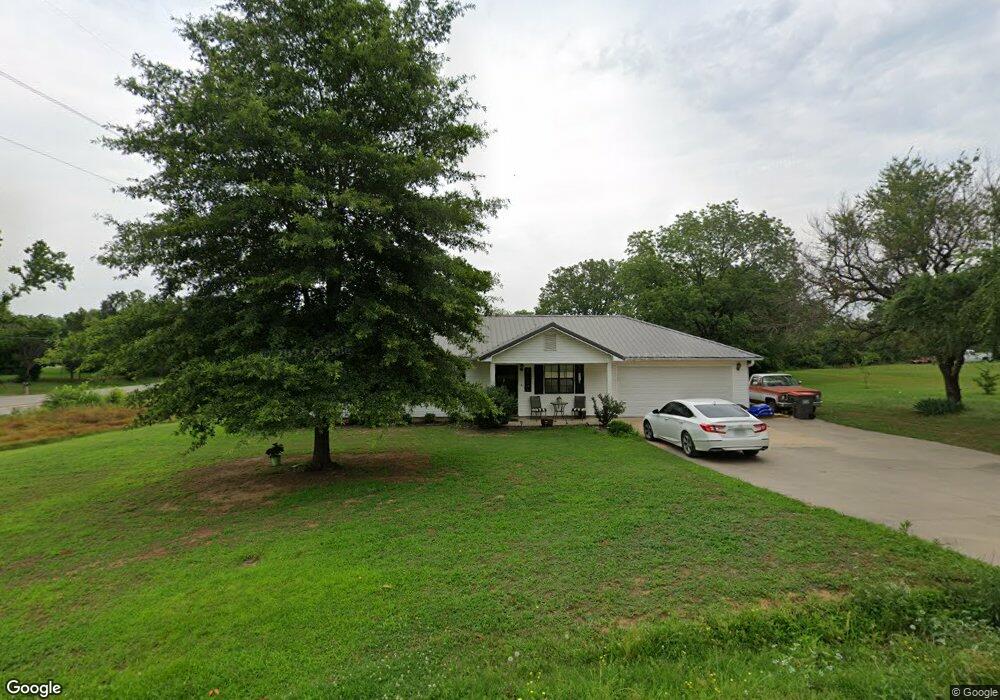
112031 S 4776 Rd Muldrow, OK 74948
Estimated Value: $173,282 - $224,000
3
Beds
2
Baths
1,264
Sq Ft
$153/Sq Ft
Est. Value
About This Home
This home is located at 112031 S 4776 Rd, Muldrow, OK 74948 and is currently estimated at $193,071, approximately $152 per square foot. 112031 S 4776 Rd is a home with nearby schools including Roland Middle School and Roland High School.
Ownership History
Date
Name
Owned For
Owner Type
Purchase Details
Closed on
Dec 9, 2016
Sold by
Edwards Clay A and Edwards Jessica E
Bought by
Pratt Robert K
Current Estimated Value
Home Financials for this Owner
Home Financials are based on the most recent Mortgage that was taken out on this home.
Original Mortgage
$90,808
Outstanding Balance
$73,212
Interest Rate
3.47%
Mortgage Type
New Conventional
Estimated Equity
$119,859
Purchase Details
Closed on
Sep 1, 2006
Sold by
Williamson John W and Williamson Rose
Bought by
Edwards Clay A
Home Financials for this Owner
Home Financials are based on the most recent Mortgage that was taken out on this home.
Original Mortgage
$15,000
Interest Rate
6.72%
Mortgage Type
Stand Alone Second
Purchase Details
Closed on
Jun 15, 2006
Sold by
Williamson John W and Williamson Rose
Bought by
Edwards Clay A
Create a Home Valuation Report for This Property
The Home Valuation Report is an in-depth analysis detailing your home's value as well as a comparison with similar homes in the area
Home Values in the Area
Average Home Value in this Area
Purchase History
| Date | Buyer | Sale Price | Title Company |
|---|---|---|---|
| Pratt Robert K | $89,900 | None Available | |
| Edwards Clay A | $50,000 | None Available | |
| Edwards Clay A | -- | None Available |
Source: Public Records
Mortgage History
| Date | Status | Borrower | Loan Amount |
|---|---|---|---|
| Open | Pratt Robert K | $90,808 | |
| Previous Owner | Edwards Clay A | $15,000 |
Source: Public Records
Tax History Compared to Growth
Tax History
| Year | Tax Paid | Tax Assessment Tax Assessment Total Assessment is a certain percentage of the fair market value that is determined by local assessors to be the total taxable value of land and additions on the property. | Land | Improvement |
|---|---|---|---|---|
| 2024 | $946 | $11,297 | $1,195 | $10,102 |
| 2023 | $916 | $10,968 | $1,195 | $9,773 |
| 2022 | $851 | $10,648 | $1,195 | $9,453 |
| 2021 | $838 | $10,406 | $1,199 | $9,207 |
| 2020 | $856 | $10,406 | $1,199 | $9,207 |
| 2019 | $878 | $10,648 | $1,199 | $9,449 |
| 2018 | $795 | $10,500 | $1,199 | $9,301 |
| 2017 | $758 | $9,889 | $1,199 | $8,690 |
| 2016 | $590 | $7,020 | $895 | $6,125 |
| 2015 | $549 | $6,686 | $841 | $5,845 |
| 2014 | $524 | $6,367 | $791 | $5,576 |
Source: Public Records
Map
Nearby Homes
- 111324 S 4780 Rd
- TBD U S Highway 64
- 113 Cherokee Blvd
- TBD W Ray Fine Blvd
- 404 W Ray Fine Blvd
- 400 W Ray Fine Blvd
- 111587 S 4760 Rd
- 320 Neal Dr
- 405 W Ray Fine Blvd
- 407 W Ray Fine Blvd
- 121 Shady Ln
- 103 Mondier St
- 102 Gama Cir
- 101 W Howard St
- 123 Gamma Cir
- Lot 1 N 4780 Rd
- 101 Hollow Dr
- 405 Woodland Hills Blvd
- 104 Math Ln
- 515 Loop W
- 477607 Old Us Highway 64
- 477633 Old Us Highway 64
- 477645 Old Us Highway 64
- 112087 S 4776 Rd
- 477688 Old Us Highway 64
- 477548 Old Us Highway 64
- 111875 S 4776 Rd
- 112145 S 4776 Rd
- 112108 S 4776 Rd
- 112180 S 4776 Rd
- 112102 S 4775 Rd
- 112196 S 4776 Rd
- 112195 S 4776 Rd
- 477839 Old Us Highway 64
- 477895 Old Us Highway 64
- 111904 S 4779 Rd
- 478181 Old Us Highway 64
- 478171 Old Us Highway 64
- 477921 Old Us Highway 64
- 477855 Old Us Highway 64