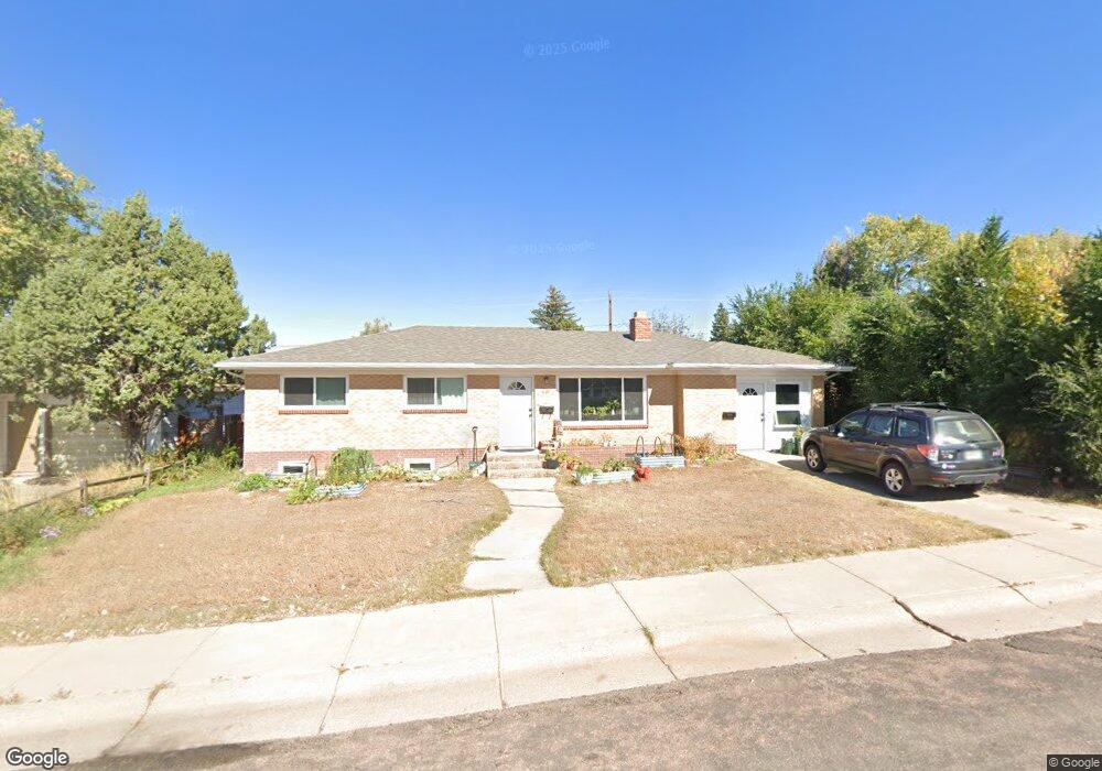
1121 E Baker St Laramie, WY 82072
Estimated Value: $230,000 - $373,429
5
Beds
2
Baths
1,053
Sq Ft
$303/Sq Ft
Est. Value
About This Home
This home is located at 1121 E Baker St, Laramie, WY 82072 and is currently estimated at $318,810, approximately $302 per square foot. 1121 E Baker St is a home located in Albany County with nearby schools including Slade Elementary School, Laramie Middle School, and Laramie High School.
Ownership History
Date
Name
Owned For
Owner Type
Purchase Details
Closed on
Sep 17, 2021
Sold by
Wong Gregory K and Wong Charles
Bought by
Blair Breanna and Kimble Amy
Current Estimated Value
Home Financials for this Owner
Home Financials are based on the most recent Mortgage that was taken out on this home.
Original Mortgage
$260,200
Outstanding Balance
$236,763
Interest Rate
2.8%
Mortgage Type
FHA
Estimated Equity
$82,047
Create a Home Valuation Report for This Property
The Home Valuation Report is an in-depth analysis detailing your home's value as well as a comparison with similar homes in the area
Home Values in the Area
Average Home Value in this Area
Purchase History
| Date | Buyer | Sale Price | Title Company |
|---|---|---|---|
| Blair Breanna | -- | First American Title |
Source: Public Records
Mortgage History
| Date | Status | Borrower | Loan Amount |
|---|---|---|---|
| Open | Blair Breanna | $260,200 |
Source: Public Records
Tax History Compared to Growth
Tax History
| Year | Tax Paid | Tax Assessment Tax Assessment Total Assessment is a certain percentage of the fair market value that is determined by local assessors to be the total taxable value of land and additions on the property. | Land | Improvement |
|---|---|---|---|---|
| 2021 | $1,629 | $22,319 | $4,249 | $18,070 |
| 2020 | $1,617 | $22,150 | $4,249 | $17,901 |
| 2019 | $1,569 | $21,495 | $4,249 | $17,246 |
| 2018 | $1,499 | $20,540 | $4,249 | $16,291 |
| 2017 | $1,596 | $21,868 | $3,653 | $18,215 |
| 2016 | $1,501 | $20,562 | $3,653 | $16,909 |
| 2015 | $1,436 | $19,672 | $4,047 | $15,625 |
| 2014 | $1,410 | $19,319 | $0 | $0 |
Source: Public Records
Map
Nearby Homes
- 1215 E Baker St
- 1068 N 11th St
- 1103 E Canby St
- 1257 N 15th St Unit H
- 1259 N 15th St Unit G
- 1251 N 15th St Unit J
- 1021 E Gibbon St
- 657 N 9th St
- 1150 N 18th St
- 1402 Mitchell St
- 716 Mitchell St
- 564 N 8th St
- 1520 W Hill Rd
- 517 Reynolds St
- 1675 N 6th St Unit 1
- 535 Mitchell St Unit C-5
- 507 Mitchell St Unit J-6
- 451 N 5th St
- 405 Mitchell St Unit G1
- 1554 Henry Dr
- 1115 E Baker St
- 1203 E Baker St
- 1109 E Baker St
- 1120 Shield St
- 1209 E Baker St
- 1114 Shield St
- 1202 Shield St
- 1208 Shield St
- 1155 N 11th St
- 1108 Shield St
- 1214 Shield St
- 1165 N 11th St
- 1221 E Baker St
- 1220 Shield St
- 1150 N 11th St
- 1162 N 11th St
- 1170 N 11th St
- 1166 N 11th St
- 1070 N 11th St
- 1015 E Baker St