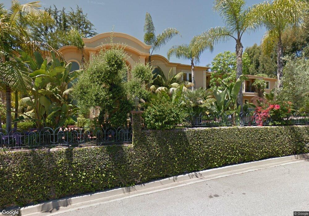
1121 Summit Dr Beverly Hills, CA 90210
Estimated Value: $6,484,000 - $8,292,162
About This Home
This home is located at 1121 Summit Dr, Beverly Hills, CA 90210 and is currently estimated at $7,273,541, approximately $902 per square foot. 1121 Summit Dr is a home located in Los Angeles County with nearby schools including El Rodeo Elementary School, Beverly Hills High School, and Good Shepherd Catholic School.
Ownership History
We collect this data history from publicly available records. To have your information removed, we recommend requesting removal directly through your county’s website.
Purchase Details
Home Financials for this Owner
Home Financials are based on the most recent Mortgage that was taken out on this home.Purchase Details
Home Financials for this Owner
Home Financials are based on the most recent Mortgage that was taken out on this home.Purchase Details
Home Financials for this Owner
Home Financials are based on the most recent Mortgage that was taken out on this home.Purchase Details
Purchase Details
Home Financials for this Owner
Home Financials are based on the most recent Mortgage that was taken out on this home.Purchase Details
Home Values in the Area
Average Home Value in this Area
Purchase History
We collect this data history from publicly available records. To have your information removed, we recommend requesting removal directly through your county’s website.
| Date | Buyer | Sale Price | Title Company |
|---|---|---|---|
| -- | Old Republic Title Company | ||
| -- | Old Republic Title Company | ||
| -- | None Available | ||
| -- | None Available | ||
| -- | None Available | ||
| -- | Landsafe Title Of California | ||
| -- | -- | ||
| -- | Equity Title | ||
| -- | -- |
Mortgage History
We collect this data history from publicly available records. To have your information removed, we recommend requesting removal directly through your county’s website.
| Date | Status | Borrower | Loan Amount |
|---|---|---|---|
| Previous Owner | $2,387,294 | ||
| Previous Owner | $1,200,000 | ||
| Previous Owner | $1,995,000 | ||
| Previous Owner | $1,300,000 |
Tax History
We collect this data history from publicly available records. To have your information removed, we recommend requesting removal directly through your county’s website.
| Year | Tax Paid | Tax Assessment Tax Assessment Total Assessment is a certain percentage of the fair market value that is determined by local assessors to be the total taxable value of land and additions on the property. | Land | Improvement |
|---|---|---|---|---|
| 2025 | $53,589 | $4,370,364 | $2,587,779 | $1,782,585 |
| 2024 | $52,423 | $4,284,672 | $2,537,039 | $1,747,633 |
| 2023 | $51,489 | $4,200,660 | $2,487,294 | $1,713,366 |
| 2022 | $50,027 | $4,118,295 | $2,438,524 | $1,679,771 |
| 2021 | $48,557 | $4,037,545 | $2,390,710 | $1,646,835 |
| 2020 | $48,393 | $3,996,146 | $2,366,197 | $1,629,949 |
| 2019 | $47,171 | $3,917,791 | $2,319,801 | $1,597,990 |
| 2018 | $45,049 | $3,840,972 | $2,274,315 | $1,566,657 |
| 2016 | $43,197 | $3,691,824 | $2,186,001 | $1,505,823 |
| 2015 | $41,357 | $3,636,371 | $2,153,166 | $1,483,205 |
| 2014 | $39,992 | $3,565,141 | $2,110,989 | $1,454,152 |
Map
- 1124 Summit Dr
- 1134 San Ysidro Dr
- 1022 Summit Dr
- 1110 Benedict Canyon Dr
- 1100 Pine Dr
- 9921 Tower Ln
- 1700 Green Acres Dr
- 2250 Benedict Canyon Dr
- 1150 Laurel Way
- 1140 Laurel Way
- 1166 San Ysidro Dr
- 1717 Chevy Chase Dr
- 1025 N Crescent Dr
- 1255 Benedict Canyon Dr
- 1006 N Crescent Dr
- 1210 Laurel Way
- 1001 N Crescent Dr
- 917 Oxford Way
- 1309 Laurel Way
- 1003 Benedict Canyon Dr
- 1129 Summit Dr
- 1122 San Ysidro Dr
- 1126 San Ysidro Dr
- 1085 Summit Dr
- 1130 San Ysidro Dr
- 1120 Summit Dr
- 1115 Carolyn Way
- 1100 Summit Dr
- 1105 Carolyn Way
- 1118 San Ysidro Dr
- 1125 Carolyn Way
- 1095 Carolyn Way
- 1125 San Ysidro Dr
- 1119 San Ysidro Dr
- 1130 Summit Dr
- 1136 San Ysidro Dr
- 1075 Carolyn Way
- 1131 San Ysidro Dr
- 1135 Carolyn Way
- 1115 San Ysidro Dr
Ask me questions while you tour the home.