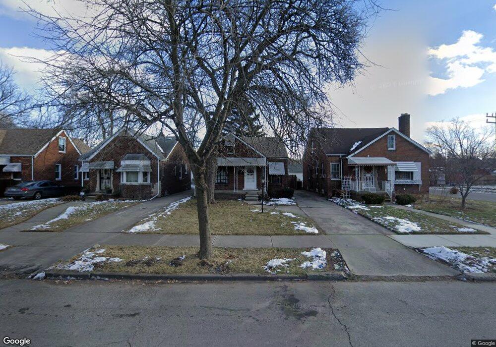
11210 Wayburn St Detroit, MI 48224
Denby NeighborhoodEstimated Value: $70,000 - $90,000
--
Bed
1
Bath
837
Sq Ft
$94/Sq Ft
Est. Value
About This Home
This home is located at 11210 Wayburn St, Detroit, MI 48224 and is currently estimated at $78,816, approximately $94 per square foot. 11210 Wayburn St is a home located in Wayne County with nearby schools including Wayne Elementary School, Edward 'Duke' Ellington Conservatory of Music and Art, and Charles L. Spain Elementary-Middle School.
Ownership History
Date
Name
Owned For
Owner Type
Purchase Details
Closed on
Mar 13, 2024
Sold by
United Cmnty Housing Coalition
Bought by
Kennedy Angela Lanette
Current Estimated Value
Purchase Details
Closed on
Jan 15, 2020
Sold by
City Of Detroit
Bought by
United Community Housing Coalition
Purchase Details
Closed on
Nov 13, 2019
Sold by
County Of Wayne
Bought by
City Of Detroit Planning And Dev Dept
Purchase Details
Closed on
Dec 16, 2011
Sold by
The Estate Of Houston R Kennedy Sr
Bought by
Kennedy Angela L
Create a Home Valuation Report for This Property
The Home Valuation Report is an in-depth analysis detailing your home's value as well as a comparison with similar homes in the area
Home Values in the Area
Average Home Value in this Area
Purchase History
| Date | Buyer | Sale Price | Title Company |
|---|---|---|---|
| Kennedy Angela Lanette | $6,500 | None Listed On Document | |
| United Community Housing Coalition | $135,209 | None Available | |
| City Of Detroit Planning And Dev Dept | $11,976 | None Available | |
| Kennedy Angela L | -- | Philip R Seaver Title Co Inc |
Source: Public Records
Tax History Compared to Growth
Tax History
| Year | Tax Paid | Tax Assessment Tax Assessment Total Assessment is a certain percentage of the fair market value that is determined by local assessors to be the total taxable value of land and additions on the property. | Land | Improvement |
|---|---|---|---|---|
| 2025 | $250 | $28,700 | $0 | $0 |
| 2024 | $250 | $26,400 | $0 | $0 |
| 2023 | $240 | $21,300 | $0 | $0 |
| 2022 | $371 | $0 | $0 | $0 |
| 2021 | $251 | $0 | $0 | $0 |
| 2019 | $960 | $11,100 | $0 | $0 |
| 2018 | $828 | $10,400 | $0 | $0 |
| 2017 | $186 | $9,800 | $0 | $0 |
| 2016 | $1,061 | $13,700 | $0 | $0 |
| 2015 | $1,370 | $13,700 | $0 | $0 |
| 2013 | $1,903 | $19,027 | $0 | $0 |
| 2010 | -- | $27,895 | $1,183 | $26,712 |
Source: Public Records
Map
Nearby Homes
- 11110 Wayburn St
- 11010 Rossiter St
- 10897 Lakepointe St
- 11059 Lakepointe St
- 11320 Wayburn St
- 10811 Roxbury St
- 10947 Roxbury St
- 10731 Roxbury St
- 11365 Whitehill St
- 11521 Whitehill St
- 11583 Whitehill St
- 10597 Beaconsfield St
- 11632 Laing St
- 11009 Roxbury St
- 10713 Beaconsfield St
- 11434 Laing St
- 11426 Laing St
- 11676 Laing St
- 11038 Whitehill St
- 10773 Beaconsfield St
- 11216 Wayburn St
- 11200 Wayburn St
- 11109 Rossiter St
- 11222 Wayburn St
- 11125 Rossiter St
- 11131 Rossiter St
- 11230 Wayburn St
- 11101 Rossiter St
- 11117 Rossiter St
- 11130 Wayburn St
- 11238 Wayburn St
- 11124 Wayburn St
- 11244 Wayburn St Unit Bldg-Unit
- 11244 Wayburn St
- 11031 Rossiter St
- 11141 Rossiter St Unit Bldg-Unit
- 11141 Rossiter St
- 11116 Wayburn St
- 11250 Wayburn St
- 11219 Wayburn St