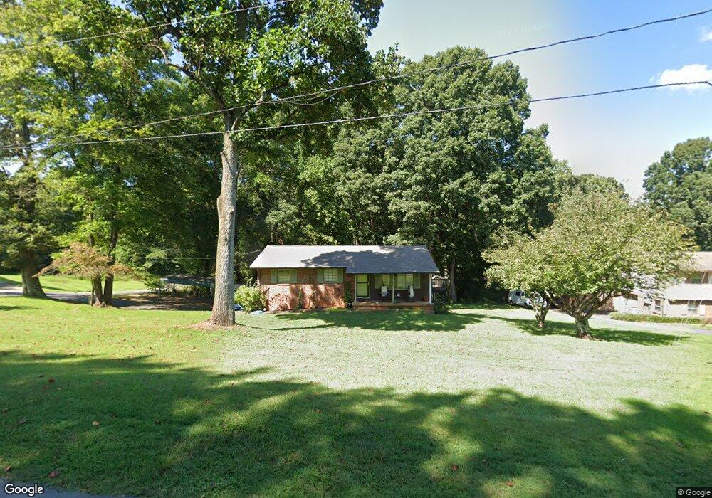
1122 Double Circle Dr Conover, NC 28613
Estimated Value: $169,000 - $226,000
3
Beds
1
Bath
1,000
Sq Ft
$201/Sq Ft
Est. Value
About This Home
This home is located at 1122 Double Circle Dr, Conover, NC 28613 and is currently estimated at $201,487, approximately $201 per square foot. 1122 Double Circle Dr is a home located in Catawba County with nearby schools including Lyle Creek Elementary School, River Bend Middle School, and Bunker Hill High School.
Ownership History
Date
Name
Owned For
Owner Type
Purchase Details
Closed on
Feb 13, 2015
Sold by
Saine Richard Stephen and Saine Kathy Reeves
Bought by
Burgess Amanda S and Burgess Thomas
Current Estimated Value
Purchase Details
Closed on
Jun 7, 2010
Sold by
Saine Richard Stephen and Saine Kathy R
Bought by
Burgess Thomas A and Burgess Amanda S
Home Financials for this Owner
Home Financials are based on the most recent Mortgage that was taken out on this home.
Original Mortgage
$64,136
Interest Rate
5.5%
Mortgage Type
FHA
Create a Home Valuation Report for This Property
The Home Valuation Report is an in-depth analysis detailing your home's value as well as a comparison with similar homes in the area
Home Values in the Area
Average Home Value in this Area
Purchase History
| Date | Buyer | Sale Price | Title Company |
|---|---|---|---|
| Burgess Amanda S | -- | None Available | |
| Burgess Thomas A | $65,000 | None Available |
Source: Public Records
Mortgage History
| Date | Status | Borrower | Loan Amount |
|---|---|---|---|
| Previous Owner | Burgess Thomas A | $64,136 |
Source: Public Records
Tax History
| Year | Tax Paid | Tax Assessment Tax Assessment Total Assessment is a certain percentage of the fair market value that is determined by local assessors to be the total taxable value of land and additions on the property. | Land | Improvement |
|---|---|---|---|---|
| 2025 | $958 | $183,300 | $15,800 | $167,500 |
| 2024 | $958 | $183,300 | $15,800 | $167,500 |
| 2023 | $921 | $111,100 | $13,500 | $97,600 |
| 2022 | $772 | $111,100 | $13,500 | $97,600 |
| 2021 | $772 | $111,100 | $13,500 | $97,600 |
| 2020 | $772 | $111,100 | $13,500 | $97,600 |
| 2019 | $772 | $111,100 | $0 | $0 |
| 2018 | $599 | $86,200 | $13,100 | $73,100 |
| 2017 | $599 | $0 | $0 | $0 |
| 2016 | $599 | $0 | $0 | $0 |
| 2015 | $534 | $86,150 | $13,100 | $73,050 |
| 2014 | $534 | $89,000 | $9,100 | $79,900 |
Source: Public Records
Map
Nearby Homes
- 1113 Pecan St
- 1246 Houston Mill Rd
- 5429 Buddy St Unit LOT 3
- 1158 Sunset Ct
- 1355 Millrace Dr
- 1371 Millrace Dr
- 4874 Stone Dr Unit 125
- 4484 Springs Rd
- 4932 Sandstone Dr
- 1098 Remington Dr
- 4645 Rifle Range Rd
- 28.8 Acres +/- Carver House Rd
- 5217 Canterbury Dr
- 5613 Springs Rd
- 4061 Springs Rd
- 1341 Misty Ln Unit 9
- 1285 Misty Ln Unit 6
- 1265 Misty Ln
- 1320 Misty Ln Unit 13
- 1296 Misty Ln Unit 14
- 1123 Double Circle Dr
- 1101 Pecan St
- 1127 Double Circle Dr
- 1138 Double Circle Dr
- 1122 Pecan St
- 1137 Double Circle Dr
- 1240 Houston Mill Rd
- 1147 Double Circle Dr
- 1148 Double Circle Dr
- 1117 Pecan St
- 1138 Pecan St
- 1238 Houston Mill Rd
- 1123 Pecan St
- 1150 Pecan St
- 1163 Double Circle Dr
- 1158 Double Circle Dr
- 1131 Pecan St
- 1234 Houston Mill Rd
- 1160 Pecan St
- 1166 Double Circle Dr
Your Personal Tour Guide
Ask me questions while you tour the home.