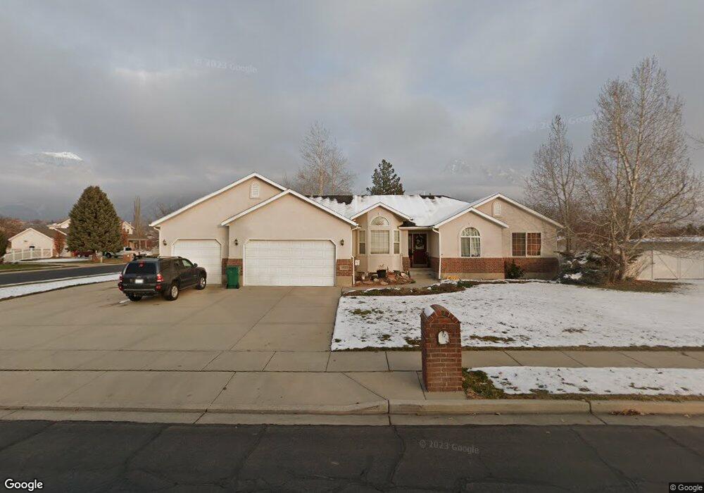
11222 N Sampson Dr Highland, UT 84003
Estimated Value: $947,000 - $1,095,000
3
Beds
3
Baths
4,000
Sq Ft
$248/Sq Ft
Est. Value
About This Home
This home is located at 11222 N Sampson Dr, Highland, UT 84003 and is currently estimated at $992,102, approximately $248 per square foot. 11222 N Sampson Dr is a home located in Utah County with nearby schools including Highland Elementary School, Timberline Middle School, and Lone Peak High School.
Ownership History
Date
Name
Owned For
Owner Type
Purchase Details
Closed on
Aug 29, 2020
Sold by
Nuccitelli Brett Michael and Nuccitelli Sherry Kaye
Bought by
Nuccitelli Brett Michael and Brett Michael Nuccitelli Trust
Current Estimated Value
Home Financials for this Owner
Home Financials are based on the most recent Mortgage that was taken out on this home.
Original Mortgage
$418,898
Outstanding Balance
$371,055
Interest Rate
2.8%
Mortgage Type
New Conventional
Estimated Equity
$621,047
Purchase Details
Closed on
Aug 22, 2019
Sold by
Nuccitelli Brett M and Nuccitelli Sherry K
Bought by
Nuccitelli Brett Michael and Brett Michael Nuccitelli Trust
Home Financials for this Owner
Home Financials are based on the most recent Mortgage that was taken out on this home.
Original Mortgage
$412,000
Interest Rate
3.7%
Mortgage Type
New Conventional
Purchase Details
Closed on
Apr 19, 2000
Sold by
D Ingledew Construction Inc
Bought by
Nuccitelli Brett M and Nuccitelli Sherry K
Home Financials for this Owner
Home Financials are based on the most recent Mortgage that was taken out on this home.
Original Mortgage
$240,930
Interest Rate
8.24%
Mortgage Type
Balloon
Purchase Details
Closed on
Mar 7, 2000
Sold by
Nuccitelli Brett M and Nuccitelli Sherry K
Bought by
D Ingledew Construction Inc
Home Financials for this Owner
Home Financials are based on the most recent Mortgage that was taken out on this home.
Original Mortgage
$240,930
Interest Rate
8.24%
Mortgage Type
Balloon
Purchase Details
Closed on
Nov 16, 1999
Sold by
D Ingledew Construction Inc
Bought by
Nuccitelli Brett M and Nuccitelli Sherry K
Purchase Details
Closed on
May 5, 1999
Sold by
J D D Investments Lc
Bought by
D Ingledew Construction Inc
Home Financials for this Owner
Home Financials are based on the most recent Mortgage that was taken out on this home.
Original Mortgage
$200,500
Interest Rate
6.96%
Mortgage Type
Construction
Create a Home Valuation Report for This Property
The Home Valuation Report is an in-depth analysis detailing your home's value as well as a comparison with similar homes in the area
Home Values in the Area
Average Home Value in this Area
Purchase History
| Date | Buyer | Sale Price | Title Company |
|---|---|---|---|
| Nuccitelli Brett Michael | -- | Amrock Inc | |
| Nuccitelli Brett Michael | -- | Amrock Inc | |
| Nuccitelli Brett Michael | -- | Amrock Inc | |
| Nuccitelli Brett M | -- | Amrock Inc | |
| Nuccitelli Brett M | -- | Sundance Title Insurance | |
| D Ingledew Construction Inc | -- | Sundance Title Insurance | |
| Nuccitelli Brett M | -- | Guardian Title Insurance Ag | |
| D Ingledew Construction Inc | -- | Guardian Title Insurance |
Source: Public Records
Mortgage History
| Date | Status | Borrower | Loan Amount |
|---|---|---|---|
| Open | Nuccitelli Brett Michael | $418,898 | |
| Closed | Nuccitelli Brett M | $412,000 | |
| Closed | Nuccitelli Brett M | $240,930 | |
| Previous Owner | D Ingledew Construction Inc | $200,500 |
Source: Public Records
Tax History Compared to Growth
Tax History
| Year | Tax Paid | Tax Assessment Tax Assessment Total Assessment is a certain percentage of the fair market value that is determined by local assessors to be the total taxable value of land and additions on the property. | Land | Improvement |
|---|---|---|---|---|
| 2025 | $3,829 | $490,380 | $527,000 | $364,600 |
| 2024 | $3,829 | $472,890 | $0 | $0 |
| 2023 | $3,521 | $469,095 | $0 | $0 |
| 2022 | $3,821 | $493,625 | $0 | $0 |
| 2021 | $3,359 | $646,400 | $318,800 | $327,600 |
| 2020 | $3,205 | $604,800 | $277,200 | $327,600 |
| 2019 | $2,847 | $562,100 | $277,200 | $284,900 |
| 2018 | $2,996 | $562,100 | $277,200 | $284,900 |
| 2017 | $3,038 | $304,260 | $0 | $0 |
| 2016 | $3,042 | $284,735 | $0 | $0 |
| 2015 | $2,923 | $259,325 | $0 | $0 |
| 2014 | $2,578 | $226,655 | $0 | $0 |
Source: Public Records
Map
Nearby Homes
- 5077 W 11000 N
- 5159 W 11000 N
- 868 S Braddock Ln
- 5984 W 11200 N Unit 1
- 10861 N Panorama Dr
- 682 Healey Blvd
- 629 S Pheasant Ridge Cir
- 909 Ridge Ln
- 5377 W Evergreen Way
- 88 W Cascade Ave
- 10685 N Jerling Dr
- 4224 W Park Dr
- 10763 N Dosh Ln
- 10905 N Vercelli Dr
- Villa A Plan at TEN700
- Villa D Plan at TEN700
- Cottonwood Villa Plan at TEN700
- Villa C Plan at TEN700
- Douglas Villa Plan at TEN700
- Villa B Plan at TEN700
- 11222 Sampson Dr
- 4827 11240 N Unit 22
- 4843 Joey Ct
- 11333 N 4880 W Unit 4
- 11227 N Sampson Dr
- 11282 N 4880 W Unit 13
- 11298 N 4880 W Unit 12
- 11297 N 4880 W Unit 5
- 11217 N 4880 W Unit 1
- 11227 N Sampson Dr
- 4842 11240 N
- 4864 Joey Ct
- 4864 W Joey Ct
- 11263 N Sampson Dr
- 4845 W 11200 N
- 11263 N Sampson Dr
- 4827 Joey Ct Unit J
- 4828 W Joey Ct
- 4828 W Joey Ct
- 4828 W Joey Ct