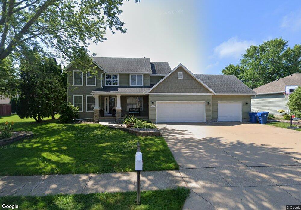
1123 W Davies St Eldridge, IA 52748
Estimated Value: $461,000 - $525,000
4
Beds
3
Baths
2,355
Sq Ft
$211/Sq Ft
Est. Value
About This Home
This home is located at 1123 W Davies St, Eldridge, IA 52748 and is currently estimated at $496,427, approximately $210 per square foot. 1123 W Davies St is a home located in Scott County with nearby schools including Edward White Elementary School, North Scott Junior High School, and North Scott Senior High School.
Ownership History
Date
Name
Owned For
Owner Type
Purchase Details
Closed on
Mar 2, 2023
Sold by
Cunningham Kevin A and Cunningham Joanne C
Bought by
Jack Lindsey A and Jack Harvey P
Current Estimated Value
Purchase Details
Closed on
Oct 19, 2010
Sold by
Jagers Kimberly Jo and Jagers Kimberly Jo
Bought by
Vice Loyd W
Create a Home Valuation Report for This Property
The Home Valuation Report is an in-depth analysis detailing your home's value as well as a comparison with similar homes in the area
Home Values in the Area
Average Home Value in this Area
Purchase History
| Date | Buyer | Sale Price | Title Company |
|---|---|---|---|
| Jack Lindsey A | $470,000 | None Listed On Document | |
| Vice Loyd W | -- | None Available |
Source: Public Records
Tax History Compared to Growth
Tax History
| Year | Tax Paid | Tax Assessment Tax Assessment Total Assessment is a certain percentage of the fair market value that is determined by local assessors to be the total taxable value of land and additions on the property. | Land | Improvement |
|---|---|---|---|---|
| 2025 | $5,780 | $503,400 | $79,300 | $424,100 |
| 2024 | $4,804 | $461,100 | $54,900 | $406,200 |
| 2023 | $4,836 | $395,000 | $54,900 | $340,100 |
| 2022 | $4,688 | $341,460 | $46,280 | $295,180 |
| 2021 | $4,688 | $341,460 | $46,280 | $295,180 |
| 2020 | $4,376 | $312,610 | $46,280 | $266,330 |
| 2019 | $4,446 | $304,200 | $37,870 | $266,330 |
| 2018 | $4,538 | $304,200 | $37,870 | $266,330 |
| 2017 | $1,692 | $304,200 | $37,870 | $266,330 |
| 2016 | $4,346 | $290,330 | $0 | $0 |
| 2015 | $4,346 | $277,710 | $0 | $0 |
| 2014 | $4,222 | $277,710 | $0 | $0 |
| 2013 | $4,146 | $0 | $0 | $0 |
| 2012 | -- | $282,510 | $37,870 | $244,640 |
Source: Public Records
Map
Nearby Homes
- 10 S 5th St
- 7 S 5th St
- 6 S 5th St
- 5 S 5th St
- 21 S 5th St
- 17 S 5th St
- 216 Central Dr
- The Braxton Plan at Grunwald Grove
- The Haven Plan at Grunwald Grove
- The Halsted Plan at Grunwald Grove
- The Remington Plan at Grunwald Grove
- The Smith Plan at Grunwald Grove
- The Westwood Plan at Grunwald Grove
- The Winchester Plan at Grunwald Grove
- The Williamson Plan at Grunwald Grove
- The Lincoln Plan at Grunwald Grove
- The Modern Farmhouse Plan at Grunwald Grove
- The Ashbury Plan at Grunwald Grove
- The Bettendorf Plan at Grunwald Grove
- 509 S 7th St
- 1135 W Davies St
- 408 Dammann Dr
- 1104 W Donahue St
- 1108 W Donahue St
- 1211 W Davies St
- 400 Dammann Dr
- 1120 W Davies St
- 1132 W Davies St
- 1200 W Donahue St
- 1108 W Davies St
- 1108 Davies Ct
- 1210 W Davies St
- 1225 W Davies St
- 409 Dammann Dr
- 405 Dammann Dr
- 1204 W Donahue St
- 1222 W Davies St
- 401 Dammann Dr
- 1101 W Donahue St