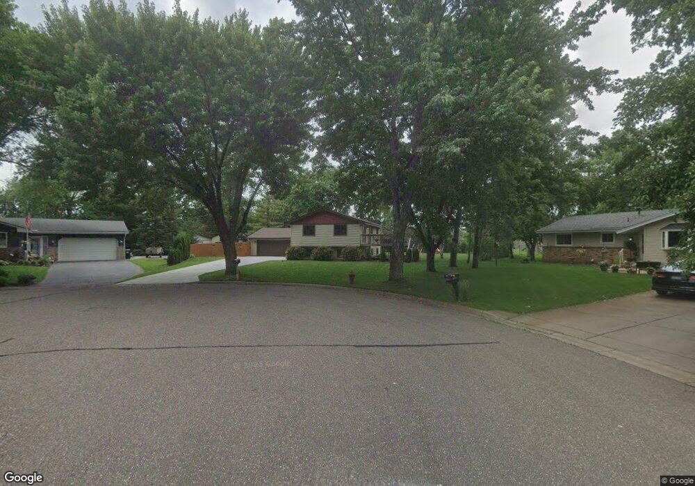
11230 Arrowood Cir N Dayton, MN 55327
Estimated Value: $368,467 - $387,000
3
Beds
2
Baths
1,162
Sq Ft
$326/Sq Ft
Est. Value
About This Home
This home is located at 11230 Arrowood Cir N, Dayton, MN 55327 and is currently estimated at $379,117, approximately $326 per square foot. 11230 Arrowood Cir N is a home located in Hennepin County with nearby schools including Dayton Elementary School, Jackson Middle School, and Champlin Park High School.
Ownership History
Date
Name
Owned For
Owner Type
Purchase Details
Closed on
Sep 15, 2011
Sold by
Deutsche Bank National Trust Company
Bought by
Haus Michael and Bach Toni
Current Estimated Value
Home Financials for this Owner
Home Financials are based on the most recent Mortgage that was taken out on this home.
Original Mortgage
$109,354
Outstanding Balance
$74,454
Interest Rate
4.14%
Mortgage Type
FHA
Estimated Equity
$304,663
Purchase Details
Closed on
Jul 27, 2011
Sold by
Mortgage Electronic Registration System
Bought by
Deutsche Bank National Trust Company
Home Financials for this Owner
Home Financials are based on the most recent Mortgage that was taken out on this home.
Original Mortgage
$109,354
Outstanding Balance
$74,454
Interest Rate
4.14%
Mortgage Type
FHA
Estimated Equity
$304,663
Create a Home Valuation Report for This Property
The Home Valuation Report is an in-depth analysis detailing your home's value as well as a comparison with similar homes in the area
Home Values in the Area
Average Home Value in this Area
Purchase History
| Date | Buyer | Sale Price | Title Company |
|---|---|---|---|
| Haus Michael | $112,200 | None Available | |
| Deutsche Bank National Trust Company | -- | None Available |
Source: Public Records
Mortgage History
| Date | Status | Borrower | Loan Amount |
|---|---|---|---|
| Open | Haus Michael | $109,354 |
Source: Public Records
Tax History Compared to Growth
Tax History
| Year | Tax Paid | Tax Assessment Tax Assessment Total Assessment is a certain percentage of the fair market value that is determined by local assessors to be the total taxable value of land and additions on the property. | Land | Improvement |
|---|---|---|---|---|
| 2024 | $3,622 | $336,800 | $104,500 | $232,300 |
| 2023 | $3,580 | $329,400 | $96,800 | $232,600 |
| 2022 | $3,175 | $314,000 | $88,000 | $226,000 |
| 2021 | $2,814 | $251,000 | $61,000 | $190,000 |
| 2020 | $2,861 | $219,000 | $47,000 | $172,000 |
| 2019 | $2,787 | $213,000 | $50,000 | $163,000 |
| 2018 | $2,883 | $204,000 | $42,000 | $162,000 |
| 2017 | $2,528 | $188,000 | $50,000 | $138,000 |
| 2016 | $2,162 | $160,000 | $39,000 | $121,000 |
| 2015 | $2,101 | $155,000 | $36,000 | $119,000 |
| 2014 | -- | $137,000 | $33,000 | $104,000 |
Source: Public Records
Map
Nearby Homes
- 12972 Bauer Dr N
- 12816 Cedar Ridge Ln
- 13041 Union Terrace Ln N
- 13348 Linwood Forest Cir
- 13217 Union Terrace Ln N
- 13451 Yorktown Ln N
- 11186 Balsam Pointe Trail
- 11162 Balsam Pointe Trail
- 11820 Pineridge Way N
- 11205 Balsam Pointe Trail
- 12726 Lake Vista Ln
- 11117 Balsam Pointe Trail
- 11121 Balsam Pointe Trail
- 11134 Balsam Pointe Trail
- 13480 Wellington Ct
- 701 Parkview Ln N
- 251 Revere Ln N
- 11581 Noon Dr
- 1102 Benton St
- 535 W River Pkwy
- 11220 Arrowood Cir N
- 11231 Arrowood Cir N
- 11301 131st Ave N
- 13040 Balsam Ln N
- 13030 Balsam Ln N
- 11311 131st Ave N
- 11221 131st Ave N
- 13020 Balsam Ln N
- 11210 Arrowood Cir N
- 11221 Arrowood Cir N
- 11211 131st Ave N
- 11211 Arrowood Cir N
- 13010 Balsam Ln N
- 11201 131st Ave N
- 11300 131st Ave N
- 13001 Arrowood Ln N
- 13033 Balsam Ln N
- 13011 Arrowood Ln N
- 11230 131st Ave N
- 13031 Balsam Ln N