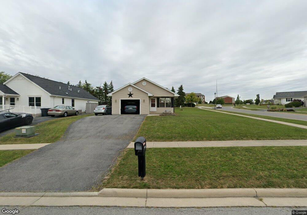
1124 Crystal Ln Findlay, OH 45840
Estimated Value: $176,000 - $216,000
3
Beds
1
Bath
1,152
Sq Ft
$170/Sq Ft
Est. Value
About This Home
This home is located at 1124 Crystal Ln, Findlay, OH 45840 and is currently estimated at $195,385, approximately $169 per square foot. 1124 Crystal Ln is a home located in Hancock County with nearby schools including Whittier Primary School, Bigelow Hill Elementary School, and Glenwood Middle School.
Ownership History
Date
Name
Owned For
Owner Type
Purchase Details
Closed on
Dec 17, 2004
Sold by
Habitat For Humanity Findlay/Hancock Cou
Bought by
Nigh Amy
Current Estimated Value
Home Financials for this Owner
Home Financials are based on the most recent Mortgage that was taken out on this home.
Original Mortgage
$60,145
Outstanding Balance
$30,201
Interest Rate
5.77%
Mortgage Type
Seller Take Back
Estimated Equity
$165,184
Purchase Details
Closed on
Apr 15, 2004
Sold by
Krystal Ridge Inc
Bought by
Habitat Humanity Findlay/Hancock Cnty
Create a Home Valuation Report for This Property
The Home Valuation Report is an in-depth analysis detailing your home's value as well as a comparison with similar homes in the area
Home Values in the Area
Average Home Value in this Area
Purchase History
| Date | Buyer | Sale Price | Title Company |
|---|---|---|---|
| Nigh Amy | $120,000 | Golden Key Title Agency | |
| Habitat Humanity Findlay/Hancock Cnty | $17,700 | -- |
Source: Public Records
Mortgage History
| Date | Status | Borrower | Loan Amount |
|---|---|---|---|
| Open | Nigh Amy | $60,145 | |
| Closed | Nigh Amy | $60,000 |
Source: Public Records
Tax History
| Year | Tax Paid | Tax Assessment Tax Assessment Total Assessment is a certain percentage of the fair market value that is determined by local assessors to be the total taxable value of land and additions on the property. | Land | Improvement |
|---|---|---|---|---|
| 2024 | $1,854 | $52,190 | $7,930 | $44,260 |
| 2023 | $1,857 | $52,190 | $7,930 | $44,260 |
| 2022 | $1,850 | $52,190 | $7,930 | $44,260 |
| 2021 | $1,823 | $44,790 | $7,940 | $36,850 |
| 2020 | $1,823 | $44,790 | $7,940 | $36,850 |
| 2019 | $1,786 | $44,790 | $7,940 | $36,850 |
| 2018 | $1,693 | $38,960 | $6,910 | $32,050 |
| 2017 | $1,694 | $38,960 | $6,910 | $32,050 |
| 2016 | $1,674 | $38,960 | $6,910 | $32,050 |
| 2015 | $1,184 | $27,080 | $5,670 | $21,410 |
| 2014 | $1,184 | $27,080 | $5,670 | $21,410 |
| 2012 | $1,543 | $35,040 | $6,100 | $28,940 |
Source: Public Records
Map
Nearby Homes
- 1030 Sheridan Ave
- 1725 Parkside Place
- 0 Sheridan Ave
- 828 N Hill Trail
- 0 E Melrose Ave
- 1474 Southwood Ave
- 1001 Skye Dr
- 1062 Vincent St
- 2414 Aberdeen Dr
- 1216 Concord Ct
- 1142 Concord Ct
- 1820 Gayle Ln
- 0 Keith Pkwy Unit 6123798
- 912 Parkside Place
- 1331 Countryside Dr
- 716 Winfield Ave
- 0 Romick Pkwy Unit 6131435
- 0 Romick Pkwy Unit 6123797
- 1450 Fostoria Ave
- 1209 Heather Dr
- 1118 Crystal Ln
- 1112 Crystal Ln
- 1919 Breckenridge Rd
- 1911 Breckenridge Rd
- 1106 Crystal Ln
- 1874 Breckenridge Rd
- 1901 Breckenridge Rd
- 1929 Breckenridge Rd
- 1877 Breckenridge Rd
- 1100 Crystal Ln
- 1866 Breckenridge Rd
- 1865 Bishop Ln
- 1871 Breckenridge Rd
- 1855 Bishop Ln
- 0 Breckenridge Rd Lot 52
- 1056 Crystal Ln
- 1860 Breckenridge Rd
- 1845 Bishop Ln
- 1050 Crystal Ln
- 1859 Breckenridge Rd
Your Personal Tour Guide
Ask me questions while you tour the home.