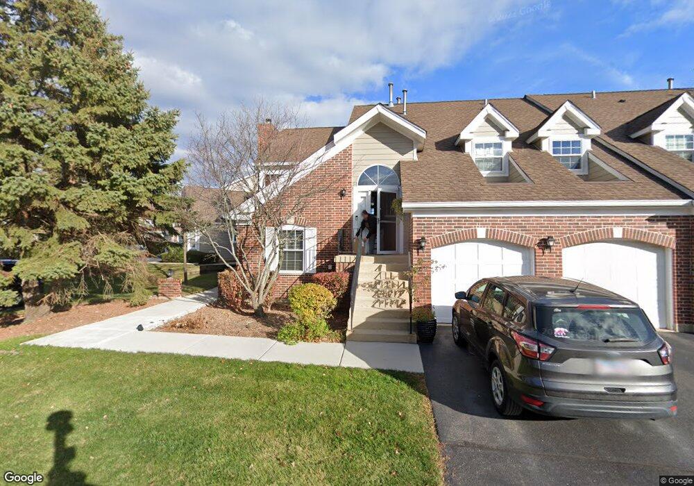
1124 Saint Andrews Ct Unit 1 Algonquin, IL 60102
Estimated Value: $277,000 - $290,000
2
Beds
2
Baths
1,649
Sq Ft
$171/Sq Ft
Est. Value
About This Home
This home is located at 1124 Saint Andrews Ct Unit 1, Algonquin, IL 60102 and is currently estimated at $282,657, approximately $171 per square foot. 1124 Saint Andrews Ct Unit 1 is a home located in McHenry County with nearby schools including Westfield Community School, Kenneth E Neubert Elementary School, and Harry D Jacobs High School.
Ownership History
Date
Name
Owned For
Owner Type
Purchase Details
Closed on
Jul 18, 2007
Sold by
Nead Eric C
Bought by
Palczynski Alexander W
Current Estimated Value
Home Financials for this Owner
Home Financials are based on the most recent Mortgage that was taken out on this home.
Original Mortgage
$187,150
Outstanding Balance
$117,219
Interest Rate
6.54%
Mortgage Type
Purchase Money Mortgage
Estimated Equity
$165,438
Purchase Details
Closed on
Mar 3, 2005
Sold by
Betterly Joan J
Bought by
Nead Eric C
Home Financials for this Owner
Home Financials are based on the most recent Mortgage that was taken out on this home.
Original Mortgage
$157,200
Interest Rate
6%
Mortgage Type
Purchase Money Mortgage
Create a Home Valuation Report for This Property
The Home Valuation Report is an in-depth analysis detailing your home's value as well as a comparison with similar homes in the area
Home Values in the Area
Average Home Value in this Area
Purchase History
| Date | Buyer | Sale Price | Title Company |
|---|---|---|---|
| Palczynski Alexander W | $197,000 | Fatic | |
| Nead Eric C | $196,500 | Republic Title Company |
Source: Public Records
Mortgage History
| Date | Status | Borrower | Loan Amount |
|---|---|---|---|
| Open | Palczynski Alexander W | $187,150 | |
| Previous Owner | Nead Eric C | $157,200 | |
| Closed | Nead Eric C | $39,300 |
Source: Public Records
Tax History Compared to Growth
Tax History
| Year | Tax Paid | Tax Assessment Tax Assessment Total Assessment is a certain percentage of the fair market value that is determined by local assessors to be the total taxable value of land and additions on the property. | Land | Improvement |
|---|---|---|---|---|
| 2024 | $5,387 | $76,858 | $15,898 | $60,960 |
| 2023 | $5,085 | $68,740 | $14,219 | $54,521 |
| 2022 | $4,990 | $64,185 | $22,054 | $42,131 |
| 2021 | $4,773 | $59,796 | $20,546 | $39,250 |
| 2020 | $4,640 | $57,680 | $19,819 | $37,861 |
| 2019 | $4,518 | $55,207 | $18,969 | $36,238 |
| 2018 | $4,357 | $51,709 | $17,523 | $34,186 |
| 2017 | $4,253 | $48,713 | $16,508 | $32,205 |
| 2016 | $4,174 | $45,688 | $15,483 | $30,205 |
| 2013 | -- | $46,464 | $14,444 | $32,020 |
Source: Public Records
Map
Nearby Homes
- 1028 Interloch Ct Unit 163
- 12 White Oak Ct
- 1850 White Oak Dr
- 1820 Crofton Dr
- SWC Talaga and Algonquin Rd
- 1 N Hubbard St
- 2021 Brindlewood Ln
- 1721 Fernwood Ln
- 741 Regal Ln
- 731 Roaring Brook Ln
- 2043 Peach Tree Ln Unit 4122
- 700 Fairfield Ln
- 1210 Brandywine Cir
- 18 Dellwood Ct Unit 4204
- 000 County Line Rd
- 2101 Peach Tree Ln Unit 4094
- 1860 Haverford Dr
- 6 Sutcliff Ct
- 1900 Waverly Ln
- 1455 Saddlebrook Cir
- 1124 Saint Andrews Ct Unit 215
- 1122 Saint Andrews Ct Unit 212
- 1122 St Andrews Ct Unit 1122
- 1122 Saint Andrews Ct Unit 1122
- 1126 Saint Andrews Ct Unit 211
- 1128 Saint Andrews Ct
- 1108 Saint Andrews Ct Unit 201
- 1106 Saint Andrews Ct Unit 202
- 1142 Saint Andrews Ct Unit 223
- 1148 Saint Andrews Ct Unit 221
- 1104 Saint Andrews Ct Unit 203
- 1102 Saint Andrews Ct Unit 204
- 1146 Saint Andrews Ct Unit 222
- 1104 St Andrews Ct
- 1144 Saint Andrews Ct Unit 224
- 1137 Saint Andrews Ct
- 1135 Saint Andrews Ct
- 1113 Saint Andrews Ct Unit 283
- 1111 Saint Andrews Ct Unit 282