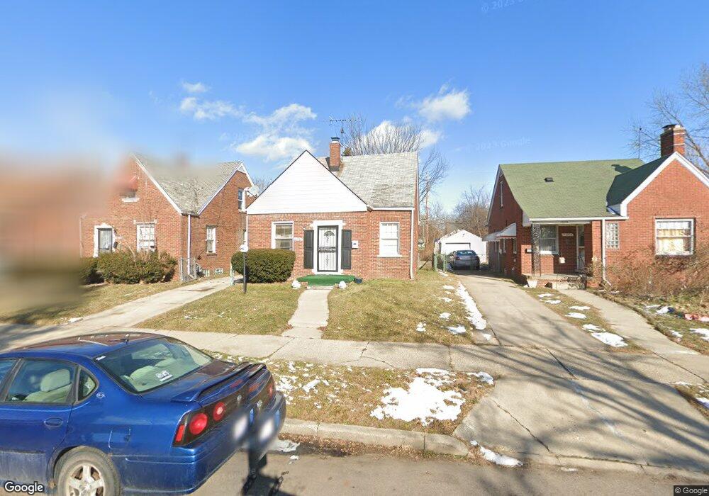
11242 Craft St Detroit, MI 48224
Outer Drive-Hayes NeighborhoodEstimated Value: $65,000 - $101,000
3
Beds
1
Bath
1,152
Sq Ft
$71/Sq Ft
Est. Value
About This Home
This home is located at 11242 Craft St, Detroit, MI 48224 and is currently estimated at $81,998, approximately $71 per square foot. 11242 Craft St is a home located in Wayne County with nearby schools including Wayne Elementary School, Edward 'Duke' Ellington Conservatory of Music and Art, and Charles L. Spain Elementary-Middle School.
Ownership History
Date
Name
Owned For
Owner Type
Purchase Details
Closed on
Jun 20, 2014
Sold by
Hudson Carlos
Bought by
Garrison Shelia
Current Estimated Value
Purchase Details
Closed on
May 11, 2009
Sold by
Donovan Shaun and Secretary Of Housing & Urban D
Bought by
Hudson Carlos
Purchase Details
Closed on
Jun 2, 2006
Sold by
Washington Mutual Banks
Bought by
Hud
Purchase Details
Closed on
Nov 30, 2005
Sold by
Walker Antoinette and Homeside Lending Inc
Bought by
Washington Mutual Banks
Create a Home Valuation Report for This Property
The Home Valuation Report is an in-depth analysis detailing your home's value as well as a comparison with similar homes in the area
Home Values in the Area
Average Home Value in this Area
Purchase History
| Date | Buyer | Sale Price | Title Company |
|---|---|---|---|
| Garrison Shelia | -- | None Available | |
| Hudson Carlos | $6,611 | None Available | |
| Hud | -- | None Available | |
| Washington Mutual Banks | $101,288 | None Available |
Source: Public Records
Tax History Compared to Growth
Tax History
| Year | Tax Paid | Tax Assessment Tax Assessment Total Assessment is a certain percentage of the fair market value that is determined by local assessors to be the total taxable value of land and additions on the property. | Land | Improvement |
|---|---|---|---|---|
| 2025 | $826 | $26,000 | $0 | $0 |
| 2024 | $826 | $21,700 | $0 | $0 |
| 2023 | $800 | $17,400 | $0 | $0 |
| 2022 | $867 | $14,400 | $0 | $0 |
| 2021 | $847 | $11,900 | $0 | $0 |
| 2020 | $839 | $11,300 | $0 | $0 |
| 2019 | $828 | $9,600 | $0 | $0 |
| 2018 | $720 | $8,600 | $0 | $0 |
| 2017 | $152 | $8,000 | $0 | $0 |
| 2016 | $820 | $9,600 | $0 | $0 |
| 2015 | $960 | $9,600 | $0 | $0 |
| 2013 | $1,335 | $13,352 | $0 | $0 |
| 2010 | -- | $19,575 | $1,107 | $18,468 |
Source: Public Records
Map
Nearby Homes
- 14931 Flanders St
- 10904 Mogul St
- 11203 Stockwell St
- 10891 Mogul St
- 15074 Mayfield St
- 14811 Rosemary St
- 15046 Mayfield St
- 11790 Payton St
- 11031 Courville St
- 15081 Mayfield St
- 14750 Lannette St
- 14895 Alma St
- 11426 Laing St
- 11434 Laing St
- 9675 E Outer Dr
- 12600 Hayes St
- 14851 Alma St
- 14756 Rosemary St
- 9776 E Outer Dr
- 11608 Duchess St
- 11250 Craft St
- 11234 Craft St
- 11258 Craft St
- 11226 Craft St
- 11220 Craft St
- 11341 Courville St
- 11335 Courville St
- 11349 Courville St
- 11355 Courville St
- 11327 Courville St
- 11210 Craft St
- 11251 Craft St
- 11364 Kelly Rd
- 11321 Courville St
- 11204 Craft St
- 11237 Craft St
- 11311 Courville St
- 11221 Craft St
- 11295 Courville St
- 11390 Kelly Rd