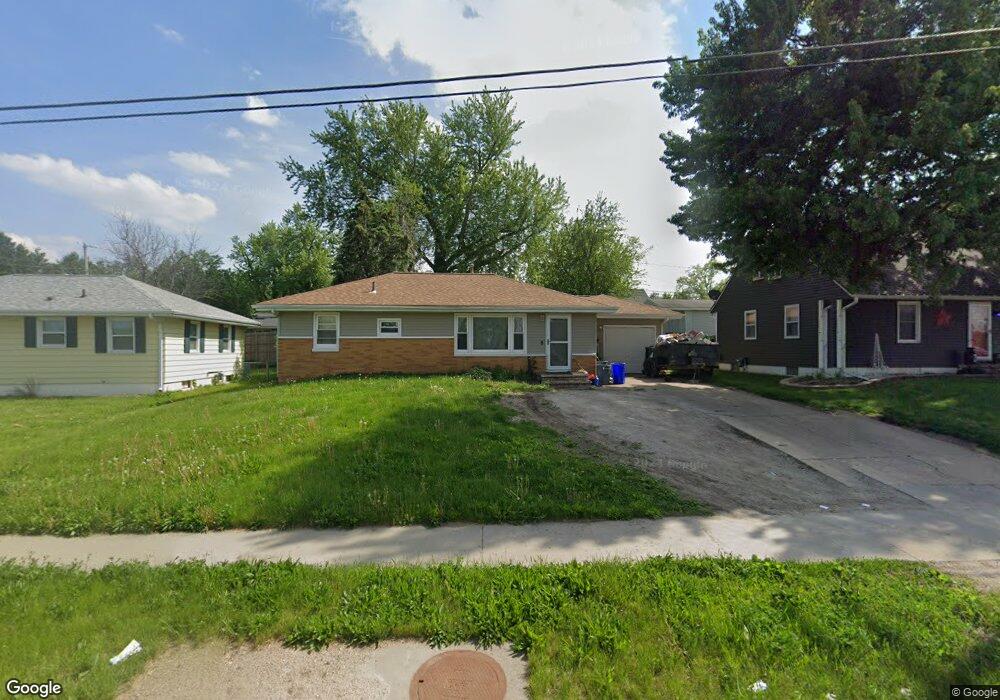
1125 Blairs Ferry Rd Marion, IA 52302
Estimated Value: $113,000 - $163,588
3
Beds
2
Baths
927
Sq Ft
$158/Sq Ft
Est. Value
About This Home
This home is located at 1125 Blairs Ferry Rd, Marion, IA 52302 and is currently estimated at $146,397, approximately $157 per square foot. 1125 Blairs Ferry Rd is a home located in Linn County with nearby schools including Novak Elementary School, Oak Ridge School, and Linn-Mar High School.
Ownership History
Date
Name
Owned For
Owner Type
Purchase Details
Closed on
Jul 9, 2021
Sold by
Rinehart Haas Darla
Bought by
Clark Jeremiah A
Current Estimated Value
Home Financials for this Owner
Home Financials are based on the most recent Mortgage that was taken out on this home.
Original Mortgage
$116,000
Outstanding Balance
$104,594
Interest Rate
2.5%
Mortgage Type
New Conventional
Estimated Equity
$41,803
Purchase Details
Closed on
Jul 8, 2021
Sold by
Mills Richard and Mills Lyn
Bought by
Rinehart Haas Dana
Home Financials for this Owner
Home Financials are based on the most recent Mortgage that was taken out on this home.
Original Mortgage
$116,000
Outstanding Balance
$104,594
Interest Rate
2.5%
Mortgage Type
New Conventional
Estimated Equity
$41,803
Purchase Details
Closed on
Jan 30, 2012
Sold by
Mills Richard
Bought by
Rinehart Haas Darla
Purchase Details
Closed on
Oct 26, 2011
Sold by
Mills Richard
Bought by
Caraballo Nancy
Home Financials for this Owner
Home Financials are based on the most recent Mortgage that was taken out on this home.
Original Mortgage
$5,000
Interest Rate
6%
Mortgage Type
Seller Take Back
Purchase Details
Closed on
Oct 24, 2011
Sold by
Caraballo Nancy
Bought by
Carpenter Wesley P and Carpenter Tiffany
Home Financials for this Owner
Home Financials are based on the most recent Mortgage that was taken out on this home.
Original Mortgage
$5,000
Interest Rate
6%
Mortgage Type
Seller Take Back
Purchase Details
Closed on
Jan 7, 2011
Sold by
The Secretary Of Housing & Urban Develop
Bought by
Mills Richard
Purchase Details
Closed on
Jul 12, 2010
Sold by
Wells Fargo Bank Na
Bought by
Secretary Of Housing & Urban Development
Purchase Details
Closed on
Apr 27, 2010
Sold by
Oppedahl Mark J
Bought by
Wells Fargo Bank Na
Purchase Details
Closed on
Feb 17, 2003
Sold by
Engin Levent R
Bought by
Oppedahl Mark J
Home Financials for this Owner
Home Financials are based on the most recent Mortgage that was taken out on this home.
Original Mortgage
$93,392
Interest Rate
6.07%
Mortgage Type
FHA
Create a Home Valuation Report for This Property
The Home Valuation Report is an in-depth analysis detailing your home's value as well as a comparison with similar homes in the area
Home Values in the Area
Average Home Value in this Area
Purchase History
| Date | Buyer | Sale Price | Title Company |
|---|---|---|---|
| Clark Jeremiah A | $145,000 | None Available | |
| Rinehart Haas Dana | $105,000 | None Available | |
| Rinehart Haas Darla | $105,000 | None Available | |
| Caraballo Nancy | $7,500 | None Available | |
| Carpenter Wesley P | $130,000 | None Available | |
| Mills Richard | -- | None Available | |
| Secretary Of Housing & Urban Development | -- | None Available | |
| Wells Fargo Bank Na | $98,442 | None Available | |
| Oppedahl Mark J | $94,000 | -- |
Source: Public Records
Mortgage History
| Date | Status | Borrower | Loan Amount |
|---|---|---|---|
| Open | Clark Jeremiah A | $116,000 | |
| Previous Owner | Carpenter Wesley P | $5,000 | |
| Previous Owner | Oppedahl Mark J | $93,392 | |
| Closed | Rinehart Haas Darla | $0 |
Source: Public Records
Tax History Compared to Growth
Tax History
| Year | Tax Paid | Tax Assessment Tax Assessment Total Assessment is a certain percentage of the fair market value that is determined by local assessors to be the total taxable value of land and additions on the property. | Land | Improvement |
|---|---|---|---|---|
| 2025 | $2,182 | $157,800 | $18,800 | $139,000 |
| 2024 | $2,558 | $126,500 | $18,800 | $107,700 |
| 2023 | $2,558 | $126,500 | $18,800 | $107,700 |
| 2022 | $2,566 | $115,300 | $18,800 | $96,500 |
| 2021 | $2,644 | $121,300 | $18,800 | $102,500 |
| 2020 | $2,644 | $117,300 | $18,800 | $98,500 |
| 2019 | $2,476 | $109,800 | $18,800 | $91,000 |
| 2018 | $2,382 | $109,800 | $18,800 | $91,000 |
| 2017 | $2,382 | $105,500 | $18,800 | $86,700 |
| 2016 | $2,276 | $105,500 | $18,800 | $86,700 |
| 2015 | $2,268 | $105,500 | $18,800 | $86,700 |
| 2014 | $2,268 | $105,500 | $18,800 | $86,700 |
| 2013 | $2,166 | $105,500 | $18,800 | $86,700 |
Source: Public Records
Map
Nearby Homes
- 1145 Blairs Ferry Rd
- 1013 Blairs Ferry R
- 655 W 9th Ave
- 915 W 10th Ave
- 1065 W 10th Ave
- 1125 W 10th Ave
- 112 Merion Blvd
- 1195 Lindale Dr
- 103 Merion Blvd
- 203 Cemar Ct
- 4551 Maureen Dr SE Unit 33
- 4571 Maureen Dr SE Unit 43
- 340 Cemar Ct
- 955 Bridgit Ln SE
- 1005 Bridgit Ct SE Unit 7
- 850 Kerry Ln SE Unit 23
- 1015 Woodland Heights Ct SE Unit 12
- 1032 Archer Dr
- 245 8th Ave
- 1074 Archer Dr
- 1115 Blairs Ferry Rd
- 1135 Blairs Ferry Rd
- 1120 Mitchell Dr
- 1130 Mitchell Dr
- 496 Hilltop Rd
- 1140 Mitchell Dr
- 420 Hilltop Rd
- 1155 Blairs Ferry Rd
- 1150 Mitchell Dr
- 1200 Blairs Ferry Rd
- 1165 Blairs Ferry Rd
- 1125 Mitchell Dr
- 1135 Mitchell Dr
- 1115 Mitchell Dr
- 1160 Mitchell Dr
- 380 Hilltop Rd
- 1145 Mitchell Dr
- 495 Hilltop Rd
- 453 Hilltop Rd
- 1175 Blairs Ferry Rd