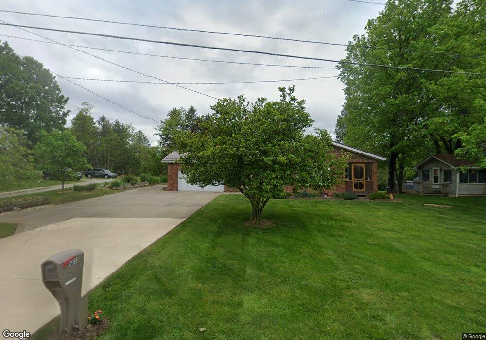
1125 Friendship Dr New Concord, OH 43762
Estimated Value: $241,000 - $291,356
2
Beds
1
Bath
1,513
Sq Ft
$178/Sq Ft
Est. Value
About This Home
This home is located at 1125 Friendship Dr, New Concord, OH 43762 and is currently estimated at $269,589, approximately $178 per square foot. 1125 Friendship Dr is a home located in Muskingum County with nearby schools including New Concord Elementary School, East Muskingum Middle School, and Larry Miller Intermediate Elementary School.
Ownership History
Date
Name
Owned For
Owner Type
Purchase Details
Closed on
Mar 31, 2017
Sold by
Daugherty Thomas E and Daugherty Thelma S
Bought by
Daugherty Jeffrey E and Daugherty Tina J
Current Estimated Value
Home Financials for this Owner
Home Financials are based on the most recent Mortgage that was taken out on this home.
Original Mortgage
$117,800
Outstanding Balance
$99,441
Interest Rate
4.75%
Mortgage Type
Adjustable Rate Mortgage/ARM
Estimated Equity
$170,148
Purchase Details
Closed on
Dec 5, 1991
Bought by
Daugherty Thomas E
Create a Home Valuation Report for This Property
The Home Valuation Report is an in-depth analysis detailing your home's value as well as a comparison with similar homes in the area
Home Values in the Area
Average Home Value in this Area
Purchase History
| Date | Buyer | Sale Price | Title Company |
|---|---|---|---|
| Daugherty Jeffrey E | $65,000 | None Available | |
| Daugherty Thomas E | $80,000 | -- |
Source: Public Records
Mortgage History
| Date | Status | Borrower | Loan Amount |
|---|---|---|---|
| Open | Daugherty Jeffrey E | $117,800 |
Source: Public Records
Tax History Compared to Growth
Tax History
| Year | Tax Paid | Tax Assessment Tax Assessment Total Assessment is a certain percentage of the fair market value that is determined by local assessors to be the total taxable value of land and additions on the property. | Land | Improvement |
|---|---|---|---|---|
| 2024 | $2,562 | $77,035 | $4,900 | $72,135 |
| 2023 | $2,131 | $59,885 | $4,095 | $55,790 |
| 2022 | $2,083 | $59,885 | $4,095 | $55,790 |
| 2021 | $2,057 | $59,885 | $4,095 | $55,790 |
| 2020 | $1,776 | $49,910 | $3,430 | $46,480 |
| 2019 | $1,767 | $49,910 | $3,430 | $46,480 |
| 2018 | $1,637 | $49,910 | $3,430 | $46,480 |
| 2017 | $1,437 | $47,355 | $3,430 | $43,925 |
| 2016 | $1,439 | $47,360 | $3,430 | $43,930 |
| 2015 | $1,473 | $47,360 | $3,430 | $43,930 |
| 2013 | $1,560 | $47,360 | $3,430 | $43,930 |
Source: Public Records
Map
Nearby Homes
- 760 Friendship Dr
- 12985 John Glenn School Rd
- 154 Montgomery Blvd
- 112 Thompson Ave
- 485 Ash Cir
- 8 E Main St
- 67 E Main St
- 0 Homestead Dr Unit 11611647
- 0 Homestead Dr Unit 5174212
- 0 Maple Ln
- 0 Rix Mills Rd
- 1420 Glenn Hwy
- 60936 Patch Rd
- Lot 18 & 19 Greenbriar Dr
- 61220 Kadon Dr
- 0 Norfield Unit 5174011
- 0 Norfield Unit 5173946
- 10545 Main St
- 3029 Best Rd
- 60040 Bliss Rd
- 1095 Friendship Dr
- 1145 Friendship Dr
- 1110 Friendship Dr
- 1140 Friendship Dr
- 1065 Friendship Dr
- 1085 Friendship Dr
- 1070 Friendship Dr
- 1165 Friendship Dr
- 194 Hillcrest Dr
- 1025 Friendship Dr
- 0 St Rt 83 Unit 8905283
- 0 Sr 83 Unit 309433
- 0 Sr 83 Unit 8906672
- 0 State Route 83 Unit 3608589
- 0 State Route 83 Unit 3922261
- 0 State Route 83 Unit 4442925
- 0 Sr 83 Unit 3178352
- 0 State Route 83 Unit 4355824
- 0 Sr 83 Unit 4104040
- 195 Hillcrest Dr