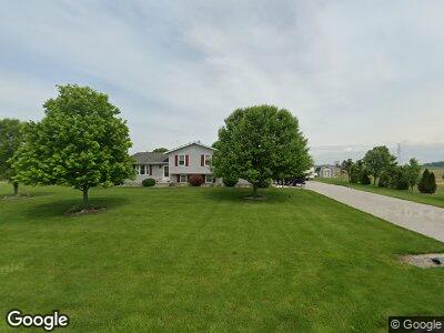
1125 N Brokate Rd Port Clinton, OH 43452
Estimated Value: $228,000 - $272,000
3
Beds
2
Baths
1,276
Sq Ft
$198/Sq Ft
Est. Value
About This Home
This home is located at 1125 N Brokate Rd, Port Clinton, OH 43452 and is currently estimated at $252,800, approximately $198 per square foot. 1125 N Brokate Rd is a home located in Ottawa County with nearby schools including Oak Harbor High School.
Ownership History
Date
Name
Owned For
Owner Type
Purchase Details
Closed on
Feb 23, 2006
Sold by
Miller Sandra A
Bought by
Rutledge Et Al Kevin R
Current Estimated Value
Home Financials for this Owner
Home Financials are based on the most recent Mortgage that was taken out on this home.
Original Mortgage
$133,000
Interest Rate
6.37%
Mortgage Type
Construction
Purchase Details
Closed on
Feb 22, 2006
Sold by
Miller Sandra A
Bought by
Rutledge Kevin R and Rutledge Michelle A
Home Financials for this Owner
Home Financials are based on the most recent Mortgage that was taken out on this home.
Original Mortgage
$133,000
Interest Rate
6.37%
Mortgage Type
Construction
Create a Home Valuation Report for This Property
The Home Valuation Report is an in-depth analysis detailing your home's value as well as a comparison with similar homes in the area
Home Values in the Area
Average Home Value in this Area
Purchase History
| Date | Buyer | Sale Price | Title Company |
|---|---|---|---|
| Rutledge Et Al Kevin R | -- | -- | |
| Rutledge Kevin R | -- | None Available |
Source: Public Records
Mortgage History
| Date | Status | Borrower | Loan Amount |
|---|---|---|---|
| Closed | Rutledge Kevin R | $105,000 | |
| Closed | Rutledge Kevin R | $126,500 | |
| Closed | Rutledge Kevin R | $133,000 |
Source: Public Records
Tax History Compared to Growth
Tax History
| Year | Tax Paid | Tax Assessment Tax Assessment Total Assessment is a certain percentage of the fair market value that is determined by local assessors to be the total taxable value of land and additions on the property. | Land | Improvement |
|---|---|---|---|---|
| 2024 | $2,542 | $69,357 | $12,751 | $56,606 |
| 2023 | $2,542 | $57,768 | $8,120 | $49,648 |
| 2022 | $2,291 | $57,768 | $8,120 | $49,648 |
| 2021 | $2,308 | $57,770 | $8,120 | $49,650 |
| 2020 | $2,212 | $51,300 | $5,410 | $45,890 |
| 2019 | $2,167 | $51,300 | $5,410 | $45,890 |
| 2018 | $1,988 | $51,300 | $5,410 | $45,890 |
| 2017 | $1,703 | $50,200 | $5,410 | $44,790 |
| 2016 | $1,732 | $50,200 | $5,410 | $44,790 |
| 2015 | $1,580 | $50,200 | $5,410 | $44,790 |
| 2014 | $766 | $47,320 | $5,410 | $41,910 |
| 2013 | $1,490 | $47,320 | $5,410 | $41,910 |
Source: Public Records
Map
Nearby Homes
- 6797 W Lakeshore Dr
- 5605 W Erie St
- 7485 W Carlton Ave
- 265 S Meachem Rd Unit 41
- 265 S Meachem Rd Unit 39
- 9317 W State Route 163
- 450 Country Meadows Dr Unit 450
- 176 Harvest Ln
- 10071 W Toussaint Rd E
- 1276 S Grandview Dr
- 430 N Locust St
- 163 E Ottawa St
- 130 E Main St
- 2020 S Mud Creek Rd
- 336 N Church St
- 119 W Park St
- 4889 N State Route 2
- 236 W Main St
- 409 W Walnut St
- 128 N Benton St
- 1125 N Brokate Rd
- 1120 N Brokate Rd
- 1150 N Brokate Rd
- 0 W Bonnie Jean Dr
- 1080 N Brokate Rd
- 1196 N Brokate Rd
- 7535 W Salem Carroll Rd
- 7605 W Bonnie Jean Dr
- 7561 W Bonnie Jean Dr
- 0 W Bonnie Jean Dr
- 1226 N Brokate Rd
- 7561 W Bonnie Jean Dr
- 7590 W Bonnie Jean Dr
- 7601 W Salem Carroll Rd
- 7605 W Bonnie Jean Dr
- 7640 W Bonnie Jean Dr
- 7631 W Salem Carroll Rd
- 7645 W Bonnie Jean Dr
- 7661 W Salem Carroll Rd
- 915 N Brokate Rd