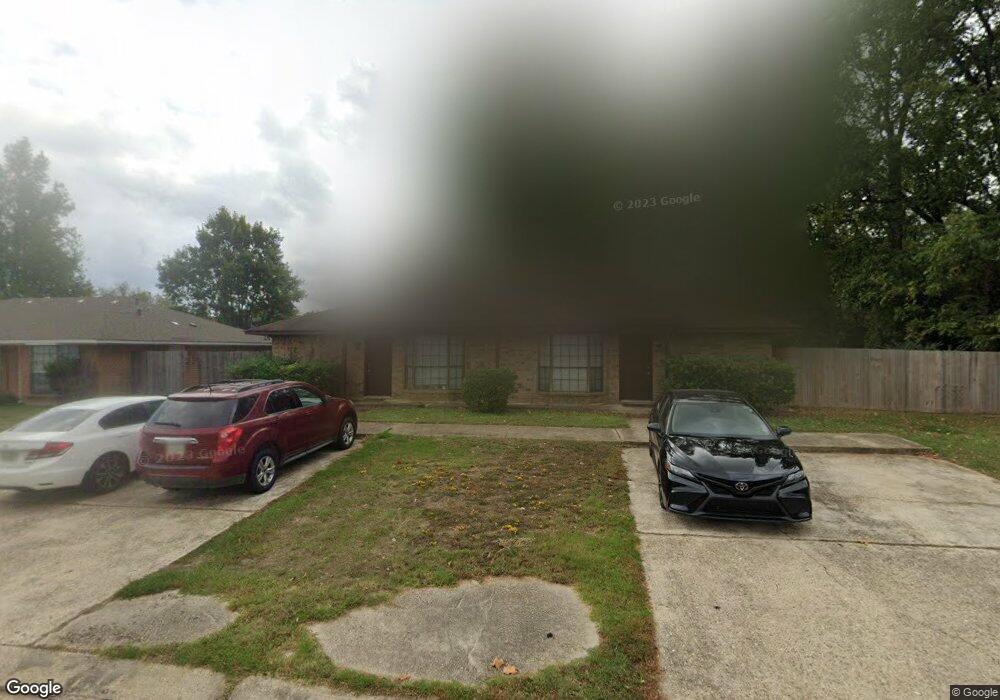
1125 Sybil Dr Ruston, LA 71270
Estimated Value: $161,000 - $301,000
Studio
2
Baths
1,584
Sq Ft
$129/Sq Ft
Est. Value
About This Home
This home is located at 1125 Sybil Dr, Ruston, LA 71270 and is currently estimated at $204,507, approximately $129 per square foot. 1125 Sybil Dr is a home located in Lincoln Parish with nearby schools including Glen View Elementary School, Cypress Springs Elementary School, and Ruston Junior High School.
Ownership History
Date
Name
Owned For
Owner Type
Purchase Details
Closed on
Nov 14, 2007
Sold by
Hood John M
Bought by
Lindsey Anthony Wayne and Gillespie Lindsey Lucretia
Current Estimated Value
Home Financials for this Owner
Home Financials are based on the most recent Mortgage that was taken out on this home.
Original Mortgage
$65,800
Outstanding Balance
$40,869
Interest Rate
6.38%
Mortgage Type
New Conventional
Estimated Equity
$163,638
Create a Home Valuation Report for This Property
The Home Valuation Report is an in-depth analysis detailing your home's value as well as a comparison with similar homes in the area
Purchase History
| Date | Buyer | Sale Price | Title Company |
|---|---|---|---|
| Lindsey Anthony Wayne | $97,290 | None Available |
Source: Public Records
Mortgage History
| Date | Status | Borrower | Loan Amount |
|---|---|---|---|
| Open | Lindsey Anthony Wayne | $65,800 |
Source: Public Records
Tax History
| Year | Tax Paid | Tax Assessment Tax Assessment Total Assessment is a certain percentage of the fair market value that is determined by local assessors to be the total taxable value of land and additions on the property. | Land | Improvement |
|---|---|---|---|---|
| 2025 | $954 | $11,176 | $1,688 | $9,488 |
| 2024 | $954 | $11,176 | $1,688 | $9,488 |
| 2023 | $1,085 | $12,204 | $1,463 | $10,741 |
| 2022 | $1,090 | $12,204 | $1,463 | $10,741 |
| 2021 | $1,009 | $12,204 | $1,463 | $10,741 |
| 2020 | $880 | $10,593 | $1,463 | $9,130 |
| 2019 | $917 | $11,295 | $1,463 | $9,832 |
| 2018 | $892 | $11,295 | $1,463 | $9,832 |
| 2017 | $895 | $11,295 | $1,463 | $9,832 |
| 2016 | $891 | $0 | $0 | $0 |
| 2015 | $833 | $9,704 | $1,125 | $8,579 |
| 2013 | $900 | $10,317 | $1,125 | $9,192 |
Source: Public Records
Map
Nearby Homes
- 1322 Cooktown Rd
- 904 Sherwood Dr
- 1904 Mimosa Cir
- 0 Gordon Dr
- 516 Glendale Dr
- 1201 Gains Ave
- 902 Arnold St
- 901 Pennington Ln
- 2158 Llangeler Dr
- 1507 Dauphine Dr
- 218 Huey Ave
- 1113 Lisa Ln
- 1607 N Trenton St
- 1508 Bonaparte Dr
- 2210 Llangeler Dr
- 542 Toma Lodge Dr
- 1715 N Trenton St
- 1604 N Trenton St
- 1114 Abby Ln
- 316 Western St Unit 314 Western Street,
- 1127 Sybil Dr
- 1117 Sybil Dr
- 1133 Sybil Dr
- 1174 Cassidy Ln
- 1160 Cassidy Ln
- 1132 Sybil Dr
- 1144 Cassidy Ln
- 1109 Sybil Dr
- 1109 & 1111 Sybil Dr
- 1112 Sybil Dr
- 1128 Sybil Dr
- 1101 Sybil Dr
- 1124 Sybil Dr
- 1434 Cooktown Rd
- 1114 Cassidy Ln
- 1100 Sybil Dr
- 1311 Cassidy Ln
- 1175 Cassidy Ln
- 1108 Sybil Dr
- 1174 Sybil Dr
Your Personal Tour Guide
Ask me questions while you tour the home.