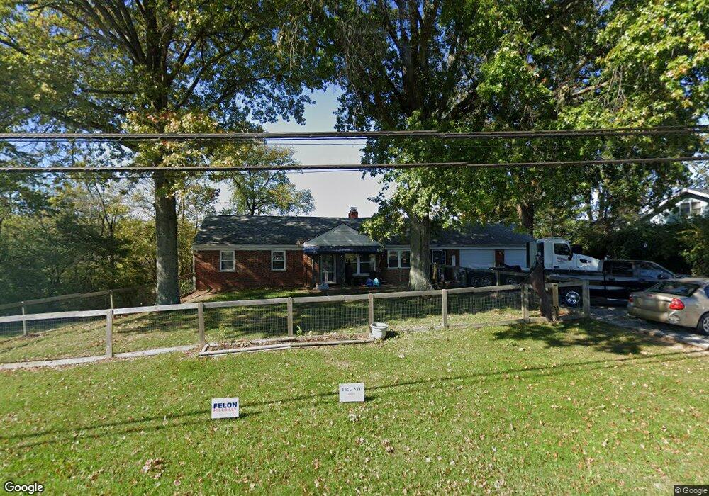
11259 Colerain Rd Cincinnati, OH 45252
Estimated Value: $263,000 - $274,000
3
Beds
2
Baths
1,524
Sq Ft
$177/Sq Ft
Est. Value
About This Home
This home is located at 11259 Colerain Rd, Cincinnati, OH 45252 and is currently estimated at $270,434, approximately $177 per square foot. 11259 Colerain Rd is a home located in Hamilton County with nearby schools including Colerain Elementary School, Colerain Middle School, and Colerain High School.
Ownership History
Date
Name
Owned For
Owner Type
Purchase Details
Closed on
Nov 20, 2020
Sold by
Kirby Celine M
Bought by
Wilder Jewell M
Current Estimated Value
Home Financials for this Owner
Home Financials are based on the most recent Mortgage that was taken out on this home.
Original Mortgage
$122,100
Outstanding Balance
$108,652
Interest Rate
2.8%
Mortgage Type
FHA
Estimated Equity
$161,782
Purchase Details
Closed on
May 31, 1994
Sold by
Kopp Katherine A
Bought by
Kirby Celine M
Create a Home Valuation Report for This Property
The Home Valuation Report is an in-depth analysis detailing your home's value as well as a comparison with similar homes in the area
Home Values in the Area
Average Home Value in this Area
Purchase History
| Date | Buyer | Sale Price | Title Company |
|---|---|---|---|
| Wilder Jewell M | -- | None Available | |
| Wilder Jewell M | -- | None Listed On Document | |
| Kirby Celine M | -- | -- |
Source: Public Records
Mortgage History
| Date | Status | Borrower | Loan Amount |
|---|---|---|---|
| Open | Wilder Jewell M | $122,100 | |
| Closed | Wilder Jewell M | $122,100 | |
| Closed | Kirby Celine M | $0 |
Source: Public Records
Tax History Compared to Growth
Tax History
| Year | Tax Paid | Tax Assessment Tax Assessment Total Assessment is a certain percentage of the fair market value that is determined by local assessors to be the total taxable value of land and additions on the property. | Land | Improvement |
|---|---|---|---|---|
| 2024 | $3,495 | $65,520 | $18,018 | $47,502 |
| 2023 | $3,517 | $65,520 | $18,018 | $47,502 |
| 2022 | $2,981 | $45,301 | $18,190 | $27,111 |
| 2021 | $2,956 | $45,301 | $18,190 | $27,111 |
| 2020 | $2,987 | $45,301 | $18,190 | $27,111 |
| 2019 | $3,018 | $42,739 | $17,161 | $25,578 |
| 2018 | $2,707 | $42,739 | $17,161 | $25,578 |
| 2017 | $2,564 | $42,739 | $17,161 | $25,578 |
| 2016 | $2,842 | $46,778 | $16,818 | $29,960 |
| 2015 | $2,870 | $46,778 | $16,818 | $29,960 |
| 2014 | $2,875 | $46,778 | $16,818 | $29,960 |
| 2013 | $2,791 | $47,734 | $17,161 | $30,573 |
Source: Public Records
Map
Nearby Homes
- 11115 Colerain Ave
- 5285 Yeatman Rd
- 11881 Stone Mill Rd
- 0 Stone Mill Rd Unit 1846428
- 1 Stone Mill Rd
- 5567 Day Rd
- 11970 Stone Mill Rd
- 10660 Colerain Ave
- 0 Miamitrail Ln Unit 1852362
- 5380 Stonetrace Dr
- 6037 Dunlap Rd
- 5208 Stonetrace Dr
- 26 Rylan Dr
- 10263 Colerain Ave
- 0 Thrush Ave Unit 1853359
- 10232 Roppelt Rd
- 10054 Prechtel Rd
- 2107 Robin Ave
- 4198 Intrepid Dr
- 5077 Pebblevalley Dr
- 11277 Old Colerain Ave
- 11277 Colerain Ave
- 11260 Colerain Rd
- 11223 Colerain Ave
- 11207 Colerain Ave
- 11199 Colerain Ave
- 11316 Colerain Ave
- 11284 Colerain Ave
- 11190 Colerain Rd
- 11179 Colerain Ave
- 11332 Colerain Rd
- 11282 Colerain Ave
- 11171 Colerain Ave
- 11171 Colerain Rd
- 11171 Old Colerain Ave
- 5293 Yeatman Rd
- 11350 Colerain Ave
- 11161 Colerain Ave
- 11113 Colerain Ave
- 5495 Yeatman Rd