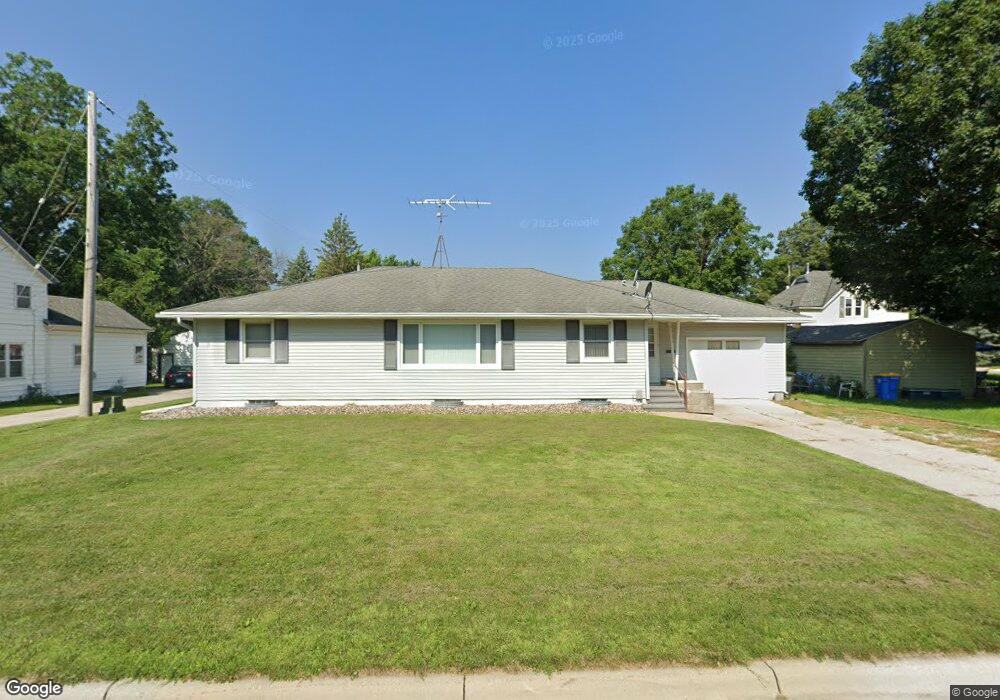
1126 S Grove Ave Owatonna, MN 55060
Estimated Value: $219,000 - $245,000
3
Beds
2
Baths
2,640
Sq Ft
$88/Sq Ft
Est. Value
About This Home
This home is located at 1126 S Grove Ave, Owatonna, MN 55060 and is currently estimated at $232,009, approximately $87 per square foot. 1126 S Grove Ave is a home located in Steele County with nearby schools including Lincoln Elementary School, Owatonna Middle School, and Owatonna Senior High School.
Ownership History
Date
Name
Owned For
Owner Type
Purchase Details
Closed on
Jul 29, 2016
Sold by
Swedberg Dnaiel K and Swedberg Karolayn
Bought by
Klein Timohty R
Current Estimated Value
Home Financials for this Owner
Home Financials are based on the most recent Mortgage that was taken out on this home.
Original Mortgage
$116,500
Outstanding Balance
$92,953
Interest Rate
3.48%
Mortgage Type
New Conventional
Estimated Equity
$139,056
Purchase Details
Closed on
Nov 12, 2014
Sold by
Kruckeberg Randy M
Bought by
Swedberg Daniel K and Swedberg Karolayn
Home Financials for this Owner
Home Financials are based on the most recent Mortgage that was taken out on this home.
Original Mortgage
$103,098
Interest Rate
3.75%
Mortgage Type
FHA
Create a Home Valuation Report for This Property
The Home Valuation Report is an in-depth analysis detailing your home's value as well as a comparison with similar homes in the area
Home Values in the Area
Average Home Value in this Area
Purchase History
| Date | Buyer | Sale Price | Title Company |
|---|---|---|---|
| Klein Timohty R | $126,500 | North American Title | |
| Swedberg Daniel K | $105,000 | -- |
Source: Public Records
Mortgage History
| Date | Status | Borrower | Loan Amount |
|---|---|---|---|
| Open | Klein Timohty R | $116,500 | |
| Previous Owner | Swedberg Daniel K | $103,098 |
Source: Public Records
Tax History Compared to Growth
Tax History
| Year | Tax Paid | Tax Assessment Tax Assessment Total Assessment is a certain percentage of the fair market value that is determined by local assessors to be the total taxable value of land and additions on the property. | Land | Improvement |
|---|---|---|---|---|
| 2025 | $2,672 | $212,300 | $28,700 | $183,600 |
| 2024 | $2,560 | $200,900 | $26,000 | $174,900 |
| 2023 | $2,614 | $185,200 | $20,500 | $164,700 |
| 2022 | $2,294 | $181,000 | $19,300 | $161,700 |
| 2021 | $2,102 | $147,294 | $17,640 | $129,654 |
| 2020 | $2,174 | $135,730 | $17,640 | $118,090 |
| 2019 | $1,862 | $134,456 | $16,562 | $117,894 |
| 2018 | $1,714 | $124,754 | $15,288 | $109,466 |
| 2017 | $1,604 | $116,718 | $14,014 | $102,704 |
| 2016 | $1,448 | $111,328 | $14,014 | $97,314 |
| 2015 | -- | $0 | $0 | $0 |
| 2014 | -- | $0 | $0 | $0 |
Source: Public Records
Map
Nearby Homes
- 1212 S Grove Ave
- 317 Havana Rd
- 203 E Mckinley St
- 1003 S Elm Ave
- 339 South St
- 1031 S Cedar Ave
- 240 South St
- 338 South St
- 241 Prospect St
- 609 13th St SE
- 1047 S Oak Ave
- 819 S Cedar Ave
- 819 819 S Cedar Ave
- 620 14th St SE
- 633 11th St SE
- 228 13th St SW
- 222 W Mckinley St
- 1031 Grandview Ave
- 1031 1031 Grandview Ave
- 604 S Elm Ave
- 1124 S Grove Ave
- 1124 1124 Grove-Street-
- 1140 S Grove Ave
- 239 E Mckinley St
- 1137 S Grove Ave
- 1137 1137 Grove-Avenue-s
- 1148 S Grove Ave
- 1136 Austin Rd
- 1116 Austin Rd
- 1147 S Grove Ave
- 252 E Mckinley St
- 233 E Mckinley St
- 1144 Austin Rd
- 1158 S Grove Ave
- 246 E Mckinley St
- 232 Hobart St
- 1155 S Grove Ave
- 1064 S Grove Ave
- 234 E Mckinley St
- 223 E Mckinley St