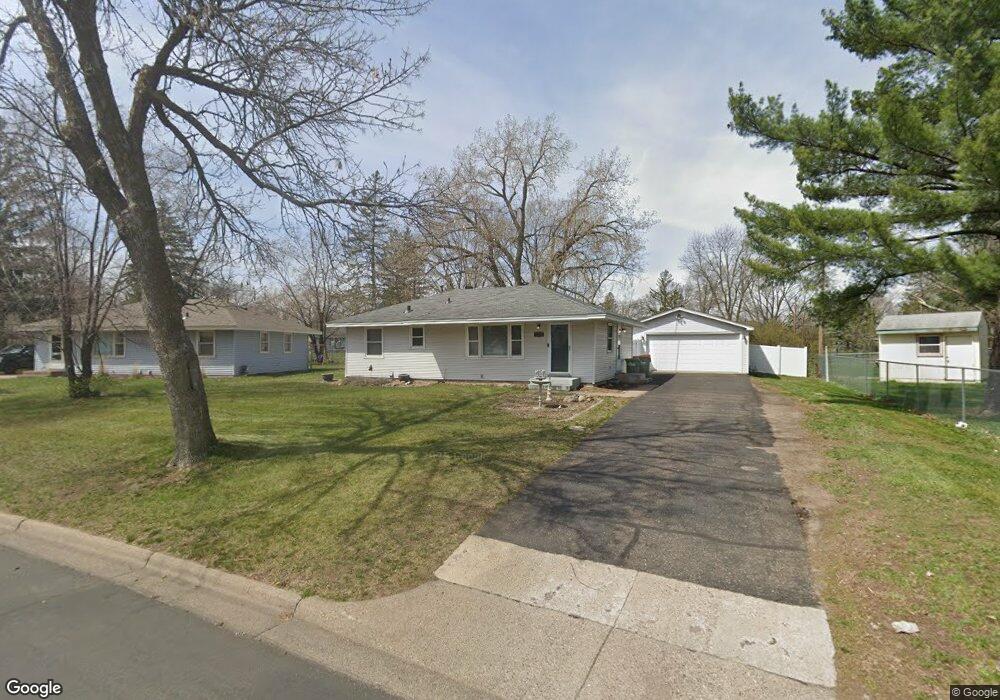
11260 Zion St NW Coon Rapids, MN 55433
Estimated Value: $301,000 - $325,000
2
Beds
1
Bath
1,594
Sq Ft
$197/Sq Ft
Est. Value
About This Home
This home is located at 11260 Zion St NW, Coon Rapids, MN 55433 and is currently estimated at $314,053, approximately $197 per square foot. 11260 Zion St NW is a home located in Anoka County with nearby schools including Lucile Bruner Elementary School, Hoover Elementary School, and Laughlin Junior/Senior High School.
Ownership History
Date
Name
Owned For
Owner Type
Purchase Details
Closed on
Oct 14, 2020
Sold by
Howard Gary S and Howard Renata J
Bought by
Thurmer Tammara Lynn
Current Estimated Value
Home Financials for this Owner
Home Financials are based on the most recent Mortgage that was taken out on this home.
Original Mortgage
$242,500
Interest Rate
2.8%
Mortgage Type
New Conventional
Purchase Details
Closed on
Jun 29, 2007
Sold by
Kruk Larry S and Kruk Rachelle L
Bought by
Howard Gary S and Howard Renata J
Home Financials for this Owner
Home Financials are based on the most recent Mortgage that was taken out on this home.
Original Mortgage
$194,900
Interest Rate
6.42%
Mortgage Type
New Conventional
Purchase Details
Closed on
Dec 30, 1998
Sold by
Gazda Daniel V and Gazda Loralie J
Bought by
Kruk Larry S and Kruk Rachelle L
Create a Home Valuation Report for This Property
The Home Valuation Report is an in-depth analysis detailing your home's value as well as a comparison with similar homes in the area
Home Values in the Area
Average Home Value in this Area
Purchase History
| Date | Buyer | Sale Price | Title Company |
|---|---|---|---|
| Thurmer Tammara Lynn | $250,000 | Burnet Title | |
| Howard Gary S | $194,900 | -- | |
| Kruk Larry S | $104,900 | -- | |
| Thurmer Tammara Tammara | $250,000 | -- |
Source: Public Records
Mortgage History
| Date | Status | Borrower | Loan Amount |
|---|---|---|---|
| Previous Owner | Thurmer Tammara Lynn | $242,500 | |
| Previous Owner | Howard Gary S | $194,900 | |
| Closed | Thurmer Tammara Tammara | $242,500 |
Source: Public Records
Tax History Compared to Growth
Tax History
| Year | Tax Paid | Tax Assessment Tax Assessment Total Assessment is a certain percentage of the fair market value that is determined by local assessors to be the total taxable value of land and additions on the property. | Land | Improvement |
|---|---|---|---|---|
| 2025 | $2,951 | $289,100 | $88,200 | $200,900 |
| 2024 | $2,951 | $288,100 | $91,400 | $196,700 |
| 2023 | $2,684 | $278,200 | $79,800 | $198,400 |
| 2022 | $2,529 | $279,200 | $70,400 | $208,800 |
| 2021 | $2,416 | $236,500 | $70,400 | $166,100 |
| 2020 | $2,566 | $222,000 | $65,100 | $156,900 |
| 2019 | $2,256 | $199,200 | $63,000 | $136,200 |
| 2018 | $2,190 | $181,200 | $0 | $0 |
| 2017 | $1,881 | $171,300 | $0 | $0 |
| 2016 | $1,882 | $144,300 | $0 | $0 |
| 2015 | -- | $144,300 | $47,300 | $97,000 |
| 2014 | -- | $122,000 | $36,500 | $85,500 |
Source: Public Records
Map
Nearby Homes
- 2851 113th Ave NW
- 2728 109th Ln NW
- 2721 109th Ave NW
- 2400 108th Ave NW
- 11000 Swallow St NW
- 2862 116th Ave NW
- 11409 Quinn St NW
- 2965 108th Ln NW
- 11749 Crooked Lake Blvd NW
- 11835 Crocus St NW
- 3020 117th Ave NW
- 10648 Wren St NW
- 11036 Hanson Blvd NW Unit 20
- 11424 Hanson Blvd NW
- 11444 Hanson Blvd NW
- 2201 108th Ave NW
- 10616 Arrowhead St NW
- 12019 Zion St NW
- 11350 Jay St NW
- 11361 Jay St NW
- 11250 Zion St NW
- 2524 S Heights Dr NW
- 2528 S Heights Dr NW
- 2516 S Heights Dr NW
- 11240 Zion St NW
- 11241 Zion St NW
- 11221 Arrowhead St NW
- 2532 S Heights Dr NW
- 11219 Arrowhead St NW
- 11227 Arrowhead St NW
- 11230 Zion St NW
- 11215 Arrowhead St NW
- 11231 Zion St NW
- 2512 S Heights Dr NW
- 2521 S Heights Dr NW
- 2529 S Heights Dr NW
- 2525 S Heights Dr NW
- 2536 S Heights Dr NW
- 11231 Arrowhead St NW
- 2517 S Heights Dr NW