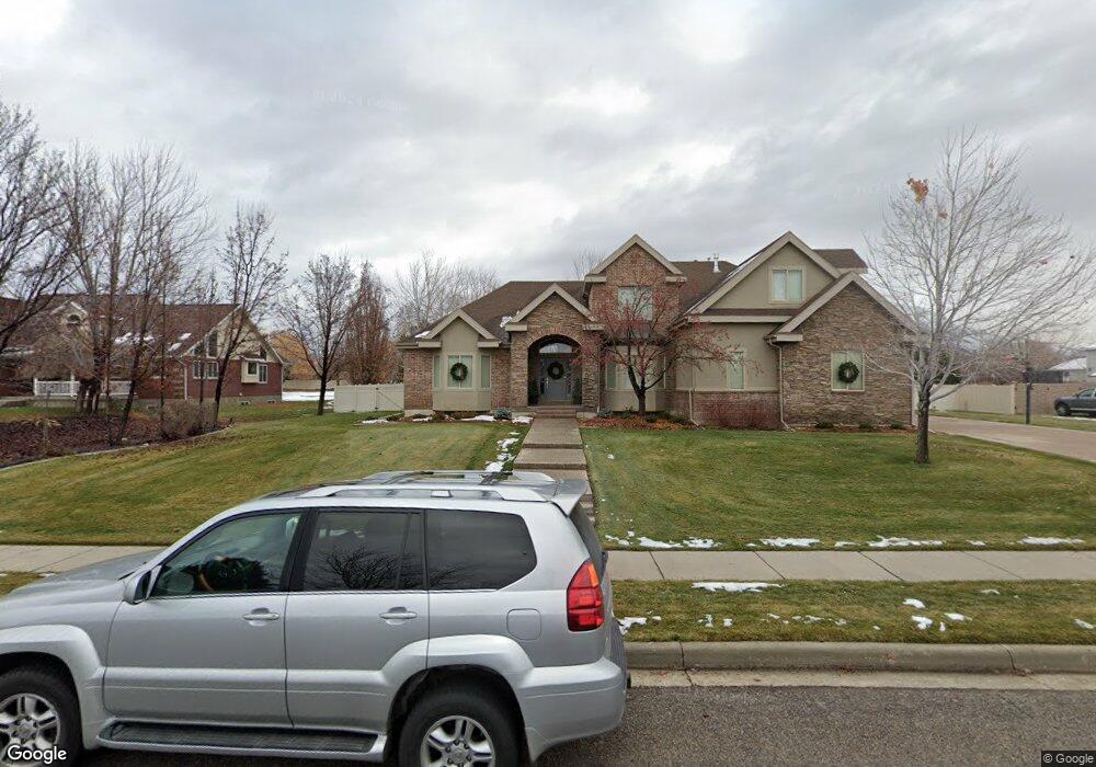
11268 N 5710 W Unit 4 Highland, UT 84003
Estimated Value: $1,049,000 - $1,494,286
5
Beds
3
Baths
3,004
Sq Ft
$439/Sq Ft
Est. Value
About This Home
This home is located at 11268 N 5710 W Unit 4, Highland, UT 84003 and is currently estimated at $1,318,572, approximately $438 per square foot. 11268 N 5710 W Unit 4 is a home located in Utah County with nearby schools including Westfield School, Timberline Middle School, and Lone Peak High School.
Ownership History
Date
Name
Owned For
Owner Type
Purchase Details
Closed on
Sep 24, 2007
Sold by
Hayes Randall and Hayes Mary Ann
Bought by
Randall & Mary Ann Hayes Family Co Llc
Current Estimated Value
Purchase Details
Closed on
Aug 4, 2006
Sold by
Bird Troy J
Bought by
Hayes Randall and Hayes Mary Ann
Purchase Details
Closed on
Feb 25, 2005
Sold by
Parry Adrian B and Parry Rita L
Bought by
Bird Troy J
Home Financials for this Owner
Home Financials are based on the most recent Mortgage that was taken out on this home.
Original Mortgage
$424,000
Interest Rate
5.66%
Mortgage Type
Construction
Purchase Details
Closed on
Feb 23, 1998
Sold by
Larsen Douglas P and Larsen Lisa A
Bought by
Patten Kristian N and Patten Neala Weiss
Purchase Details
Closed on
Jul 3, 1996
Sold by
Bott Robert and Bott Dawn
Bought by
Larsen Douglas P and Larsen Lisa A
Create a Home Valuation Report for This Property
The Home Valuation Report is an in-depth analysis detailing your home's value as well as a comparison with similar homes in the area
Home Values in the Area
Average Home Value in this Area
Purchase History
| Date | Buyer | Sale Price | Title Company |
|---|---|---|---|
| Randall & Mary Ann Hayes Family Co Llc | -- | None Available | |
| Hayes Randall | -- | Surety Title | |
| Bird Troy J | -- | Atlas Title | |
| Patten Kristian N | -- | -- | |
| Larsen Douglas P | -- | Backman Stewart Title Servic |
Source: Public Records
Mortgage History
| Date | Status | Borrower | Loan Amount |
|---|---|---|---|
| Previous Owner | Bird Troy J | $424,000 | |
| Closed | Bird Troy J | $48,135 |
Source: Public Records
Tax History Compared to Growth
Tax History
| Year | Tax Paid | Tax Assessment Tax Assessment Total Assessment is a certain percentage of the fair market value that is determined by local assessors to be the total taxable value of land and additions on the property. | Land | Improvement |
|---|---|---|---|---|
| 2025 | $5,876 | $762,630 | $756,000 | $630,600 |
| 2024 | $5,444 | $725,780 | $0 | $0 |
| 2023 | $5,444 | $725,340 | $0 | $0 |
| 2022 | $5,219 | $674,245 | $0 | $0 |
| 2021 | $4,155 | $799,600 | $381,100 | $418,500 |
| 2020 | $3,909 | $737,700 | $331,400 | $406,300 |
| 2019 | $3,539 | $698,700 | $292,400 | $406,300 |
| 2018 | $3,441 | $645,700 | $292,400 | $353,300 |
| 2017 | $3,238 | $324,280 | $0 | $0 |
| 2016 | $3,489 | $326,535 | $0 | $0 |
| 2015 | -- | $305,085 | $0 | $0 |
| 2014 | $3,176 | $279,235 | $0 | $0 |
Source: Public Records
Map
Nearby Homes
- 5983 W 11270 N Unit 4
- 5976 W 11270 N Unit 5
- 5798 W 11350 N
- 11124 N 6000 W
- 5377 W Evergreen Way
- 11248 Hawkstone Way Unit 109
- 6024 Hawkstone Way Unit 108
- 11228 Hawkstone Way Unit 110
- 5538 W Turin Ln
- 5538 W Naples Dr Unit 125
- 10925 N Marsala Dr
- 5984 W 11200 N Unit 1
- 10905 N Vercelli Dr
- 5509 W Sicily Ln
- 10818 N 6000 W
- 868 S Braddock Ln
- 10763 N Dosh Ln
- 11886 Harvest Moon Ln
- 5159 W 11000 N
- Villa A Plan at TEN700
- 11268 N 5710 W
- 11219 N 5710 St W Unit 10
- 11217 N 5710 St W Unit 13
- 11288 N 5710 W
- 11248 N 5710 W
- 11275 N 5710 W
- 11275 N 5710 W Unit 13
- 11255 N 5710 W
- 11295 N 5710 W
- 11308 N 5710 W
- 11228 N 5710 W
- 11235 N 5710 W
- 5641 W 11270 N
- 11315 N 5710 W
- 5646 W 11270 N
- 11208 N 5710 W
- 11328 N 5710 W
- 5656 W 11200 N
- 11213 N 5710 W
- 5679 W 11350 N