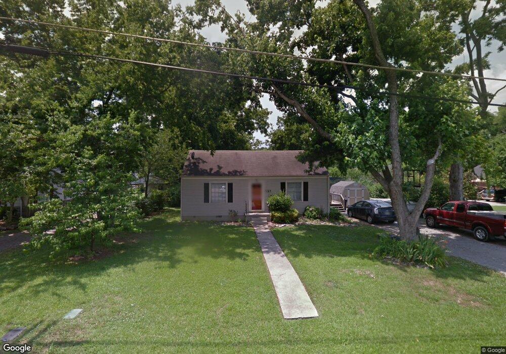
1127 Allen Ave Murfreesboro, TN 37129
Estimated Value: $237,000 - $308,000
--
Bed
1
Bath
1,356
Sq Ft
$198/Sq Ft
Est. Value
About This Home
This home is located at 1127 Allen Ave, Murfreesboro, TN 37129 and is currently estimated at $269,120, approximately $198 per square foot. 1127 Allen Ave is a home located in Rutherford County with nearby schools including Mitchell-Neilson Elementary, Siegel Middle School, and Siegel High School.
Ownership History
Date
Name
Owned For
Owner Type
Purchase Details
Closed on
Feb 12, 2003
Sold by
Carter Lacey R
Bought by
Davis Kerry D
Current Estimated Value
Home Financials for this Owner
Home Financials are based on the most recent Mortgage that was taken out on this home.
Original Mortgage
$70,000
Interest Rate
5.89%
Purchase Details
Closed on
Jul 19, 1999
Sold by
White and Kathie
Bought by
Carter Lacey R and Carter Derek A
Home Financials for this Owner
Home Financials are based on the most recent Mortgage that was taken out on this home.
Original Mortgage
$86,000
Interest Rate
7.95%
Purchase Details
Closed on
May 26, 1999
Sold by
Day Harry W
Bought by
White and Kathie
Home Financials for this Owner
Home Financials are based on the most recent Mortgage that was taken out on this home.
Original Mortgage
$86,000
Interest Rate
7.95%
Create a Home Valuation Report for This Property
The Home Valuation Report is an in-depth analysis detailing your home's value as well as a comparison with similar homes in the area
Home Values in the Area
Average Home Value in this Area
Purchase History
| Date | Buyer | Sale Price | Title Company |
|---|---|---|---|
| Davis Kerry D | $89,000 | -- | |
| Carter Lacey R | $81,000 | -- | |
| White | $78,100 | -- |
Source: Public Records
Mortgage History
| Date | Status | Borrower | Loan Amount |
|---|---|---|---|
| Closed | White | $70,000 | |
| Closed | White | $20,200 | |
| Previous Owner | White | $86,000 |
Source: Public Records
Tax History Compared to Growth
Tax History
| Year | Tax Paid | Tax Assessment Tax Assessment Total Assessment is a certain percentage of the fair market value that is determined by local assessors to be the total taxable value of land and additions on the property. | Land | Improvement |
|---|---|---|---|---|
| 2025 | $1,573 | $55,600 | $13,750 | $41,850 |
| 2024 | $1,573 | $55,600 | $13,750 | $41,850 |
| 2023 | $1,043 | $55,600 | $13,750 | $41,850 |
| 2022 | $899 | $55,600 | $13,750 | $41,850 |
| 2021 | $780 | $35,150 | $8,750 | $26,400 |
| 2020 | $780 | $35,150 | $8,750 | $26,400 |
| 2019 | $780 | $35,150 | $8,750 | $26,400 |
| 2018 | $1,072 | $35,150 | $0 | $0 |
| 2017 | $948 | $24,400 | $0 | $0 |
| 2016 | $948 | $24,400 | $0 | $0 |
| 2015 | $948 | $24,400 | $0 | $0 |
| 2014 | $607 | $24,400 | $0 | $0 |
| 2013 | -- | $22,250 | $0 | $0 |
Source: Public Records
Map
Nearby Homes
- 1107 Owen Layne Dr
- 1116 Owen Layne Dr
- 608 Lynn St
- 1007 Grantland Ave
- 1022 Poplar Ave
- 1019 N Maple St Unit 2D
- 1006 Jones Blvd
- 1120 White Blvd
- 301 Kingwood Dr
- 906 N Maple St
- 904 N Maple St
- 1620 Idlewood Dr
- 814 N Church St
- 717 N Church St
- 1610 Jones Blvd
- 1006 W Clark Blvd
- 0 Lebanon Pike Unit RTC2818012
- 623 Spencer Dr
- 607 Staley St
- 710 Spencer Dr
- 1123 Allen Ave
- 503 W Mcknight Dr
- 501 W Mcknight Dr
- 507 W Mcknight Dr
- 1119 Allen Ave
- 1104 Owen Layne Dr
- 1132 Owen Layne Dr
- 1124 Owen Layne Dr
- 1007 Owen Layne Dr
- 1010 Owen Layne Dr
- 1127 Owen Layne Dr
- 1018 Owen Layne Dr
- 1015 Owen Layne Dr
- 1123 Owen Layne Dr
- 1128 Owen Layne Dr
- 1002 Owen Layne Dr
- 1111 Owen Layne Dr
- 1119 Owen Layne Dr
- 1120 Owen Layne Dr
- 1112 Owen Layne Dr