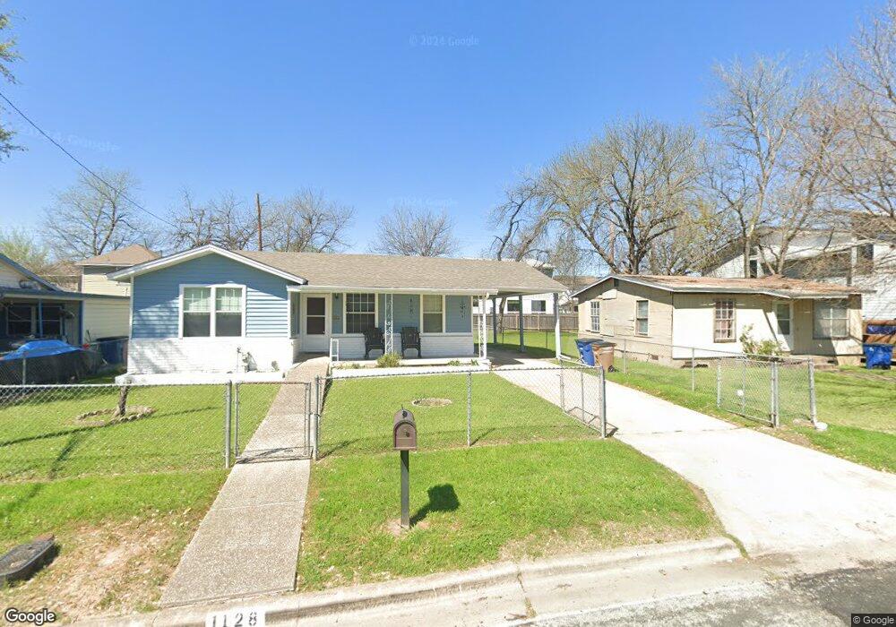
1128 Denfield St Unit D Austin, TX 78721
East MLK NeighborhoodEstimated Value: $345,487 - $437,000
--
Bed
2
Baths
1,064
Sq Ft
$379/Sq Ft
Est. Value
About This Home
This home is located at 1128 Denfield St Unit D, Austin, TX 78721 and is currently estimated at $403,372, approximately $379 per square foot. 1128 Denfield St Unit D is a home located in Travis County with nearby schools including Ortega Elementary School, Martin Middle School, and Eastside Early College High School.
Ownership History
Date
Name
Owned For
Owner Type
Purchase Details
Closed on
Mar 7, 2000
Sold by
Guerrero Henry Hank A and Guerrero Miguel Mike
Bought by
Tonche Eutimio Neave and Tonche Evangelina
Current Estimated Value
Home Financials for this Owner
Home Financials are based on the most recent Mortgage that was taken out on this home.
Original Mortgage
$53,425
Outstanding Balance
$18,028
Interest Rate
8.23%
Mortgage Type
FHA
Estimated Equity
$385,344
Purchase Details
Closed on
Jan 28, 1997
Sold by
Rivera Stella Guerrero and Guerrero Hipolito A
Bought by
Espinoza Mary Ann Guerrero and Guerrero Henry A
Purchase Details
Closed on
Oct 30, 1995
Sold by
Guerrero Hipolito A
Bought by
Espinosa Mary Ann Guerrero and Guerrero Henry A
Create a Home Valuation Report for This Property
The Home Valuation Report is an in-depth analysis detailing your home's value as well as a comparison with similar homes in the area
Home Values in the Area
Average Home Value in this Area
Purchase History
| Date | Buyer | Sale Price | Title Company |
|---|---|---|---|
| Tonche Eutimio Neave | -- | -- | |
| Espinoza Mary Ann Guerrero | -- | -- | |
| Espinosa Mary Ann Guerrero | -- | -- |
Source: Public Records
Mortgage History
| Date | Status | Borrower | Loan Amount |
|---|---|---|---|
| Open | Tonche Eutimio Neave | $53,425 |
Source: Public Records
Tax History Compared to Growth
Tax History
| Year | Tax Paid | Tax Assessment Tax Assessment Total Assessment is a certain percentage of the fair market value that is determined by local assessors to be the total taxable value of land and additions on the property. | Land | Improvement |
|---|---|---|---|---|
| 2025 | $2,453 | $371,424 | -- | -- |
| 2023 | $4,167 | $306,963 | $0 | $0 |
| 2022 | $5,511 | $279,057 | $0 | $0 |
| 2021 | $5,522 | $253,688 | $175,000 | $208,630 |
| 2020 | $4,947 | $230,625 | $175,000 | $80,752 |
| 2018 | $4,220 | $190,599 | $175,000 | $103,161 |
| 2017 | $3,864 | $173,272 | $140,000 | $114,526 |
| 2016 | $3,513 | $157,520 | $75,000 | $130,113 |
| 2015 | $2,758 | $143,200 | $75,000 | $110,215 |
| 2014 | $2,758 | $130,182 | $0 | $0 |
Source: Public Records
Map
Nearby Homes
- 1115 Mark St Unit D
- 1124 Spur St
- 1130 Spur St Unit A
- 1118 Spur St Unit D
- 3600 Oak Springs Dr
- 4712 Reyes St Unit 1
- 3614 Abbate Cir Unit B
- 4615 Munson St
- 4602 Alf Ave Unit B
- 1147 Gunter St
- 1130 Richardine Ave
- 5006 Sara Dr
- 4810 Alf Ave
- 1148 Gunter St Unit A & B
- 1148 Gunter St
- 1133 Saucedo St
- 3509 Oak Springs Dr Unit A
- 3611 Munson St
- 1115 Ebert Ave Unit D
- 3613 Munson St
- 1126 Denfield St
- 1130 Denfield St
- 1124 Denfield St
- 1129 Map St
- 1132 Denfield St Unit D
- 1132 Denfield St Unit B
- 1132 Denfield St Unit A
- 1127 Map St Unit B
- 1127 Map St Unit A
- 1127 Map St
- 1131 Map St Unit 1
- 1131 Map St
- 1131 Map St Unit 2
- 1125 Map St Unit A
- 1125 Map St Unit B
- 1125 Map St
- 1125 Map St
- 1133 Map St Unit D
- 1122 Denfield St Unit D
- 1129 Denfield St Unit D