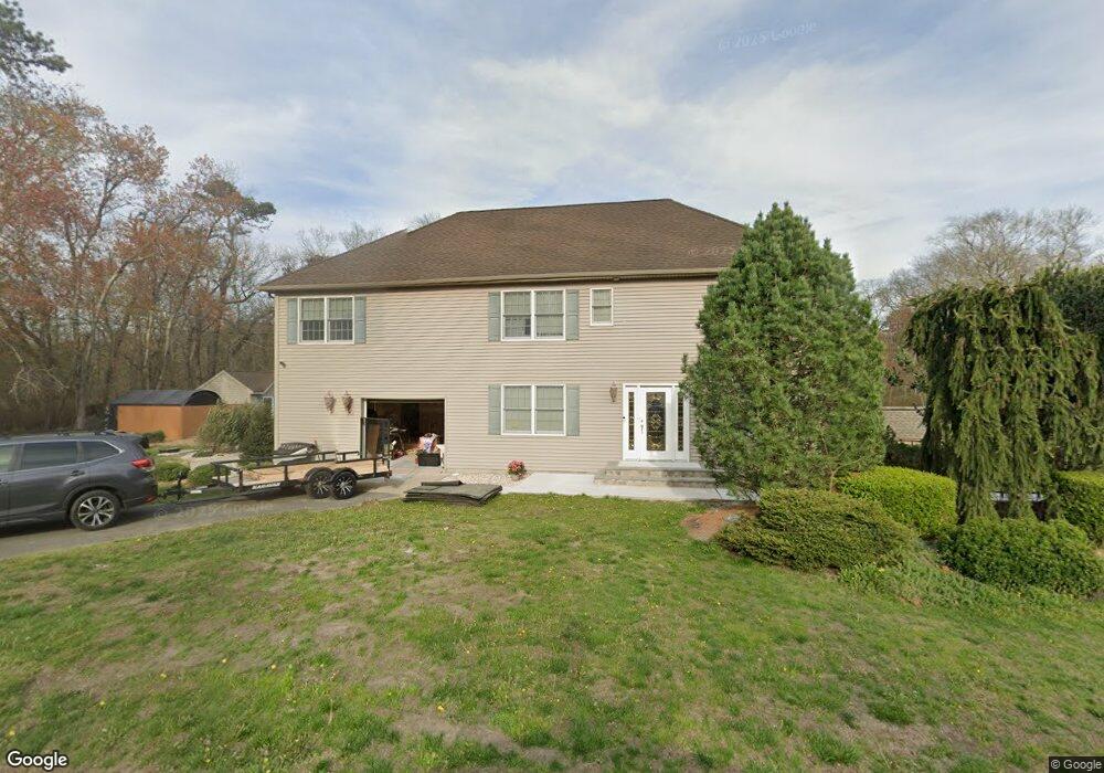
1128 Maxim Southard Rd Howell, NJ 07731
Southard NeighborhoodEstimated Value: $500,000 - $829,000
3
Beds
2
Baths
2,716
Sq Ft
$258/Sq Ft
Est. Value
About This Home
This home is located at 1128 Maxim Southard Rd, Howell, NJ 07731 and is currently estimated at $700,854, approximately $258 per square foot. 1128 Maxim Southard Rd is a home located in Monmouth County with nearby schools including Ramtown School, Greenville School, and Howell Township Middle School South.
Ownership History
Date
Name
Owned For
Owner Type
Purchase Details
Closed on
Sep 30, 2004
Sold by
Clayton Doris
Bought by
Lemay Diane and Lemay David
Current Estimated Value
Home Financials for this Owner
Home Financials are based on the most recent Mortgage that was taken out on this home.
Original Mortgage
$172,000
Outstanding Balance
$85,354
Interest Rate
5.8%
Estimated Equity
$615,500
Create a Home Valuation Report for This Property
The Home Valuation Report is an in-depth analysis detailing your home's value as well as a comparison with similar homes in the area
Home Values in the Area
Average Home Value in this Area
Purchase History
| Date | Buyer | Sale Price | Title Company |
|---|---|---|---|
| Lemay Diane | $215,000 | -- |
Source: Public Records
Mortgage History
| Date | Status | Borrower | Loan Amount |
|---|---|---|---|
| Open | Lemay Diane | $172,000 |
Source: Public Records
Tax History Compared to Growth
Tax History
| Year | Tax Paid | Tax Assessment Tax Assessment Total Assessment is a certain percentage of the fair market value that is determined by local assessors to be the total taxable value of land and additions on the property. | Land | Improvement |
|---|---|---|---|---|
| 2025 | $9,370 | $578,700 | $267,000 | $311,700 |
| 2024 | $9,281 | $527,000 | $221,000 | $306,000 |
| 2023 | $9,281 | $498,700 | $199,900 | $298,800 |
| 2022 | $9,620 | $450,400 | $165,900 | $284,500 |
| 2021 | $9,620 | $419,000 | $165,900 | $253,100 |
| 2020 | $9,662 | $416,100 | $165,900 | $250,200 |
| 2019 | $9,722 | $410,900 | $165,000 | $245,900 |
| 2018 | $9,512 | $399,500 | $165,000 | $234,500 |
| 2017 | $9,206 | $382,300 | $155,000 | $227,300 |
| 2016 | $8,843 | $363,600 | $142,000 | $221,600 |
| 2015 | $8,794 | $357,900 | $142,000 | $215,900 |
| 2014 | $8,701 | $322,200 | $157,000 | $165,200 |
Source: Public Records
Map
Nearby Homes
- 1042 Maxim Southard Rd
- 31 Rappleyea Rd
- 0 Alexander Ave
- 222 Lanes Pond Rd
- 0 Maxim Southard Rd Unit 22531504
- 269 Alexander Ave
- 270 Alexander Ave
- 0 Larrabee Blvd Unit 22533292
- 0 Larrabee Blvd Unit 22533293
- 254 Alexander Ave
- 1070 Maxim Southard Rd
- 140 Locust Ave
- 460 Alexander Ave
- 6 Taft St
- 42 Brown Rd
- 3 Larrabee Blvd
- 40 S Westfield Rd
- 124 Williamsburg Ln Unit 8
- 176 Downing St Unit 1
- 184 Downing St
- 1138 Maxim Southard Rd
- 1131 Maxim Southard Rd
- 1152 Maxim Southard Rd
- 59 Maxim Southard Rd
- 1100 Maxim Southard Rd
- 194 Lanes Mill Rd
- 1164 Maxim Southard Rd
- 1092 Maxim Southard Rd
- 228 Lanes Mill Rd
- 184 Lanes Mill Rd
- 1174 Maxim Southard Rd
- 1173 Maxim Southard Rd
- 236 Lanes Mill Rd
- 168 Lanes Mill Rd
- 185 Lanes Mill Rd
- 229 Lanes Mill Rd
- 248 Lanes Mill Rd
- 1184 Maxim Southard Rd
- 169 Lanes Mill Rd
- 235 Lanes Mill Rd