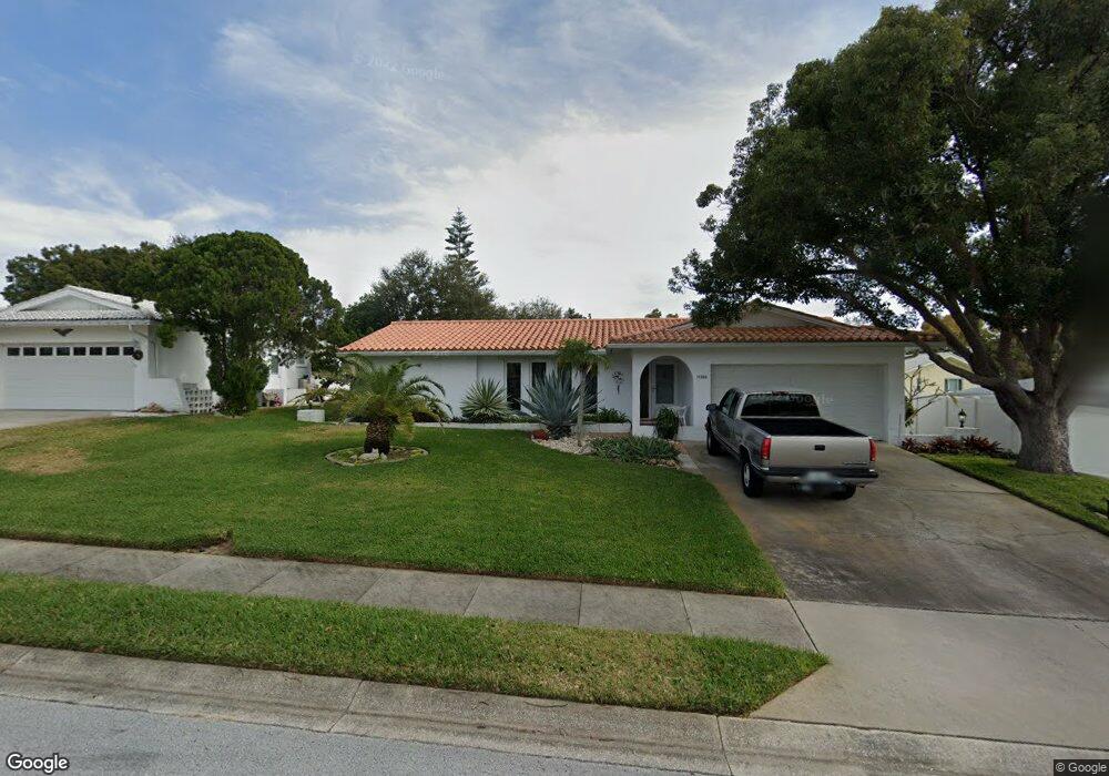
11283 144th St Largo, FL 33774
Collins Estates NeighborhoodEstimated Value: $427,062 - $503,000
Studio
2
Baths
1,501
Sq Ft
$309/Sq Ft
Est. Value
About This Home
This home is located at 11283 144th St, Largo, FL 33774 and is currently estimated at $464,266, approximately $309 per square foot. 11283 144th St is a home located in Pinellas County with nearby schools including Oakhurst Elementary School, Seminole Middle School, and Seminole High School.
Ownership History
Date
Name
Owned For
Owner Type
Purchase Details
Closed on
Mar 31, 2005
Sold by
Gaughan Edward F and Gaughan Margaret C
Bought by
Guyer Bruce and Guyer Vicki
Current Estimated Value
Home Financials for this Owner
Home Financials are based on the most recent Mortgage that was taken out on this home.
Original Mortgage
$118,000
Outstanding Balance
$59,064
Interest Rate
5.62%
Mortgage Type
Purchase Money Mortgage
Estimated Equity
$405,202
Create a Home Valuation Report for This Property
The Home Valuation Report is an in-depth analysis detailing your home's value as well as a comparison with similar homes in the area
Home Values in the Area
Average Home Value in this Area
Purchase History
| Date | Buyer | Sale Price | Title Company |
|---|---|---|---|
| Guyer Bruce | $215,000 | Fidelity Natl Title Ins Co |
Source: Public Records
Mortgage History
| Date | Status | Borrower | Loan Amount |
|---|---|---|---|
| Open | Guyer Bruce | $118,000 |
Source: Public Records
Tax History
| Year | Tax Paid | Tax Assessment Tax Assessment Total Assessment is a certain percentage of the fair market value that is determined by local assessors to be the total taxable value of land and additions on the property. | Land | Improvement |
|---|---|---|---|---|
| 2025 | $2,241 | $151,451 | -- | -- |
| 2024 | $2,176 | $147,183 | -- | -- |
| 2023 | $2,176 | $142,896 | $0 | $0 |
| 2022 | $2,055 | $138,734 | $0 | $0 |
| 2021 | $2,072 | $134,693 | $0 | $0 |
| 2020 | $2,065 | $132,833 | $0 | $0 |
| 2019 | $2,031 | $129,847 | $0 | $0 |
| 2018 | $1,904 | $127,426 | $0 | $0 |
| 2017 | $1,888 | $124,805 | $0 | $0 |
| 2016 | $1,872 | $122,238 | $0 | $0 |
| 2015 | $1,900 | $121,388 | $0 | $0 |
| 2014 | $1,888 | $120,425 | $0 | $0 |
Source: Public Records
Map
Nearby Homes
- 11320 Currie Ln
- 7501 142nd Way N Unit 530
- 14557 Apache Ave
- 14095 Chamberlain Ave
- 11722 Currie Ln Unit D1
- 14595 Oliver St
- 14108 110th Terrace
- 13941 Kimberly Dr
- 11469 Oakhurst Rd
- 14423 Kandi Ct
- 11534 Lowe Rd
- 11485 Oakhurst Rd Unit 204
- 11485 Oakhurst Rd Unit 200-321
- 11485 Oakhurst Rd Unit 200-207
- 11485 Oakhurst Rd Unit 319
- 11485 Oakhurst Rd Unit 200-306
- 11485 Oakhurst Rd Unit 211
- 11485 Oakhurst Rd Unit 1200-216
- 11485 Oakhurst Rd Unit 310
- 11485 Oakhurst Rd Unit 206
- 11341 144th St
- 14371 Apache Ave
- 11244 Currie Ln
- 14351 Apache Ave
- 11351 144th St
- 11250 144th St
- 11360 144th St
- 14331 Apache Ave
- 11240 144th St
- 11338 Currie Ln
- 11370 144th St
- 14360 Apache Ave
- 11361 144th St
- 14380 Apache Ave
- 14390 Apache Ave
- 11235 Apache Place
- 14340 Apache Ave
- 14435 Apache Ave
- 14410 Apache Ave
- 11350 Currie Ln
Your Personal Tour Guide
Ask me questions while you tour the home.